Song District
| Song สอง | |
|---|---|
| Amphoe | |
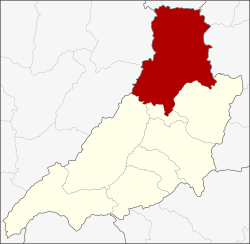 Amphoe location in Phrae Province | |
| Coordinates: 18°28′12″N 100°11′0″E / 18.47000°N 100.18333°ECoordinates: 18°28′12″N 100°11′0″E / 18.47000°N 100.18333°E | |
| Country |
|
| Province | Phrae |
| Seat | Ban Klang |
| Area | |
| • Total | 1,624.5 km2 (627.2 sq mi) |
| Population (2005) | |
| • Total | 53,687 |
| • Density | 33.0/km2 (85/sq mi) |
| Time zone | THA (UTC+7) |
| Postal code | 54120 |
| Geocode | 5406 |
Song (Thai: สอง; IPA: [sɔ̌ːŋ]) is the northernmost district (Amphoe) of Phrae Province, northern Thailand.
Geography
Neighboring districts are (from the southeast clockwise) Rong Kwang, Nong Muang Khai, Long of Phrae Province, Mae Mo, Ngao of Lampang Province, Dok Khamtai, Chiang Muan of Phayao Province, Ban Luang and Wiang Sa of Nan Province.
The mountainous landscape of the Phi Pan Nam Range dominates the district. Mae Yom National Park is located in Song district. The everyday life of the villagers there was investigated by Living River Siam because of the possibility that a dam would be built in Kaeng Sua Ten.
Phra That Phra Lo
Phra That Phra Lo, an ancient chedi is located in Ban Klang Subdistrict, west of Song.[1] The chedi is said to house the remains of king Phra Lo, who died together with Phra Phuean and Phra Phaeng, the two women he loved who were the daughters of the ruler of the city of Song.[2] The tragic story Lilit Phra Lo (ลิลิตพระลอ) originated in a tale of Thai folklore and later became part of Thai literature. It was voted the best lilit work by King Rama VI's Royal literary club in 1916.[3]
History
Originally named Mueang Song, 1917 the district was renamed to Ban Klang after the name of the central tambon.[4] It was named back to the original name Song in 1939, only leaving out the word Mueang which was reserved for the capital districts of provinces.[5]
Administration
The district is subdivided into 8 subdistricts (tambon), which are further subdivided into 84 villages (muban). Song is a township (thesaban tambon) and covers parts of tambon Ban Nun and Ban Klang. There are further 8 Tambon administrative organizations (TAO).
| No. | Name | Thai name | Villages | Inh. | |
|---|---|---|---|---|---|
| 1. | Ban Nun | บ้านหนุน | 11 | 9,160 | |
| 2. | Ban Klang | บ้านกลาง | 12 | 8,392 | |
| 3. | Huai Mai | ห้วยหม้าย | 17 | 8,769 | |
| 4. | Tao Pun | เตาปูน | 12 | 8,418 | |
| 5. | Hua Mueang | หัวเมือง | 13 | 6,828 | |
| 6. | Sa-iap | สะเอียบ | 9 | 5,671 | |
| 7. | Daen Chumphon | แดนชุมพล | 4 | 2,685 | |
| 8. | Thung Nao | ทุ่งน้าว | 5 | 3,764 |
References
- ↑ Phrae - Tourist Attractions
- ↑ Phra Phuean and Phra Phaeng
- ↑ Ayutthaya Literature
- ↑ ประกาศกระทรวงมหาดไทย เรื่อง เปลี่ยนชื่ออำเภอ (PDF). Royal Gazette (in Thai). 34 (0 ก): 40–68. April 29, 1917.
- ↑ พระราชกฤษฎีกาเปลี่ยนนามอำเภอ กิ่งอำเภอ และตำบลบางแห่ง พุทธศักราช ๒๔๘๒ (PDF). Royal Gazette (in Thai). 56 (0 ก): 354–364. April 17, 1939.