Allendale, Illinois
| Allendale | |
| Village | |
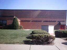 The Allendale Community Consolidated School | |
| Country | United States |
|---|---|
| State | Illinois |
| County | Wabash |
| Precinct | Wabash |
| Elevation | 492 ft (150 m) |
| Coordinates | 38°31′43″N 87°42′35″W / 38.52861°N 87.70972°WCoordinates: 38°31′43″N 87°42′35″W / 38.52861°N 87.70972°W |
| Area | 0.31 sq mi (1 km2) |
| - land | 0.31 sq mi (1 km2) |
| - water | 0.00 sq mi (0 km2) |
| Population | 475 (2010) |
| Density | 1,755.5/sq mi (678/km2) |
| Timezone | CST (UTC-6) |
| - summer (DST) | CDT (UTC-5) |
| Postal code | 62410 |
| Area code | Area code 618 |
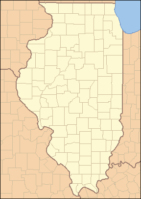 Location of Allendale within Illinois
| |
| Wikimedia Commons: Allendale, Illinois | |
Allendale is a village in Wabash Precinct, Wabash County, Illinois. The population was 475 at the 2010 census.[1]
History
Allendale was founded in 1869, taking its name from Colonel C. M. Allen, a railroad official.[2]
1989 tornado
On January 7, 1989, an F4 tornado leveled a good portion of the town of Allendale and injured 55 of its residents.[3][4] The tornado directly impacted Allendale's school, destroying the grade school portion, built in the 1960s. Ironically, the high school portion, built in the late 1920s, withstood the storm with minimal damage, despite being condemned two years earlier due to lobbying by Mt. Carmel's District 348 in an attempt to usurp District 17. Relief funds paid to build a brand new school to be used by the elementary and middle school students of District 17.
Current Allendale
Today Allendale has about 500 residents with a First National Bank, a Cj's Fast Shop Gas Station and Convince Store, a United States Post Office, a Fire Station, and a Ruritan Hall.
Geography
Allendale is located 4 miles (6.4 km) northeast of Patton and 1.75 miles (2.82 km) east-northeast of Adams Corner at 38°31′43″N 87°42′35″W / 38.52861°N 87.70972°W (38.528524, -87.709811).[5] According to the 2010 census, Allendale has a total area of 0.31 square miles (0.80 km2), all land.[6]
Demographics
| Historical population | |||
|---|---|---|---|
| Census | Pop. | %± | |
| 1880 | 283 | — | |
| 1920 | 451 | — | |
| 1930 | 462 | 2.4% | |
| 1940 | 432 | −6.5% | |
| 1950 | 442 | 2.3% | |
| 1960 | 465 | 5.2% | |
| 1970 | 425 | −8.6% | |
| 1980 | 613 | 44.2% | |
| 1990 | 476 | −22.3% | |
| 2000 | 528 | 10.9% | |
| 2010 | 475 | −10.0% | |
| Est. 2015 | 460 | [7] | −3.2% |
As of the census[9] of 2000, there were 528 people, 192 households, and 142 families residing in the village. The population density was 1,755.5 people per square mile (679.5/km²). There were 205 housing units at an average density of 681.6 per square mile (263.8/km²). The racial makeup of the village was 97.92% White, 0.76% African American, 0.95% from other races, and 0.38% from two or more races. Hispanic or Latino of any race were 1.14% of the population.
There were 192 households out of which 35.4% had children under the age of 18 living with them, 60.9% were married couples living together, 10.4% had a female householder with no husband present, and 26.0% were non-families. 25.5% of all households were made up of individuals and 12.0% had someone living alone who was 65 years of age or older. The average household size was 2.65 and the average family size was 3.20.
In the village the population was spread out with 28.4% under the age of 18, 10.2% from 18 to 24, 25.8% from 25 to 44, 23.7% from 45 to 64, and 11.9% who were 65 years of age or older. The median age was 37 years. For every 100 females there were 98.5 males. For every 100 females age 18 and over, there were 93.8 males.
The median income for a household in the village was $31,705, and the median income for a family was $38,472. Males had a median income of $30,000 versus $16,719 for females. The per capita income for the village was $12,117. About 12.1% of families and 16.6% of the population were below the poverty line, including 26.4% of those under age 18 and 1.9% of those age 65 or over.
Notes
- ↑ City data. 2010 census information Retrieved on July 31, 2012
- ↑ Callary, Edward (29 September 2008). Place Names of Illinois. University of Illinois Press. p. 5. ISBN 978-0-252-09070-7.
- ↑ Allendale, Illinois (IL) Detailed Profile - relocation, real estate, travel, jobs, hospitals, schools, crime, news, sex offenders
- ↑ http://ams.allenpress.com/perlserv/?request=get-abstract&doi=10.1175%2F1520-0434(1992)007%3C0588%3ASLSF%3E2.0.CO%3B2 Published by the American Meteorological Society — Severe Local Storms Forecasting Robert H. Johns and Charles A. Doswell III
- ↑ "US Gazetteer files: 2010, 2000, and 1990". United States Census Bureau. 2011-02-12. Retrieved 2011-04-23.
- ↑ "G001 - Geographic Identifiers - 2010 Census Summary File 1". United States Census Bureau. Retrieved 2015-08-01.
- ↑ "Annual Estimates of the Resident Population for Incorporated Places: April 1, 2010 to July 1, 2015". Retrieved July 2, 2016.
- ↑ "Census of Population and Housing". Census.gov. Archived from the original on May 11, 2015. Retrieved June 4, 2015.
- ↑ "American FactFinder". United States Census Bureau. Archived from the original on 2013-09-11. Retrieved 2008-01-31.
Municipalities and communities of Wabash County, Illinois, United States | ||
|---|---|---|
| Cities | ||
| Villages | ||
| Precincts | ||
| Unincorporated communities | ||