Alkimos, Western Australia
| Alkimos Perth, Western Australia | |||||||||||||
|---|---|---|---|---|---|---|---|---|---|---|---|---|---|
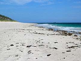 Looking south along Alkimos Beach towards wreck. | |||||||||||||
 Alkimos | |||||||||||||
| Coordinates | 31°36′25″S 115°40′08″E / 31.607°S 115.669°ECoordinates: 31°36′25″S 115°40′08″E / 31.607°S 115.669°E | ||||||||||||
| Population | 0 (2006)[1] | ||||||||||||
| • Density | 0.00/km2 (0.00/sq mi) | ||||||||||||
| Postcode(s) | 6038 | ||||||||||||
| Area | 13 km2 (5.0 sq mi) | ||||||||||||
| Location | 42 km (26 mi) NNW of Perth CBD | ||||||||||||
| LGA(s) | City of Wanneroo | ||||||||||||
| State electorate(s) | Mindarie | ||||||||||||
| Federal Division(s) | Pearce | ||||||||||||
| |||||||||||||
Alkimos is a coastal suburb of Perth, Western Australia, located 42 kilometres (26 mi) north-northwest of Perth's central business district. It is part of the City of Wanneroo local government area.
For the most part, the suburb is covered in native banksia woodland, scrubland and heath typical of the Swan Coastal Plain. The area is part of the Alkimos-Eglinton region being considered by the State Government for a future city centre and urban region. On 5 November 2008, the WA State Government announced it was actively seeking a development partner for the project.[2]
Geography
Alkimos lies roughly between the proposed Mitchell Freeway to the east and the Indian Ocean to the west.[3] The locality is bounded to the north by Eglinton, to the east by Carabooda and to the south by the newly developed suburbs of Butler and Jindalee.
History
Alkimos is named after the shipwreck of the Greek freighter Alkimos which ran aground on the coast nearby in 1963.[4] The wreck lies a few hundred metres off shore and is subject to a number of strange events and ghost stories.[5]
There are future plans for an Alkimos-Eglinton Satellite City, covered by Amendment 1029/33 to the Metropolitan Region Scheme (May 2006). LandCorp, the State's land development agency, estimates that 55,000 people will live in the area once it is complete, that the centre will include "hospitals, tertiary educational institutions, major retail, commercial and recreational facilities" and that stage 1 blocks would be offered for sale in 2008.[6][7] The Environmental Protection Authority, however, raised concerns in November 2005 about the amendment, saying that it "would, in part, be inconsistent with the conservation and protection of significant environmental and geoheritage values in the area", and recommended that the amount of reserves be greatly increased.[8] When the town is developed, a proposed extension of the Joondalup railway line will see three stations in the area.
Demographics
Alkimos had a nil population at the ABS 2006 census.[1] The suburb was not enumerated in the 2011 census.
Amenities and facilities
Alkimos has no conventional facilities at the present stage. Eglinton Rocks and the Alkimos wreck can be viewed from the coastline, where almost untouched beaches are accessible by sandtrack which can be reached from the Marmion Avenue stretch. The suburb offers a wide array of native scrubland, woodland and heath, varying in condition from excellent to completely degraded, and including Xanthorrhoea preissii (commonly known as "black boys"), banksia, sheoak and Nuytsia floribunda. Some degradation has occurred due to uncontrolled vehicular access, clearing for stock grazing, fire and rabbits.[9]
Transport
In 2008, Marmion Avenue was extended through the suburb, which had previously been unserviced by the road network. On 14 December 2008, the 490 Transperth service between Clarkson train station and Two Rocks was rerouted from Wanneroo Road to Marmion Avenue through the middle of Alkimos,[10] operated by Veolia Transdev. As part of the satellite city proposals, the Joondalup Line will be extended through the area with a planned 3 stations, with possible names Alkimos, North Alkimos, & Eglinton.
References
- 1 2 Australian Bureau of Statistics (25 October 2007). "Alkimos (State Suburb)". 2006 Census QuickStats. Retrieved 15 July 2011. Map
- ↑ "Landcorp press release". Retrieved 5 November 2008.
- ↑ Department of Land Information. StreetSmart® Perth Street Directory (54 (2013) ed.). West Australian Newspapers Ltd. pp. Maps 128–129. ISBN 978-0-909439-67-5.
- ↑ Western Australian Land Information Authority. "History of metropolitan suburb names – A". Retrieved 2007-05-15.
- ↑ LovePerth (15 Sep 2012). "Alkimos". Retrieved 2012-09-22.
- ↑ Votes and Proceedings, No.75, WA Legislative Assembly, 10 May 2006. Accessed 29 September 2006.
- ↑ Alkimos-Eglinton, LandCorp, 2005. Accessed 29 September 2006.
- ↑ EPA Bulletin 1207 - Alkimos-Eglinton MRS Amendment 1029/33 Archived 22 August 2006 at the Wayback Machine., Environmental Protection Authority, 21 November 1995. Accessed 29 September 2006.
- ↑ Environmental Review: Alkimos/Eglinton (MRS Amendment 1029/33), WA Planning Commission, 2003, p.45 etc. (Large PDF)
- ↑ Northern 78 timetable Archived 8 May 2010 at the Wayback Machine., Transperth, effective 4 April 2010. Accessed 23 May 2010.
External links
- Metropolitan Region Scheme Amendment 1029/33 Alkimos-Eglinton - Download (6MB)
Suburbs and localities of the City of Wanneroo, Perth, Western Australia | ||
|---|---|---|
| North West |  | |
| North East | ||
| South | ||
¹ Suburb shared with the City of Joondalup | ||