Alexandria, Alabama
| Alexandria, Alabama | |
|---|---|
| Census-designated place | |
|
The old post office in Alexandria is currently undergoing restoration by the Alexandria Historical Preservation Society. | |
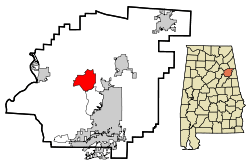 Location in Calhoun County and the state of Alabama | |
| Coordinates: 33°45′57″N 85°53′3″W / 33.76583°N 85.88417°W | |
| Country | United States |
| State | Alabama |
| County | Calhoun |
| Area | |
| • Total | 11.13 sq mi (28.82 km2) |
| • Land | 11.12 sq mi (28.79 km2) |
| • Water | 0.01 sq mi (0.03 km2) |
| Elevation | 577 ft (176 m) |
| Population (2010) | |
| • Total | 3,917 |
| • Density | 352/sq mi (136.1/km2) |
| Time zone | Central (CST) (UTC-6) |
| • Summer (DST) | CDT (UTC-5) |
| ZIP code | 36250 |
| Area code | 256 |
| FIPS code | 01-01180 |
| GNIS feature ID | 0157876 |

Alexandria is a census-designated place and unincorporated community in Calhoun County, Alabama, United States. At the 2010 census the population was 3,917.[1] It is included in the Anniston–Oxford, Alabama Metropolitan Statistical Area.
Geography
Alexandria is located near the center of Calhoun County at 33°45′57″N 85°53′3″W / 33.76583°N 85.88417°W (33.766072, -85.884389).[2] It is bordered to the south by the Saks CDP.
According to the U.S. Census Bureau, the Alexandria CDP has a total area of 11.1 square miles (28.8 km2), of which 0.012 square miles (0.03 km2), or 0.11%, is water.[1]
Demographics
| Historical population | |||
|---|---|---|---|
| Census | Pop. | %± | |
| 1880 | 121 | — | |
| 2000 | 3,692 | — | |
| 2010 | 3,917 | 6.1% | |
| U.S. Decennial Census[3] | |||
As of the census[4] of 2010, there were 3,917 people, 1,505 households, and 1,150 families residing in Alexandria. The population density was 352 people per square mile (136.1/km²). There were 1,599 housing units at an average density of 143.6 per square mile (55.5/km²). The racial makeup of the community was 87.4% White, 10.2% Black or African American, 0.3% Native American, 0.5% Asian, 0.3% Pacific Islander, 0.5% from other races, and 0.8% from two or more races. 0.9% of the population were Hispanic or Latino of any race.
There were 1,505 households out of which 31.5% had children under the age of 18 living with them, 59.3% were married couples living together, 13.2% had a female householder with no husband present, and 23.6% were non-families. 20.1% of all households were made up of individuals and 7.3% had someone living alone who was 65 years of age or older. The average household size was 2.60 and the average family size was 2.99.
The population is spread out with 25.1% under the age of 18, 7.5% from 18 to 24, 26.3% from 25 to 44, 28.6% from 45 to 64, and 12.6% who were 65 years of age or older. The median age was 39.2 years. For every 100 females there were 94.1 males. For every 100 females age 18 and over, there were 94.6 males.
The median income for a household in Alexandria was $41,324, and the median income for a family was $66,061. Males had a median income of $47,788 versus $30,294 for females. The per capita income for the community was $21,647. About 19.8% of families and 19.4% of the population were below the poverty line, including 29.7% of those under age 18 and 16.2% of those age 65 or over.
Education
There are two public schools located in the community:
- Alexandria High School
- Alexandria Elementary School
Both schools are part of the Calhoun County School System.
Transportation
Intercity bus service is provided by Greyhound Lines.[5]
Other information
Though not incorporated, Alexandria is a rapidly growing community. There are a number of restaurants and stores on US 431 within this area, including a grocery store at the intersection with State Route 144 (formerly State Route 62).
Local history
The Battle of Tallushatchee was fought in 1813, when Andrew Jackson sent General John Coffee with 900 dragoons (cavalry) to attack the Red Stick Creek Indians, 3.2 miles (5.1 km) north of Alexandria. Legendary frontiersman Davy Crockett participated in the ensuing massacre, where 180 warriors were killed.
Notable people
- T. J. Heath, NFL cornerback
- John Pelham, artillery officer who served with the Confederate cavalry under J.E.B. Stuart during the American Civil War
References
- 1 2 "Geographic Identifiers: 2010 Demographic Profile Data (G001): Alexandria CDP, Alabama". U.S. Census Bureau, American Factfinder. Retrieved June 2, 2014.
- ↑ "US Gazetteer files: 2010, 2000, and 1990". United States Census Bureau. 2011-02-12. Retrieved 2011-04-23.
- ↑ "U.S. Decennial Census". Census.gov. Archived from the original on May 11, 2015. Retrieved June 6, 2013.
- ↑ "American FactFinder". United States Census Bureau. Archived from the original on 2013-09-11. Retrieved 2015-07-10.
- ↑ Greyhound Alexandria AL Station
Coordinates: 33°45′58″N 85°53′04″W / 33.766072°N 85.884389°W
Municipalities and communities of Calhoun County, Alabama, United States | ||
|---|---|---|
| Cities | 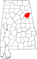 | |
| Towns | ||
| CDPs | ||
| Unincorporated communities | ||
| Ghost town | ||
| Footnotes | ‡This populated place also has portions in an adjacent county or counties | |