Alexander, Maine
| Alexander, Maine | |
|---|---|
| Town | |
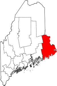
 Alexander, Maine Location within the state of Maine | |
| Coordinates: 45°4′16″N 67°28′39″W / 45.07111°N 67.47750°W | |
| Country | United States |
| State | Maine |
| County | Washington |
| Area[1] | |
| • Total | 45.65 sq mi (118.23 km2) |
| • Land | 40.14 sq mi (103.96 km2) |
| • Water | 5.51 sq mi (14.27 km2) |
| Elevation | 417 ft (127 m) |
| Population (2010)[2] | |
| • Total | 499 |
| • Estimate (2012[3]) | 492 |
| • Density | 12.4/sq mi (4.8/km2) |
| Time zone | Eastern (EST) (UTC-5) |
| • Summer (DST) | EDT (UTC-4) |
| ZIP code | 04694 |
| Area code(s) | 207 |
| FIPS code | 23-00660 |
| GNIS feature ID | 0582318 |
Alexander is a town in Washington County, Maine, United States. The population was 499 at the 2010 census.[4] The town is named for Alexander Baring, 1st Baron Ashburton, the British negotiator of the Webster–Ashburton Treaty which ended the Aroostook War in 1838-1839.[5]
Geography
According to the United States Census Bureau, the town has a total area of 45.65 square miles (118.23 km2), of which, 40.14 square miles (103.96 km2) of it is land and 5.51 square miles (14.27 km2) is water.[1]
Demographics
| Historical population | |||
|---|---|---|---|
| Census | Pop. | %± | |
| 1830 | 336 | — | |
| 1840 | 513 | 52.7% | |
| 1850 | 544 | 6.0% | |
| 1860 | 445 | −18.2% | |
| 1870 | 456 | 2.5% | |
| 1880 | 439 | −3.7% | |
| 1890 | 337 | −23.2% | |
| 1900 | 333 | −1.2% | |
| 1910 | 374 | 12.3% | |
| 1920 | 371 | −0.8% | |
| 1930 | 312 | −15.9% | |
| 1940 | 292 | −6.4% | |
| 1950 | 282 | −3.4% | |
| 1960 | 220 | −22.0% | |
| 1970 | 169 | −23.2% | |
| 1980 | 385 | 127.8% | |
| 1990 | 478 | 24.2% | |
| 2000 | 514 | 7.5% | |
| 2010 | 499 | −2.9% | |
| Est. 2014 | 490 | [6] | −1.8% |
2010 census
As of the census[2] of 2010, there were 499 people, 223 households, and 156 families residing in the town. The population density was 12.4 inhabitants per square mile (4.8/km2). There were 399 housing units at an average density of 9.9 per square mile (3.8/km2). The racial makeup of the town was 98.2% White, 1.0% Native American, and 0.8% from two or more races. Hispanic or Latino of any race were 1.2% of the population.
There were 223 households of which 25.1% had children under the age of 18 living with them, 56.1% were married couples living together, 9.9% had a female householder with no husband present, 4.0% had a male householder with no wife present, and 30.0% were non-families. 24.2% of all households were made up of individuals and 6.2% had someone living alone who was 65 years of age or older. The average household size was 2.24 and the average family size was 2.58.
The median age in the town was 49.8 years. 16.6% of residents were under the age of 18; 4.8% were between the ages of 18 and 24; 21% were from 25 to 44; 41.4% were from 45 to 64; and 16% were 65 years of age or older. The gender makeup of the town was 49.9% male and 50.1% female.
2000 census
As of the census[8] of 2000, there were 514 people, 196 households, and 150 families residing in the town. The population density was 13.0 people per square mile (5.0/km²). There were 359 housing units at an average density of 9.1 per square mile (3.5/km²). The racial makeup of the town was 98.05% White, 0.19% African American, 0.78% Native American, and 0.97% from two or more races. Hispanic or Latino of any race were 0.19% of the population.
There were 196 households out of which 32.1% had children under the age of 18 living with them, 64.3% were married couples living together, 5.1% had a female householder with no husband present, and 23.0% were non-families. 19.4% of all households were made up of individuals and 5.6% had someone living alone who was 65 years of age or older. The average household size was 2.62 and the average family size was 2.97.
In the town the population was spread out with 24.7% under the age of 18, 6.4% from 18 to 24, 30.9% from 25 to 44, 25.5% from 45 to 64, and 12.5% who were 65 years of age or older. The median age was 38 years. For every 100 females there were 104.8 males. For every 100 females age 18 and over, there were 110.3 males.
The median income for a household in the town was $29,306, and the median income for a family was $33,125. Males had a median income of $37,500 versus $25,000 for females. The per capita income for the town was $14,943. About 14.6% of families and 20.0% of the population were below the poverty line, including 27.1% of those under age 18 and 10.2% of those age 65 or over.
References
- 1 2 "US Gazetteer files 2010". United States Census Bureau. Retrieved 2012-12-16.
- 1 2 "American FactFinder". United States Census Bureau. Retrieved 2012-12-16.
- ↑ "Population Estimates". United States Census Bureau. Archived from the original on 2013-06-17. Retrieved 2013-07-06.
- ↑ "Profile of General Population and Housing Characteristics: 2010 Demographic Profile Data (DP-1): Alexander town, Washington County, Maine". U.S. Census Bureau, American Factfinder. Archived from the original on September 11, 2013. Retrieved July 19, 2012.
- ↑ Caldwell, D.W. (1998). "Maine 9: The Air Line, Bangor-Calais". Roadside Geology of Maine. Roadside Geology. Missoula, Montana: Mountain Press. p. 102. ISBN 0-87842-375-3.
The two towns at the eastern end of the Air Line, Alexander and Baring, are the first and last names of Lord Ashburton
- ↑ "Annual Estimates of the Resident Population for Incorporated Places: April 1, 2010 to July 1, 2014". Retrieved June 4, 2015.
- ↑ "Census of Population and Housing". Census.gov. Archived from the original on May 11, 2015. Retrieved June 4, 2015.
- ↑ "American FactFinder". United States Census Bureau. Archived from the original on 2013-09-11. Retrieved 2008-01-31.
External links
- Alexander, Maine
- Varney, George J. (1886). "Gazetteer of the state of Maine. Addison". Boston: Russell.
Coordinates: 45°05′19″N 67°28′06″W / 45.08861°N 67.46833°W