Jonesport, Maine
| Jonesport, Maine | ||
|---|---|---|
| Town | ||
 | ||
| ||
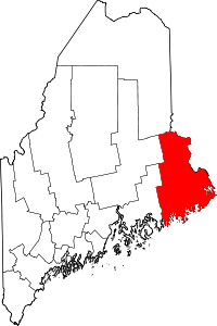
 Jonesport, Maine Location within the state of Maine | ||
| Coordinates: 44°33′17″N 67°34′41″W / 44.55472°N 67.57806°W | ||
| Country | United States | |
| State | Maine | |
| County | Washington | |
| Incorporated | February 3, 1832 | |
| Area[1] | ||
| • Total | 100.35 sq mi (259.91 km2) | |
| • Land | 28.51 sq mi (73.84 km2) | |
| • Water | 71.84 sq mi (186.06 km2) | |
| Elevation | 23 ft (7 m) | |
| Population (2010)[2] | ||
| • Total | 1,370 | |
| • Estimate (2012[3]) | 1,359 | |
| • Density | 48.1/sq mi (18.6/km2) | |
| Time zone | Eastern (EST) (UTC-5) | |
| • Summer (DST) | EDT (UTC-4) | |
| ZIP code | 04649 | |
| Area code(s) | 207 | |
| FIPS code | 23-36010 | |
| GNIS feature ID | 0582537 | |

Jonesport is a town in Washington County, Maine, United States. The population was 1,370 at the 2010 census.[4] Jonesport is a fishing and lobstering town.
History

Settled before the American Revolution, this was part of a grant of 48,160 acres (194.9 km2) made by the Massachusetts General Court in 1789 to John C. Jones[5] and others. It was incorporated on March 4, 1809, as Jonesborough. On February 3, 1832, a portion of Jonesborough was set off and incorporated as Jones' Port. Then a portion of Jonesport was set off and incorporated on April 7, 1925, as the island town of Beals, accessible by bridge, built in 1958, across the Moosabec Reach.[6]
Located on a peninsula 6 miles (9.7 km) out in the Gulf of Maine, the town's principal industries are fishing, boat building, harvesting blueberries, and tourist services. Jonesport includes many uninhabited islands which provide nesting areas for eider, cormorants, seagulls, razorbills, guillemots, loons, black scoters, grebes and eagles. There are two nature preserves: Western Brothers Island and the Great Wass Archipelago (which includes Great Wass Island), the latter shared with the town of Beals.[7]
In 1866, a group of Christian restorationists sailed from Jonesport to Ottoman-occupied Palestine in the hope of preparing the land for the Jews to return, thereby hastening the coming of the Christian Messiah. The Maine Friendship House, a small, wooden clapboard New England-style house built by one of those families, still stands in modern Tel Aviv.[8]
Geography
According to the United States Census Bureau, the town has a total area of 100.35 square miles (259.91 km2), of which, 28.51 square miles (73.84 km2) of it is land and 71.84 square miles (186.06 km2) is water.[1] Jonesport is situated on a peninsula between Chandler Bay, Wohoa Bay and the tidal Indian River, all part of the Gulf of Maine and Atlantic Ocean. Roque Island, Chandler Island, Great Spruce Island, and several others are located offshore, separating Chandler Bay from Englishman Bay.
The town is crossed by Maine State Route 187. It is bordered by the towns of Addison to the west, Jonesboro to the north, and Beals to the south.
Demographics
| Historical population | |||
|---|---|---|---|
| Census | Pop. | %± | |
| 1840 | 576 | — | |
| 1850 | 826 | 43.4% | |
| 1860 | 1,148 | 39.0% | |
| 1870 | 1,305 | 13.7% | |
| 1880 | 1,917 | 46.9% | |
| 1890 | 2,124 | 10.8% | |
| 1900 | 2,074 | −2.4% | |
| 1910 | 2,129 | 2.7% | |
| 1920 | 1,641 | −22.9% | |
| 1930 | 1,641 | 0.0% | |
| 1940 | 1,745 | 6.3% | |
| 1950 | 1,727 | −1.0% | |
| 1960 | 1,563 | −9.5% | |
| 1970 | 1,326 | −15.2% | |
| 1980 | 1,512 | 14.0% | |
| 1990 | 1,525 | 0.9% | |
| 2000 | 1,408 | −7.7% | |
| 2010 | 1,370 | −2.7% | |
| Est. 2014 | 1,329 | [9] | −3.0% |
2010 census
As of the census[2] of 2010, there were 1,370 people, 599 households, and 384 families residing in the town. The population density was 48.1 inhabitants per square mile (18.6/km2). There were 939 housing units at an average density of 32.9 per square mile (12.7/km2). The racial makeup of the town was 98.1% White, 0.1% African American, 0.7% Native American, 0.1% Asian, 0.1% from other races, and 0.9% from two or more races. Hispanic or Latino of any race were 1.3% of the population.
There were 599 households of which 23.9% had children under the age of 18 living with them, 53.9% were married couples living together, 6.7% had a female householder with no husband present, 3.5% had a male householder with no wife present, and 35.9% were non-families. 28.4% of all households were made up of individuals and 13.7% had someone living alone who was 65 years of age or older. The average household size was 2.23 and the average family size was 2.69.
The median age in the town was 49 years. 18.2% of residents were under the age of 18; 5.2% were between the ages of 18 and 24; 21.3% were from 25 to 44; 30.7% were from 45 to 64; and 24.4% were 65 years of age or older. The gender makeup of the town was 48.3% male and 51.7% female.
2000 census
As of the census[11] of 2000, there were 1,408 people, 597 households, and 397 families residing in the town. The population density was 49.4 people per square mile (19.1/km²). There were 877 housing units at an average density of 30.8 per square mile (11.9/km²). The racial makeup of the town was 97.80% White, 0.28% African American, 0.71% Native American, 0.07% Asian, 0.14% from other races, and 0.99% from two or more races. Hispanic or Latino of any race were 0.43% of the population.
There were 597 households out of which 27.0% had children under the age of 18 living with them, 54.3% were married couples living together, 8.4% had a female householder with no husband present, and 33.5% were non-families. 29.0% of all households were made up of individuals and 17.4% had someone living alone who was 65 years of age or older. The average household size was 2.30 and the average family size was 2.79.
In the town the population was spread out with 21.0% under the age of 18, 8.8% from 18 to 24, 23.7% from 25 to 44, 23.9% from 45 to 64, and 22.7% who were 65 years of age or older. The median age was 43 years. For every 100 females there were 91.0 males. For every 100 females age 18 and over, there were 89.3 males.
The median income for a household in the town was $23,224, and the median income for a family was $30,474. Males had a median income of $22,917 versus $15,917 for females. The per capita income for the town was $14,135. About 14.7% of families and 19.8% of the population were below the poverty line, including 22.4% of those under age 18 and 22.6% of those age 65 or over.
Sites of interest
Education
Jonesport is part of the Moosabec Central School District and School Union No. 103. The three schools in the district are Beals Elementary School, Jonesport Elementary School and Jonesport-Beals High School.
William Shuttleworth is the Superintendent of Schools.[12]
Notable people
- Marv Peasley, pitcher for the Detroit Tigers
- Dana Sawyer, professor of religion and philosophy
References
- 1 2 "US Gazetteer files 2010". United States Census Bureau. Retrieved 2012-12-16.
- 1 2 "American FactFinder". United States Census Bureau. Retrieved 2012-12-16.
- ↑ "Population Estimates". United States Census Bureau. Retrieved 2013-07-06.
- ↑ "Profile of General Population and Housing Characteristics: 2010 Demographic Profile Data (DP-1): Jonesport town, Washington County, Maine". U.S. Census Bureau, American Factfinder. Retrieved July 20, 2012.
- ↑ Gannett, Henry (1905). The Origin of Certain Place Names in the United States. Govt. Print. Off. p. 170.
- ↑ Coolidge, Austin J.; John B. Mansfield (1859). A History and Description of New England. Boston, Massachusetts. p. 962.
- ↑ Varney, George J. (1886), Gazetteer of the state of Maine. Jonesborough, Boston: Russell
- ↑ Joanna Paraszczuk, "An American colony in Jaffa", Nov. 27, 2009, Jerusalem Post
- ↑ "Annual Estimates of the Resident Population for Incorporated Places: April 1, 2010 to July 1, 2014". Retrieved June 4, 2015.
- ↑ "Census of Population and Housing". Census.gov. Retrieved June 4, 2015.
- ↑ "American FactFinder". United States Census Bureau. Retrieved 2008-01-31.
- ↑ "Moosabec Community School District and School Union No. 103". Moosabec Community School District and School Union No. 103. Retrieved 2012-109-06. Check date values in:
|access-date=(help)
External links
Coordinates: 44°31′58″N 67°35′54″W / 44.53278°N 67.59833°W