Roy, Louisiana
| Roy | |
| Roytown | |
| Unincorporated community | |
| Nickname: Roytown | |
| Country | United States |
|---|---|
| State | Louisiana |
| Parish | Bienville |
| Elevation | 200 ft (61 m) |
| Coordinates | 32°13′26″N 93°09′07″W / 32.22389°N 93.15194°WCoordinates: 32°13′26″N 93°09′07″W / 32.22389°N 93.15194°W |
| Timezone | CST (UTC-6) |
| - summer (DST) | CDT (UTC-5) |
| ZIP Code | 71016 |
| Area code | 318 |
 Location of Roy in Louisiana | |
 Location of Louisiana in the United States | |
Roy, also known as Roytown, is an unincorporated community located about two miles south of Castor in Bienville Parish in northern Louisiana. To the south of Roy is Ashland in Natchitoches Parish. Named for Roy Otis Martin, Sr. (1890-1973), the community was the location of a closed sawmill owned and operated by the Martin Timber Company based in Alexandria, Louisiana, and operated by Martin's son, Roy O. Martin, Jr., and then his grandson, Roy O. Martin, III.
History


From 1898 to 1927, the Alberta community thrived just north of Roy. Alberta began when E. M. Werkheiser established a sawmill, and the Louisiana and Arkansas Railway came into the area. By 1900, some three hundred were employed at a sawmill of the Bienville Lumber Company, which built a school, which also served as a chapel for area churches. There was a grocery store, dry goods store, cotton gin, blacksmith shop, and several gristmills. In 1915, the sawmill was moved to Mississippi. A post office operated at Alberta until 1927[1]
Later, across from the Martin company sawmill were a grocery store and a gasoline station. A general store was located about a mile south from the sawmill. During the heyday of the mill, the grocery store was referred to as a commissary of the company town. Housing quarters for the mill workers were constructed along what is now Louisiana Highway 153. Most of those living near the mill worked for the company. The Kansas City Southern Railroad had a track that ran near the sawmill, and a spur line connected the railroad to the sawmill to facilitate shipping of the lumber.
In 1952, a tornado, spiraling from the direction of Black Lake Bayou, destroyed the sawmill and housing quarters, but the gas station, grocery store, and nearby general store survived the storm. The sawmill was rebuilt and remained operational until the death of an employee in the late 1990s caused the company to close the plant.
The grocery store burned and was razed. The gas station became a tire and lube shop until it went out of business in the late 1990s. The general store closed in the 1970s. Another general store was built behind the previous one and operated until 1990. A general store still operates in Castor.
Present day
Most of the Roy area, formerly open country, is now a dense thicket. Existing businesses include a gas station and a bar.
Roy uses the same ZIP code and telephone numbers as the residents of Castor. Pupils from Roy attend Castor High School.
Geography


Nelson Creek, a branch of Black Lake Bayou, traverses Roy.
Roads
Besides Highway 153, the Punkin Center, and Sawmill roads provide access about Roy.
References
- ↑ "Alberta, Louisiana", Louisiana historical marker
Municipalities and communities of Bienville Parish, Louisiana, United States | ||
|---|---|---|
| Towns | 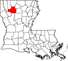 | |
| Villages | ||
| Unincorporated communities | ||