Alabaster Historic District
|
Alabaster Historic District | |
|
Quarry, c. 1904 | |
  | |
| Location | Bounded by Lake Huron, Gypsum, Keystone, and Rempert Rds., Alabaster, Michigan |
|---|---|
| Coordinates | 44°11′12″N 83°34′4″W / 44.18667°N 83.56778°WCoordinates: 44°11′12″N 83°34′4″W / 44.18667°N 83.56778°W |
| Area | 400 acres (160 ha) |
| Built | 1861 |
| Built by | United States Gypsum Co. |
| NRHP Reference # | 77000715[1] |
| Added to NRHP | December 16, 1977 |
The Alabaster Historic District is a mining complex bounded by on the east by Lake Huron, on the north by Gypsum Road, on the south by Keystone Road, and on the west by Rempert Road, south of Tawas City, Michigan. It was listed on the National Register of Historic Places in 1977.[1]
Description
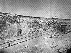
The Alabaster Historic District, located on the shore of Lake Huron, contains an enormous open pit gypsum mine, with the associated processing buildings, shops, and offices.[2] The district also contains the company town, with houses and outbuildings; most of the housing is built in a similar way, as 1-1/2-story frame houses with gable roofs.[2] The district also contains a rail line and the remains of an elevated marine tramway running 1-1/2 miles into Saginaw Bay. The district contains 36 buildings over 400 acres.[1]
History
This location was named "Alabaster" after a variety of gypsum discovered offshore in 1837 by Douglass Houghton.[3] Soon, prospectors began searching for further sources of gypsum in the area, and stumbled upon the deposits at this site.[4] The deposits came to the attention of Geoarge B. Smith, whose father, B.F. Smith, owned a gypsum mill in Detroit.[4] Smith bought the land, and opened the mine in 1862[2] George Smith soon died, and ownership changed hands, with B.F. Smith purchasing a major share. In 1891, the company was called Western Plaster Works.[4] A fire in 1891 completely destroyed the mining structures, but operations were soon rebuilt, and the Alabaster Mine supplied material for the main buildings, known as the "white city," at the World's Columbian Exposition in 1893.
In 1898, the company name was changed to the Alabaster Company.[4] In 1902, the mine was incorporated into the U.S. Gypsum Corporation.[3] Housing for workers was constructed primarily in the period around 1910. The most visible and impressive structure in the district, the elevated marine tramway, was constructed in 1929.[2] The tramway was demolished in the 1990s.[5]
The mine is no longer used.[2]
-

Alabaster Gypsum Quarry c 1904
-

Loading Dock c 1904
References
- 1 2 3 National Park Service (2010-07-09). "National Register Information System". National Register of Historic Places. National Park Service.
- 1 2 3 4 5 "Alabaster Historic District". Michigan State Housing Development Authority: Historic Sites Online. Archived from the original on October 12, 2013. Retrieved October 13, 2013.
- 1 2 "Alabaster". MichiganMarkers.com. Retrieved October 10, 2013.
- 1 2 3 4 George Perry Grimsley (1904), The Gypsum of Michigan and the Plaster Industry, R. Smith printing Company, pp. 50–75
- ↑ Amy L. Payne (February 26, 2009). "Planners propose retrofitting old gypsum tramway for wind turbines on Lake Huron". Booth Mid-Michigan.
| Topics | |
|---|---|
| Lists by states |
|
| Lists by insular areas | |
| Lists by associated states | |
| Other areas | |
| |