Agathonisi
| Agathonisi Αγαθονήσι | |
|---|---|
|
Agathonisi, with the small harbor of Agios Georgios | |
 Agathonisi | |
|
Location within the region  | |
| Coordinates: 37°27.5′N 26°58′E / 37.4583°N 26.967°ECoordinates: 37°27.5′N 26°58′E / 37.4583°N 26.967°E | |
| Country | Greece |
| Administrative region | South Aegean |
| Regional unit | Kalymnos |
| Area | |
| • Municipality | 14.5 km2 (5.6 sq mi) |
| Population (2011)[1] | |
| • Municipality | 185 |
| • Municipality density | 13/km2 (33/sq mi) |
| Time zone | EET (UTC+2) |
| • Summer (DST) | EEST (UTC+3) |

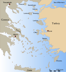
Agathonísi (Greek: Αγαθονήσι) is a small Greek island and municipality located at the northernmost point of the Dodecanese in Greece. It is surrounded by many smaller islands and is home to two villages, both inland; Megálo Chorió ("Big Village"), and Mikró Chorió ("Small Village"). Between them is the small settlement of Agios Georgios (Saint George), which forms the island's only harbor and consists of a few hotels and restaurants. The island is also locally known as Gaidaro ("Donkey"), or by its ancient name Tragea.

The highest point on the island is 209 metres (686 feet) above sea level. This peak is located close to Mikro Chorio. The island covers an area of 13.5 square kilometres (5.2 square miles). It is made almost entirely of subcrystalline stratified limestones, and is covered with thorny macchia.[2]
In the late 1920s the island had 80 inhabitants, active in agriculture and sheep rearing.[2] A census of the island in 1981 showed that it was populated by 133 people. In 1991, another census showed that the population had dropped to 112. By the 2001 census it had again risen to 158 residents, and in 2011 its population was 185, 168 of whom lived in Megálo Chorió, and only 17 in Mikró Chorió. The municipality of Agathonisi, which includes the uninhabited offshore islets of Gláros, Kounéli, Nerá, and Psathonísio, has a combined land area of 14,500 square kilometres (5,598 square miles).
Name
In ancient times, Agathonisi was known as Psetoussa (Greek: Ψετούσσα). The ancient historian Thucydides also referred to it as Tragaia (Greek: Τραγαία), while Strabo as Tragaiae and Plutarchus as Tragia. The island is known as Gaidaro in Italian and as Eşek Adası in Turkish.
History
In modern times, the islet-dependent from Patmos-was occupied in 1912 by the Kingdom of Italy during the Italo-turkish war and, after being part of the Italian Islands of the Aegean (of which it was the northernmost islet),[2] was ceded from Italy to Greece in 1947.
Administration
In 2011, as part of the Kallikratis Plan, the island's status has been upgraded from Community to Municipality.
Archipelago of Agathonisi
Near Agathonisi lie several islets: Psatonisi, Strongili, Neronisi, Katagani, all made with crystalline limestones, and Kunellonisi, which is made of schistose-crystalline rocks.[2]
References
| Wikivoyage has a travel guide for Agathonisi. |
Sources
- Bertarelli, L.V. (1929). Guida d'Italia, Vol. XVII (in Italian). Milano: Consociazione Turistica Italiana.
| Regional unit of Andros | 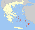 | |
|---|---|---|
| Regional unit of Kalymnos | ||
| Regional unit of Karpathos | ||
| Regional unit of Kea-Kythnos | ||
| Regional unit of Kos | ||
| Regional unit of Milos | ||
| Regional unit of Mykonos | ||
| Regional unit of Naxos | ||
| Regional unit of Paros | ||
| Regional unit of Rhodes | ||
| Regional unit of Syros | ||
| Regional unit of Thira | ||
| Regional unit of Tinos | ||