Abu Hamamah
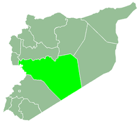
Abu Hamamah (Arabic: عسيلة, also known as Abu Humama) is a village in northern Syria, administratively part of the Rastan District, located north of Homs on the southern banks of the Orontes River. According to the Syria Central Bureau of Statistics (CBS), Abu Hamamah had a population of 255 in the 2004 census.[1] Its inhabitants are predominantly Circassians from the Shapsugh tribe.[2]
References
|
|---|
|
| |
|---|
| Homs
Subdistrict | |
|---|
| Ayn al-Niser
Subdistrict | |
|---|
| Furqlus
Subdistrict | |
|---|
| Hisyah
Subdistrict | |
|---|
| Khirbet Tin Nur
Subdistrict | |
|---|
| Mahin
Subdistrict | |
|---|
| Qabu
Subdistrict | |
|---|
| Qaryatayn
Subdistrict | |
|---|
| Riqama
Subdistrict | |
|---|
| Sadad
Subdistrict | |
|---|
| Shin
Subdistrict | |
|---|
| Taldou
Subdistrict | |
|---|
|
| |
|
| |
|---|
| Mukharram
Subdistrict | |
|---|
| Jubb al-Jarrah
Subdistrict |
- Jubb al-Jarrah
- Abu Qatur
- Aliyat al-Alyan
- Duwayr al-Gharbiyah
- Duwayr al-Sharqiyah
- Ghuzayliyah
- Maksar al-Hisan
- Masaadah
- Masudiyah
- Mughayzil
- Muntar al-Abal
- Mushayrifah al-Qibliyah
- Rasm Humaydah
- Shiha
- Taladi
- Talaqtah
- Tarfawi
- Tawil
- Umm al-Rif (al-Rish)
- Umm Tuwaynah al-Shamali
- Usmud
|
|---|
|
|
|
|
|
| |
|---|
| Rastan
Subdistrict | |
|---|
| Talbiseh
Subdistrict | |
|---|
|
|
|
| |
|---|
| Tadmur
Subdistrict | |
|---|
| Sukhnah
Subdistrict | |
|---|
|
|
|
| |
|---|
| Talkalakh
Subdistrict | |
|---|
| Hadidah
Subdistrict | |
|---|
| Hawash
Subdistrict | |
|---|
| Nasirah
Subdistrict | |
|---|
|
|