Al-Taybah al-Gharbiyah
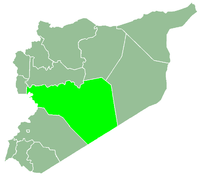
Al-Taybah al-Gharbiyah (Arabic: الطيبة الغربية, also spelled Teiba or Tayibeh al-Gharbiyeh) is a town in central Syria, administratively part of the Homs Governorate, northwest of Homs. Nearby localities include al-Shinyah to the southwest, al-Qabu to the south, Sharqliyya to the southeast, Taldou to the east, Kafr Laha and Tell Dahab to the northeast, Qarmas and Aqrab to the north, Qasraya to the northwest and Khunayzir to the west. According to the Central Bureau of Statistics (CBS), al-Taybah al-Gharbiyah had a population of 4,086 in the 2004 census.[1] Its inhabitants today are predominantly Sunni Muslims.[2]
In 1829, during Ottoman rule, the village consisted of 33 feddans and paid 3,190 qirsh in annual tax revenues.[3] In 1838 al-Taybah al-Gharbiyah's inhabitants were reported to be Alawites by English scholar Eli Smith.[4]
References
Bibliography
|
|---|
|
| |
|---|
| Homs
Subdistrict | |
|---|
| Ayn al-Niser
Subdistrict | |
|---|
| Furqlus
Subdistrict | |
|---|
| Hisyah
Subdistrict | |
|---|
| Khirbet Tin Nur
Subdistrict | |
|---|
| Mahin
Subdistrict | |
|---|
| Qabu
Subdistrict | |
|---|
| Qaryatayn
Subdistrict | |
|---|
| Riqama
Subdistrict | |
|---|
| Sadad
Subdistrict | |
|---|
| Shin
Subdistrict | |
|---|
| Taldou
Subdistrict | |
|---|
|
| |
|
| |
|---|
| Mukharram
Subdistrict | |
|---|
| Jubb al-Jarrah
Subdistrict |
- Jubb al-Jarrah
- Abu Qatur
- Aliyat al-Alyan
- Duwayr al-Gharbiyah
- Duwayr al-Sharqiyah
- Ghuzayliyah
- Maksar al-Hisan
- Masaadah
- Masudiyah
- Mughayzil
- Muntar al-Abal
- Mushayrifah al-Qibliyah
- Rasm Humaydah
- Shiha
- Taladi
- Talaqtah
- Tarfawi
- Tawil
- Umm al-Rif (al-Rish)
- Umm Tuwaynah al-Shamali
- Usmud
|
|---|
|
|
|
|
|
| |
|---|
| Rastan
Subdistrict | |
|---|
| Talbiseh
Subdistrict | |
|---|
|
|
|
| |
|---|
| Tadmur
Subdistrict | |
|---|
| Sukhnah
Subdistrict | |
|---|
|
|
|
| |
|---|
| Talkalakh
Subdistrict | |
|---|
| Hadidah
Subdistrict | |
|---|
| Hawash
Subdistrict | |
|---|
| Nasirah
Subdistrict | |
|---|
|
|