Khirbet Tin Nur
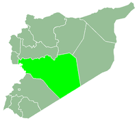
Khirbet Tin Nur (Arabic: خربة تين نور, also spelled Khirbat at-Teen Nour) is a town in central Syria, administratively part of the Homs Governorate, west of Homs. Nearby localities include Homs to the east, Qattinah to the southeast, Khirbet al-Sawda to the south, Khirbet Ghazi to the southwest, Khirbet al-Hamam to the west, Umm al-'Adam to the northwest and Khirbet Tin Mahmoud to the north. According to the Central Bureau of Statistics (CBS), Khirbet Tin Nur had a population of 2,726 in the 2004 census. It is the administrative center of a nahiyah ("sub-district") which consists of 43 localities with a combined population of 52,879 in 2004.[1] The town has a total land area of 163 hectares.[2]
The town's name, which is translated as the "Ruins of Nur's Figs," has its origins in the old part of town which was known for its abundance of fig orchards. Most of the trees have since been uprooted and today the old town is covered by shrubbery. The modern town was built southwards of the ruins.[2] In the early 1960s Khirbet Tin Nur's houses were built of basaltic lava stone.[3]
According to Swiss scholar Max van Berchem, in the early 20th-century ruins from a medieval Arab fortress were located just outside Khirbet Tin Nur.[4] Today the fortress is no longer intact.[2]
References
Bibliography
|
|---|
|
| |
|---|
| Homs
Subdistrict | |
|---|
| Ayn al-Niser
Subdistrict | |
|---|
| Furqlus
Subdistrict | |
|---|
| Hisyah
Subdistrict | |
|---|
| Khirbet Tin Nur
Subdistrict | |
|---|
| Mahin
Subdistrict | |
|---|
| Qabu
Subdistrict | |
|---|
| Qaryatayn
Subdistrict | |
|---|
| Riqama
Subdistrict | |
|---|
| Sadad
Subdistrict | |
|---|
| Shin
Subdistrict | |
|---|
| Taldou
Subdistrict | |
|---|
|
| |
|
| |
|---|
| Mukharram
Subdistrict | |
|---|
| Jubb al-Jarrah
Subdistrict |
- Jubb al-Jarrah
- Abu Qatur
- Aliyat al-Alyan
- Duwayr al-Gharbiyah
- Duwayr al-Sharqiyah
- Ghuzayliyah
- Maksar al-Hisan
- Masaadah
- Masudiyah
- Mughayzil
- Muntar al-Abal
- Mushayrifah al-Qibliyah
- Rasm Humaydah
- Shiha
- Taladi
- Talaqtah
- Tarfawi
- Tawil
- Umm al-Rif (al-Rish)
- Umm Tuwaynah al-Shamali
- Usmud
|
|---|
|
|
|
|
|
| |
|---|
| Rastan
Subdistrict | |
|---|
| Talbiseh
Subdistrict | |
|---|
|
|
|
| |
|---|
| Tadmur
Subdistrict | |
|---|
| Sukhnah
Subdistrict | |
|---|
|
|
|
| |
|---|
| Talkalakh
Subdistrict | |
|---|
| Hadidah
Subdistrict | |
|---|
| Hawash
Subdistrict | |
|---|
| Nasirah
Subdistrict | |
|---|
|
|