Aberdeenshire Canal
| Aberdeenshire Canal | |
|---|---|
|
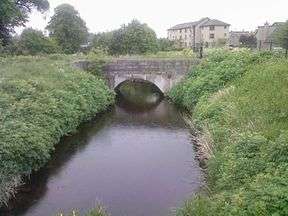
Aberdeenshire Canal at Port Elphinstone in 2007 | |
| Specifications | |
| Locks |
18 (level dropped 168 ft) |
| Status | Railway built over route |
| History | |
| Original owner | Aberdeenshire Canal Navigation Company |
| Principal engineer | Robert Whitworth |
| Date of act | 1796 |
| Date of first use | 1805 |
| Date closed | 1854 |
| Geography | |
| Start point | Port Elphinstone, Inverurie |
| End point | Aberdeen Docks |
Aberdeenshire Canal | |||||||||||||||||||||||||||||||||||||||||||||||||||||||||||||||||||||||||||||||||||||||||||||||||||||||||||||||||||||||||||||||||||||||||||||||||||||||||||||||||||||||||||||||||||||||||||||||||||||||||||||||||||||||||||||||||||||||||||||||||||||||||||||||||||||||||||||||||||||||||||||
|---|---|---|---|---|---|---|---|---|---|---|---|---|---|---|---|---|---|---|---|---|---|---|---|---|---|---|---|---|---|---|---|---|---|---|---|---|---|---|---|---|---|---|---|---|---|---|---|---|---|---|---|---|---|---|---|---|---|---|---|---|---|---|---|---|---|---|---|---|---|---|---|---|---|---|---|---|---|---|---|---|---|---|---|---|---|---|---|---|---|---|---|---|---|---|---|---|---|---|---|---|---|---|---|---|---|---|---|---|---|---|---|---|---|---|---|---|---|---|---|---|---|---|---|---|---|---|---|---|---|---|---|---|---|---|---|---|---|---|---|---|---|---|---|---|---|---|---|---|---|---|---|---|---|---|---|---|---|---|---|---|---|---|---|---|---|---|---|---|---|---|---|---|---|---|---|---|---|---|---|---|---|---|---|---|---|---|---|---|---|---|---|---|---|---|---|---|---|---|---|---|---|---|---|---|---|---|---|---|---|---|---|---|---|---|---|---|---|---|---|---|---|---|---|---|---|---|---|---|---|---|---|---|---|---|---|---|---|---|---|---|---|---|---|---|---|---|---|---|---|---|---|---|---|---|---|---|---|---|---|---|---|---|---|---|---|---|---|---|---|---|---|---|---|---|---|---|---|---|---|---|---|---|---|---|---|
Legend
| |||||||||||||||||||||||||||||||||||||||||||||||||||||||||||||||||||||||||||||||||||||||||||||||||||||||||||||||||||||||||||||||||||||||||||||||||||||||||||||||||||||||||||||||||||||||||||||||||||||||||||||||||||||||||||||||||||||||||||||||||||||||||||||||||||||||||||||||||||||||||||||
The Aberdeenshire Canal was a waterway in Aberdeenshire, Scotland, designed by John Rennie, which ran from the port of Aberdeen to Port Elphinstone, Inverurie. It opened in 1805, and closed in 1854, when it was replaced by a railway which ran along the course of the canal for most of its length.
History
The canal was originally conceived as part of a bigger scheme to link Aberdeen to Monymusk, via Inverurie, with a branch from Inverurie along the course of the Urie Glen to Insch. Captain George Taylor conducted a survey, which confirmed that the plan was feasible, but only the first part of it, to Inverurie, was built.[1]Canal Navigation, and authorised them to raise £20,000 in £50 shares. No person was permitted to have less than one share or more than 40.[2] Work started in 1796. In 1801, the project ran into financial difficulty and another Act was submitted to Parliament. In the Act, dated 24 March 1801, the company noted that of An Act of Parliament was obtained on 26 April 1796, which created The Company of Proprietors of the Aberdeenshire the £20,000 authorized by the previous Act, only £17,800 had been subscribed.[2] All of this had been spent and the company were now in debt.
The canal eventually opened in June 1805. Fourteen of the locks failed within the first few weeks, and reconstruction of the masonry resulted in the canal being shut until 1806.[3] A third Act of Parliament was passed on 13 March 1809, which enabled the company to raise a further £45,000 for work on the canal.[2]
The canal ran up the strath of the River Don from Aberdeen for a total of 18 miles (29 km)[1] to a terminus just south of Inverurie. The terminus area came to be known as Port Elphinstone after Sir James Elphinstone,[4] who was a keen supporter and financier of the canal. He lived nearby at Logie House near Oyne and Pitcaple. The canal had 17 locks, all in the first 5.5 miles (8.8 km) between Aberdeen harbour and Stoneywood, together with 56 road bridges, 20 culverts and five aqueducts.[1] From Stoneywood it ran level to Port Elphinstone and was used to carry both freight and passenger boats. Passengers were only carried on the top section, and disembarked at a building called the Boathouse,[5] situated above the five St Machar Drive locks. The fall from Stoneywood to the low water mark at Aberdeen was 168 feet (51 m).[1] It had a width of 23 feet (7.0 m) and averaged 3 feet 9 inches (1.14 m) in depth.
As built, there was no direct connection to the Aberdeen docks, which made transshipment difficult, and it was not until 1834 that the sea lock was constructed, enabling boats to enter the docks at certain states of the tide.[1] The weather also created problems, with the canal normally being shut between December and March due to icing.[6]
The main material into which the canal was cut was granite, some of which was quarried and transported to London.[2] The canal was never a financial success. It had cost nearly £44,000 to build, and revenues rose from £311 in 1807, the first full year of operation, to just £3062 in 1853, the last full year of operation.[3]
Conversion to a railway
The canal was bought by the Great North of Scotland Railway in 1845, who started the construction of a railway from Inverness to Aberdeen in 1849. The canal remained open until early 1854, when it was closed so that railway tracks could be laid along much of its length. The railway opened in September of that year.[1]
The canal today
Some fragments of the original canal construction may be discerned along the route of the railway. Within Aberdeen these include where the railway runs parallel to Elmbank Terrace, Kittybrewster (at the foot of which road is an elderly bridge carrying the road diagonally over the railway), and again where the railway runs parallel to Great Northern Road in Woodside. Dyce and Dalwearie also have obvious remains. Woodside still has a canal bridge which is in use for the road only with nothing now running underneath;[5] the railway is slightly to the north at this point. It was once well outside the bounds of the city proper, and so both that area and Old Aberdeen still boast roads named Canal Street, which sometimes leads to confusion. The original canal structure can be seen alongside the Ruschlach road to the south of Kintore.
At Port Elphinstone, by Inverurie, a short section of open water, about 1.7km (1 mile) in length, remains and a circular walkway has been created at the northern end. The footpath continues along the west bank of the canal until the end of the watered section at the site of the old Inverurie Paper Mill, where it drains into the River Don.
Points of interest
| Point | Coordinates (Links to map resources) |
OS Grid Ref | Notes |
|---|---|---|---|
| Port Elphinstone Basin | 57°16′27″N 2°22′11″W / 57.2741°N 2.3697°W | NJ778204 | |
| Railway over canal bed | 57°15′17″N 2°21′37″W / 57.2546°N 2.3604°W | NJ783182 | |
| Kintore (wharf) | 57°14′15″N 2°20′39″W / 57.2375°N 2.3441°W | NJ793163 | |
| Kinaldie | 57°13′42″N 2°16′44″W / 57.2282°N 2.2789°W | NJ832153 | |
| Remains of canal | 57°13′47″N 2°14′38″W / 57.2298°N 2.2439°W | NJ853154 | |
| Pitmedden | 57°13′31″N 2°13′35″W / 57.2254°N 2.2264°W | NJ864149 | |
| Route through Dyce | 57°12′03″N 2°10′41″W / 57.2009°N 2.1781°W | NJ893122 | |
| Woodside | 57°10′23″N 2°08′14″W / 57.1731°N 2.1372°W | NJ918091 | |
| Kittybrewster | 57°09′48″N 2°06′48″W / 57.1634°N 2.1132°W | NJ932080 | |
| Canal Street Aberdeen | 57°09′21″N 2°06′02″W / 57.1557°N 2.1005°W | NJ940072 | |
| Aberdeen Tidal Harbour | 57°08′31″N 2°04′36″W / 57.1420°N 2.0766°W | NJ954056 |
See also
Bibliography
- Davidson, Rev John (2010) [1878]. Inverurie and the Earldom of the Garioch. Kessinger Publishing. ISBN 978-1-162-12632-6.
- Lindsay, Jean (1968). The Canals of Scotland. Newton Abbott: David & Charles. ISBN 978-0-7153-4240-4.
- Priestley, Joseph (1831). "Priestley's Navigable Rivers and Canals".
References
- 1 2 3 4 5 6 Archaeology Data Service, Proceedings of the Society, 1967-8
- 1 2 3 4 Priestley 1831, pp. 2–4
- 1 2 Electric Scotland: History
- ↑ Davidson 1878, p. 472
- 1 2 North Sea Trail photo resource and history Archived July 21, 2011, at the Wayback Machine.
- ↑ Waterscape: Aberdeenshire Canal
External links
- Map and aerial photo sources for:
- "The Aberdeenshire Canal".
- "Aberdeenshire canal at Woodside". Archived from the original on 2011-07-21.
Coordinates: 57°16′06″N 2°22′11″W / 57.26831°N 2.36973°W