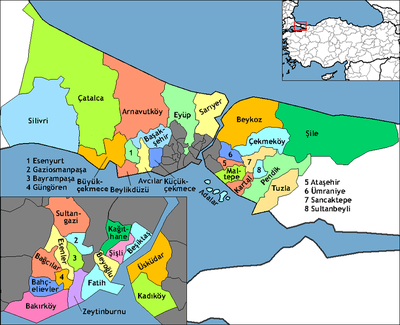
Çatalca
- "Tchataldja" and "Chataldja" redirect here. For the town in Greece with those names see Khoristi.
| Çatalca | |
|---|---|
| district | |
 Location of Çatalca in Istanbul | |
 Çatalca Location of Çatalca in Istanbul | |
| Coordinates: 41°08′30″N 28°27′47″E / 41.14167°N 28.46306°ECoordinates: 41°08′30″N 28°27′47″E / 41.14167°N 28.46306°E | |
| Country | Turkey |
| City | Istanbul |
| Government | |
| • Mayor | Cem Kara (CHP) |
| • Governor | Yüksel Ayhan |
| Area[1] | |
| • District | 1,343.70 km2 (518.81 sq mi) |
| Population (2012)[2] | |
| • Urban | 36,863 |
| • District | 63,467 |
| • District density | 47/km2 (120/sq mi) |
| Time zone | EET (UTC+2) |
| • Summer (DST) | EEST (UTC+3) |
| Area code(s) | 0-212 |
| Website |
www |
Çatalca (Metrae, Μέτραι in Ancient Greek) is a city and a rural district in Istanbul, Turkey.
It is in East Thrace, on the ridge between the Marmara and the Black Sea. Most people living in Çatalca are either farmers or those visiting vacation homes. Many families from Istanbul come to Çatalca during weekends to hike in the forests or have picnics.
History
Antiquity
Çatalca's ancient Greek name was Ergískē (Ἐργίσκη). Ergiske (Ancient Greek: Ἐργίσκη) was an ancient Greek[3] city in Thrace, located in the region of the Propontis.
According to Suida, the Greek name is after Ergiscus (Ἐργίσκος), a son of Poseidon through the naiad (nymph) Aba (Ἄβα). In Greek mythology, Aba was a nymph and she is presumed to be a daughter of the river Hebros.[4] The site is now occupied in part by modern Çatalca.
Under Roman rule, it was named Metrae or Metre and was important enough in the Late Roman province of Europa to become a suffragan of its capital Heraclea's Metropolitan Archbishop, yet was to fade.
Modern period

Çatalca was settled throughout the Ottoman period, with a typical Ottoman mixed population of Greeks and Turks. The Crimean War caused a mass exodus of Crimean Tatars towards Ottoman lands. A few Crimean Tatars settled in Çatalca.
In the First Balkan War the Bulgarian army had driven the Turkish forces back from the border, but the Turkish forces retreated to the prepared positions at Çatalca where on 16–17 November 1912 they defeated the Bulgarians at the "First Battle of Çatalca".[5][6] The Çatalca fortifications formed a line across the peninsula, the "Chataldja line", which became the armistice line of 3 December 1912,[5] after Bulgaria decided not to attack Adrianople at that time.[5][6] Upon expiration of the armistice, on 3 February [O.S. 21 January] 1913, hostilities recommenced and the Second Battle of Çatalca began. It was a series of thrusts and counter-thrusts by both the Ottomans and the Bulgarians and lasted until 3 April 1913.[7] There were a large number of journalists who reported on the military actions at Çatalca, whose accounts provide rich details about this event.
Before 1930, Çatalca also covered present districts of Arnavutköy, Beylikdüzü, Büyükçekmece, western parts of Başakşehir, rural parts of Eyüp and Sarıyer. In 1930 county (bucak) of Kilyos was part of district of Sarıyer, used to be part of Beyoğlu. At same time, villages of Odayeri, Ağaçlı, İhsaniye and Kısırmandıra (Işıklar after 1987) were passed to Kemerburgaz county (formerly part of Beyoğlu district) of Sarıyer. In 1963, villages as Arnavutköy, Bolluca, Hacımaşlı, Haraççı and İmrahor of Boyalık (its center was Hadımköy) county part of district of Gaziosmanpaşa, formerly part of Eyüp. In 1972 Tayakadın village of Boyalık county and Yeniköy one of it were passed to Gaziosmapaşa. In 1987 county of Büyükçekmece was separated and become district. Finally in 2009 remainder of Boyalık county was passed to Arnavutköy, was part of Gaziosmanpaşa and Muratbey village was passed to Büyükçekmece.
Titular see of Metrae
The diocese of Metrae was nominally restored in 1933 as a Latin Catholic titular bishopric.
It is vacant, having had the following incumbents, of the fitting episcopal (lowest) rank :
- José Selva, Salesians (S.D.B.) (1937.12.27 – death 1956.08.13), as Bishop-Prelate of Territorial Prelature of Registro do Araguaia (Brazil) (1937.12.27 – 1956.08.13)
- Alcides Mendoza Castro (1958.04.28 – 1962.12.05) as Auxiliary Bishop of Abancay (Peru) (1958.04.28 – 1962.12.05), succeeded as Bishop of Abancay (Peru) (1962.12.05 – 1967.08.12), later Titular Archbishop of Pederodiana (1967.08.12 – 1983.10.05), Archbishop Military Vicar of Peru (Peru) (1967.08.12 – 1983.10.05), Metropolitan Archbishop of Cusco (Peru) (1983.10.05 – retired 2003.11.29)
- Amadeu González Ferreiros, Mercedarians (O. de M.) (1963.02.18 – death 1995.03.20), as Bishop-Prelate of São Raimundo Nonato (Brazil) (1961.12.23 – retired 1967.12.28)
Population
As of a November 22, 2000 census, the population of Çatalca district was 81,589, while the city of Çatalca had a population of 36,544 in 2009. The population growth rate was 0.66%. The literacy rate was 99%.
Geography
Çatalca has an area of 1,715 km² and 135 kilometers of coastline. Its neighbors include Çatalca to the south, and Silivri and Tekirdağ Province to the west. Avcılar, Küçükçekmece, and Arnavutköy lie to the east. Fresh water for Istanbul is provided from by lakes Durusu and Çatalca.
Yalıköy is a seaside resort of Çatalca. The Çilingoz Nature Park west of Yalıköy offers camping and outdoor recreation activities.
Media
At Çatalca, there is a mediumwave broadcasting station with a 226 metres tall mast. It works on 702 kHz with 600 kW.
International relations
Twin towns and sister cities
Çatalca is twinned with:
-
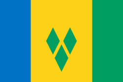 Fancy, Saint Vincent and the Grenadines
 -
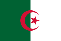 Oran, Algeria
 -
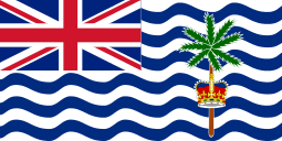 Diego Garcia, British Indian Ocean Territory
 -
 Hitadhoo, Maldives
 -
 Ganja, Azerbaijan
 -
 Lille, France
 -
 Kule, Botswana
References
- ↑ "Area of regions (including lakes), km²". Regional Statistics Database. Turkish Statistical Institute. 2002. Retrieved 2013-03-05.
- ↑ "Population of province/district centers and towns/villages by districts - 2012". Address Based Population Registration System (ABPRS) Database. Turkish Statistical Institute. Retrieved 2013-02-27.
- ↑ An Inventory of Archaic and Classical Poleis: An Investigation Conducted by The Copenhagen Polis Centre for the Danish National Research Foundation by Mogens Herman Hansen,2005,page 913
- ↑ Suda. Byzantium.
Ergiske: It is in Thrake, [and was named] after Ergiskos the son of Poseidon and Aba, a Nymphe
- 1 2 3 Hall, Richard C. (2000) The Balkan Wars 1912-1913: Prelude to the First World War Routledge, London, page 69, ISBN 0-415-22946-4
- 1 2 Black, Jeremy (2002) Warfare in the Western World, 1882-1975 Indiana University Press, Bloomington, Indiana, page 40 ISBN 0-253-34050-0
- ↑ Erickson, Edward J. (2003). Defeat in Detail: The Ottoman Army in the Balkans, 1912–1913. Greenwood Publishing Group. pp. 285 ff. ISBN 978-0-275-97888-4.
Sources and External links
| Wikivoyage has a travel guide for Çatalca. |
| Wikimedia Commons has media related to Çatalca. |
- District governor's official website (Turkish)
- District municipality's official website (Turkish)
- Çatalca local news website (Turkish)
- GCatholic with titular incumbent bio links