Mooreville, Mississippi
Mooreville, sometimes misspelled as Mooresville, is an unincorporated community and census-designated place (CDP) in Lee County, Mississippi, United States. As of the 2010 census the population was 650.[3] It was named for the Moore family, its first settlers.[4]
Mooreville, Mississippi | |
|---|---|
 Mooreville  Mooreville | |
| Coordinates: 34°15′54″N 88°34′37″W | |
| Country | United States |
| State | Mississippi |
| County | Lee |
| Area | |
| • Total | 2.794 sq mi (7.24 km2) |
| • Land | 0 sq mi (0 km2) |
| • Water | 0 sq mi (0 km2) |
| Elevation | 394 ft (120 m) |
| Population (2010) | |
| • Total | 650 |
| • Density | 232.6/sq mi (89.8/km2) |
| Time zone | UTC-6 (Central (CST)) |
| • Summer (DST) | UTC-5 (CDT) |
| ZIP code | 38857 |
| Area code(s) | 662 |
| GNIS feature ID | 2586604[2] |
| FIPS code | 28-48720 |
Mooreville is part of the Tupelo Micropolitan Statistical Area. It has a post office and a ZIP code (38857).[5]
Geography
Mooreville is in eastern Lee County along Mississippi Highway 178, 7 miles (11 km) east of the center of Tupelo, the county seat, and 4 miles (6 km) west of Dorsey. The Interstate 22 / U.S. Route 78 freeway forms the northern edge of the community, with access from Exit 94 (Highway 371). I-22/US-78 lead northwest 113 miles (182 km) to Memphis, Tennessee, and southeast 124 miles (200 km) to Birmingham, Alabama. Highway 371 leads northeast 7 miles (11 km) to Mantachie and south 19 miles (31 km) to Bigbee.
According to the U.S. Census Bureau, the Mooreville CDP has an area of 2.8 square miles (7.2 km2), all of it recorded as land.[6] Boguegaba Creek flows through the west side of the community, and Boguefala Creek forms the eastern edge; the creeks flow south-southeast to the Tombigbee River north of Amory. South Tulip Creek forms the western edge of the CDP; the creek flows southwest to Tulip Creek and thence Town Creek, which flows south-southeast to the Tombigbee south of Amory.
References
- "Archived copy". Archived from the original on 2014-08-21. Retrieved 2017-12-09.CS1 maint: archived copy as title (link)
- U.S. Geological Survey Geographic Names Information System: Mooreville, Mississippi
- "Total Population: 2010 Census DEC Summary File 1 (P1), Mooresville [sic] CDP, Mississippi". data.census.gov. U.S. Census Bureau. Retrieved April 6, 2020.
- McElvaine, Robert S. (2013). Mississippi: The WPA Guide to the Magnolia State. University Press of Mississippi. ISBN 9781604732924.
- United States Postal Service (2012). "USPS - Postmaster Finder". Retrieved 2014-08-19.
- "U.S. Gazetteer Files: 2019: Places: Mississippi". U.S. Census Bureau Geography Division. Retrieved April 6, 2020.
Municipalities and communities of Lee County, Mississippi, United States | ||
|---|---|---|
| Cities | 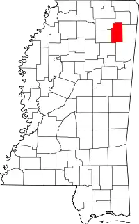 Map of Mississippi highlighting Lee County | |
| Towns | ||
| CDP | ||
Unincorporated communities | ||
| Ghost town | ||
| Footnotes | ‡This populated place also has portions in an adjacent county or counties | |
| ||
| Authority control |
|---|