Claveisolles
Claveisolles is a commune in the Rhône department in eastern France.
Claveisolles | |
|---|---|
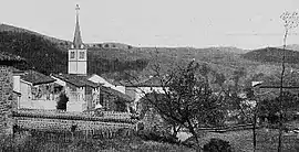 A general view of Claveisolles, at the beginning of the 20th century | |
Location of Claveisolles 
| |
 Claveisolles  Claveisolles | |
| Coordinates: 46°06′03″N 4°29′41″E | |
| Country | France |
| Region | Auvergne-Rhône-Alpes |
| Department | Rhône |
| Arrondissement | Villefranche-sur-Saône |
| Canton | Thizy-les-Bourgs |
| Intercommunality | CA de l'Ouest Rhodanien |
| Government | |
| • Mayor (2008–2014) | Gérard Poulenard |
| Area 1 | 28.33 km2 (10.94 sq mi) |
| Population (2017-01-01)[1] | 635 |
| • Density | 22/km2 (58/sq mi) |
| Time zone | UTC+01:00 (CET) |
| • Summer (DST) | UTC+02:00 (CEST) |
| INSEE/Postal code | 69060 /69870 |
| Elevation | 394–886 m (1,293–2,907 ft) (avg. 483 m or 1,585 ft) |
| 1 French Land Register data, which excludes lakes, ponds, glaciers > 1 km2 (0.386 sq mi or 247 acres) and river estuaries. | |
See also
References
- "Populations légales 2017". INSEE. Retrieved 6 January 2020.
| Wikimedia Commons has media related to Claveisolles. |
| Authority control |
|---|
This article is issued from Wikipedia. The text is licensed under Creative Commons - Attribution - Sharealike. Additional terms may apply for the media files.