Arundel, Queensland
Arundel is a suburb in the City of Gold Coast, Queensland, Australia.[2] In the 2016 census, Arundel had a population of 10,246 people.[1]
| Arundel Gold Coast, Queensland | |||||||||||||||
|---|---|---|---|---|---|---|---|---|---|---|---|---|---|---|---|
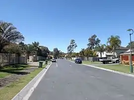 Greenacre Drive, 2015 | |||||||||||||||
 Arundel | |||||||||||||||
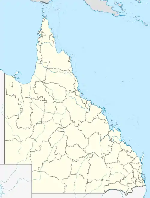
| Coordinates | 27.9386°S 153.3638°E | ||||||||||||||
| Population | 10,246 (2016 census)[1] | ||||||||||||||
| • Density | 995/km2 (2,576/sq mi) | ||||||||||||||
| Postcode(s) | 4214 | ||||||||||||||
| Area | 10.3 km2 (4.0 sq mi) | ||||||||||||||
| Time zone | AEST (UTC+10:00) | ||||||||||||||
| Location |
| ||||||||||||||
| LGA(s) | City of Gold Coast | ||||||||||||||
| State electorate(s) | Bonney | ||||||||||||||
| Federal Division(s) | Fadden | ||||||||||||||
| |||||||||||||||
Geography
Located in the suburb is the Coombabah Lake Conservation Park, bordered by Coombabah Creek and adjacent to the Ivan Gibbs Wetlands Reserve in Coombabah. The Biggera Creek Dam is located in Arundel, for the purpose of flood mitigation.
History
A.B. Paterson College opened on 1 January 1991.[3] In 2016, A.B. Paterson College celebrated its 25th anniversary.[4]
Arundel State School opened on 1 January 1994.[3]
At the 2011 census, Arundel had a population of 9,575.[5]
In the 2016 census, Arundel had a population of 10,246 people.[1]
Education
Arundel State School is a government primary (Prep-6) school for boys and girls at Cnr Napper Road & Arundel Drive (27.9450°S 153.3658°E).[6][7] In 2018, the school had an enrolment of 1125 students with 78 teachers (72 full-time equivalent) and 40 non-teaching staff (28 full-time equivalent).[8] It includes a special education program.[6][9]
A B Paterson College is a private primary and secondary (Prep-12) school for boys and girls at 10 A B Paterson Drive (27.9276°S 153.3603°E).[6][10] In 2018, the school had an enrolment of 1390 students with 103 teachers and 90 non-teaching staff (72 full-time equi
There is no government secondary school in Arundel. The nearest government secondary schools are Coombabah State High School in neighbouring Coombabah to the north, Southport State High School in neighbouring Southport to the south-east, and Pacific Pines State High School in Pacific Pines to the west.[11]
Amenities
Situated nearby is the Arundel Hills Country Club, which has its own golf course. Other major facilities are located in adjacent suburbs, including Helensvale railway station and Westfield Helensvale (Helensvale), Harbour Town Shopping Centre (Biggera Waters) and Griffith University, Gold Coast University Hospital and the G:link light rail service.
Heritage listings
There are a number of heritage-listed sites in Arundel, including:
- 120 - 124 Allied Drive: former Burleigh Police Station, former Tallebudgera Polic Station, Nui Dat House [12]
Demographics
In the 2011 census, Arundel recorded a population of 9,575 people, 51.7% female and 48.3% male.[5] The median age of the Arundel population was 36 years, 1 year below the national median of 37. 60.9% of people living in Arundel were born in Australia. The other top responses for country of birth were New Zealand 9.7%, England 5.5%, China 1.3%, South Africa 1.2%, Korea, Republic of 1.2%. 80% of people spoke only English at home; the next most common languages were 1.6% Korean, 1.5% Mandarin, 1.2% Japanese, 0.8% Cantonese, 0.5% Greek.
See also
References
- Australian Bureau of Statistics (27 June 2017). "Arundel (SSC)". 2016 Census QuickStats. Retrieved 20 October 2018.

- "Arundel – suburb in City of Gold Coast (entry 49865)". Queensland Place Names. Queensland Government. Retrieved 18 September 2020.
- "Opening and closing dates of Queensland Schools". Queensland Government. Retrieved 18 April 2019.
- "Queensland school anniversaries". Education Queensland. 1 July 2016. Archived from the original on 16 February 2018. Retrieved 12 March 2018.
- Australian Bureau of Statistics (31 October 2012). "Arundel (State Suburb)". 2011 Census QuickStats. Retrieved 6 July 2014.
- "State and non-state school details". Queensland Government. 9 July 2018. Archived from the original on 21 November 2018. Retrieved 21 November 2018.
- "Arundel State School". Archived from the original on 21 April 2013. Retrieved 21 November 2018.
- "ACARA School Profile 2018". Australian Curriculum, Assessment and Reporting Authority. Archived from the original on 27 August 2020. Retrieved 28 January 2020.
- "Arundel SS - Special Education Program". Archived from the original on 21 April 2013. Retrieved 21 November 2018.
- "A B Paterson College". Archived from the original on 9 November 2018. Retrieved 21 November 2018.
- "Queensland Globe". State of Queensland. Retrieved 17 October 2020.
- Gold Coast Local Heritage Register - A to M, pp. 17-18
Sources
- "Gold Coast Local Heritage Register - A to M" (PDF). Gold Coast City Council. Retrieved 26 August 2020.
External links
| Wikimedia Commons has media related to Arundel, Queensland. |
- "Arundel". Queensland Places. Centre for the Government of Queensland, University of Queensland.