Alipur Chatha
Ali Pur Chattha (Urdu: علی پور چٹھہ ) is a city and a union council of Wazirabad Tehsil, Gujranwala District, Punjab, Pakistan.[2][3]
Alipur Chattha
علی پور چٹھہ Akalgarh | |
|---|---|
Town | |
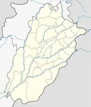 Alipur Chattha Location of Alipur Chattha  Alipur Chattha Alipur Chattha (Pakistan) | |
| Coordinates: 32.16°N 73.49°E | |
| Country | |
| Province | |
| District | Gujranwala |
| Tehsil | Wazirabad |
| Area | |
| • Total | 5 sq mi (12 km2) |
| Population | |
| • Estimate (2017) | 60,989 [1] |
| Time zone | UTC+5 (PST) |
| • Summer (DST) | +5 |
| Postal code type | 34451 |
| Calling code | 055 |
In the Ali Pur Chattha area, there are the ruins of the historical city of Akālgarh with the remnants of the Sikh Empire in this area.[4]
History
Prior to British colonial rule (1858 – 1947), the area that would become Alipur Chatha was dominated by Akalgarh. Alipur Chatha itself was founded in 1867. It was developed as a railway town on the Wazirabad – Lyallpur branch of the North – Western Railway. In 1901, the population of Alipur Chatha was 4,961.[5] When the British departed in 1947, Hindu and Sikh people left leaving a majority Muslim population.
Old town
Alipur Chatha was a walled city. One gate is known as Paki Deohri remains. In the old town, some houses (havelies) have decorative wooden gates. Small shops in the old town attract shoppers from surrounding areas.
Surrounding area
Ali Pur Chattha is surrounded by ponds and reservoirs such as the Purana Talab and the Bara Dari. The land supports agriculture which attracted people to the town. The main crops of the town are rice, wheat, sugarcane and maize or corn. Famous for the inland fishery, approximately 35,000 acres (140 km²) of land area covered by fish ponds.
Infrastructure
Sabzi Mandi is the main market in the town, where fresh produce is bought and homegrown by local farmers. There is one high school (Government High School of Alipur Chatha) which is located next to Paki Deorhi. The city also has one Government Hospital and many private hospitals where access to medical services is readily available. Govt.Post Graduate Degree Colleges for boys and girls and other govt. and private institutes are situated in the city. And more private colleges situated in the city. A highway links Alipur Chatha with Gujranwala which is considered as the major road connection of the city with the rest of Pakistan. Another road runs from Alipur to Head Qadirabad which connects Gujranwala and Alipur to Phalia and Mandi Bahauddin. Alipur railway station is situated on Wazirabad-Faisalabad railway line.
Location
The town is located 24 km from the town of Hafiz Abad, 35 km away from the city of Gujranwala, 40 km to Wazirabad, 55 km to Gujrat and 12 km away from Qadir Abad Barage.
Geography
Ali Pur Chattha is located at an elevation of 418 m (1374 ft).[6] It is situated nearly 37 km away in west from Gujranwala, 24 km in north from Hafizabad and 6 km in south from Rasulnagar and Chenab River.[7]
See also
References
- "GUJRANWALA BLOCKWISE" (PDF). Pakistan Bureau of Statistics. Retrieved 10 April 2020.
- Chief Minister looks into alleged torture of two sisters (at Alipur Chatha) Pakistan Today (newspaper), Published 9 June 2012, Retrieved 1 June 2018
- Detailed map of Alipur Chatha on mapcarta.com website Retrieved 1 June 2018
- Bansal, Bobby Singh (1 December 2015). Remnants of the Sikh Empire: Historical Sikh Monuments in India & Pakistan. Hay House, Inc. ISBN 9789384544935.
- Akālgarh - Imperial Gazetteer of India, v. 5, p. 177.
- "Location of Alipur". fallingrain.com. Falling Rain Genomics. Retrieved 1 June 2018.
- Town History of Alipur Chatha on pakgeotagging.com website Published 4 June 2017, Retrieved 1 June 2018