Unity, Oregon
- Not to be confused with the unincorporated community of Unity, in Lane County.
| Unity, Oregon | |
|---|---|
| City | |
|
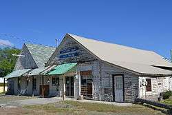
A store in Unity | |
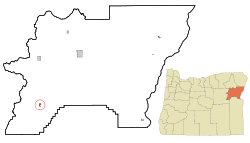 Location in Oregon | |
| Coordinates: 44°26′15″N 118°11′34″W / 44.43750°N 118.19278°WCoordinates: 44°26′15″N 118°11′34″W / 44.43750°N 118.19278°W | |
| Country | United States |
| State | Oregon |
| County | Baker |
| Incorporated | 1972 |
| Government | |
| • General Manager | Mark Bennett |
| Area[1] | |
| • Total | 0.65 sq mi (1.68 km2) |
| • Land | 0.64 sq mi (1.66 km2) |
| • Water | 0.01 sq mi (0.03 km2) |
| Elevation | 4,040 ft (1,230 m) |
| Population (2010)[2] | |
| • Total | 71 |
| • Estimate (2012[3]) | 70 |
| • Density | 110.9/sq mi (42.8/km2) |
| Time zone | Pacific (UTC-8) |
| • Summer (DST) | Pacific (UTC-7) |
| ZIP code | 97884 |
| Area code(s) | 541 |
| FIPS code | 41-76250[4] |
| GNIS feature ID | 1151657[5] |
Unity is a city in Baker County, Oregon, United States, located in the Burnt River Valley. The population was 71 at the 2010 census.
History
While the town was never platted, a post office was established in Unity in 1891.[6] A sawmill existed for some time.[6] The Unity Ranger Station, which was built by the Civilian Conservation Corps, is listed on the National Register of Historic Places
Geography
According to the United States Census Bureau, the city has a total area of 0.65 square miles (1.68 km2), of which, 0.64 square miles (1.66 km2) is land and 0.01 square miles (0.03 km2) is water.[1]
Climate
This climatic region is typified by large seasonal temperature differences, with warm to hot (and often humid) summers and cold (sometimes severely cold) winters. According to the Köppen Climate Classification system, Unity has a humid continental climate, abbreviated "Dfb" on climate maps.[7]
| Climate data for Unity | |||||||||||||
|---|---|---|---|---|---|---|---|---|---|---|---|---|---|
| Month | Jan | Feb | Mar | Apr | May | Jun | Jul | Aug | Sep | Oct | Nov | Dec | Year |
| Record high °F (°C) | 56 (13) |
68 (20) |
84 (29) |
92 (33) |
97 (36) |
105 (41) |
107 (42) |
103 (39) |
101 (38) |
88 (31) |
69 (21) |
58 (14) |
107 (42) |
| Average high °F (°C) | 32.5 (0.3) |
39.3 (4.1) |
47.9 (8.8) |
57.7 (14.3) |
66.5 (19.2) |
74.7 (23.7) |
85.6 (29.8) |
84.6 (29.2) |
74.9 (23.8) |
61.8 (16.6) |
44.7 (7.1) |
34.6 (1.4) |
58.7 (14.8) |
| Average low °F (°C) | 11.8 (−11.2) |
17.3 (−8.2) |
22.7 (−5.2) |
27.8 (−2.3) |
33.7 (0.9) |
39 (4) |
43.4 (6.3) |
42.1 (5.6) |
35 (2) |
28 (−2) |
21.4 (−5.9) |
15.8 (−9) |
28.2 (−2.1) |
| Record low °F (°C) | −32 (−36) |
−28 (−33) |
−15 (−26) |
6 (−14) |
11 (−12) |
20 (−7) |
24 (−4) |
22 (−6) |
11 (−12) |
−2 (−19) |
−21 (−29) |
−33 (−36) |
−33 (−36) |
| Average precipitation inches (mm) | 1.13 (28.7) |
0.75 (19) |
0.71 (18) |
0.66 (16.8) |
1.13 (28.7) |
1.16 (29.5) |
0.52 (13.2) |
0.6 (15) |
0.55 (14) |
0.63 (16) |
1.07 (27.2) |
1.24 (31.5) |
10.16 (258.1) |
| Average snowfall inches (cm) | 9.8 (24.9) |
6 (15) |
2.3 (5.8) |
0.4 (1) |
0.1 (0.3) |
0.1 (0.3) |
0 (0) |
0 (0) |
0 (0) |
0.3 (0.8) |
3.4 (8.6) |
8.5 (21.6) |
31 (79) |
| Average precipitation days | 9 | 7 | 7 | 6 | 8 | 7 | 4 | 4 | 4 | 5 | 8 | 9 | 78 |
| Source: [8] | |||||||||||||
Demographics
| Historical population | |||
|---|---|---|---|
| Census | Pop. | %± | |
| 1980 | 115 | — | |
| 1990 | 87 | −24.3% | |
| 2000 | 131 | 50.6% | |
| 2010 | 71 | −45.8% | |
| Est. 2015 | 68 | [9] | −4.2% |
2010 census
As of the census[2] of 2010, there were 71 people, 36 households, and 20 families residing in the city. The population density was 110.9 inhabitants per square mile (42.8/km2). There were 58 housing units at an average density of 90.6 per square mile (35.0/km2). The racial makeup of the city was 83.1% White, 4.2% Native American, and 12.7% Asian. Hispanic or Latino of any race were 8.5% of the population.
There were 36 households of which 22.2% had children under the age of 18 living with them, 38.9% were married couples living together, 5.6% had a female householder with no husband present, 11.1% had a male householder with no wife present, and 44.4% were non-families. 41.7% of all households were made up of individuals and 16.6% had someone living alone who was 65 years of age or older. The average household size was 1.97 and the average family size was 2.65.
The median age in the city was 49.6 years. 18.3% of residents were under the age of 18; 0.0% were between the ages of 18 and 24; 25.2% were from 25 to 44; 32.4% were from 45 to 64; and 23.9% were 65 years of age or older. The gender makeup of the city was 56.3% male and 43.7% female.
2000 census
As of the census[4] of 2000, there were 131 people, 57 households, and 36 families residing in the city. The population density was 283.0 people per square mile (110.0/km²). There were 75 housing units at an average density of 162.0 per square mile (63.0/km²). The racial makeup of the city was 97.71% White, 1.53% Native American, and 0.76% from two or more races. Hispanic or Latino of any race were 2.29% of the population.
There were 57 households out of which 35.1% had children under the age of 18 living with them, 47.4% were married couples living together, 7.0% had a female householder with no husband present, and 35.1% were non-families. 33.3% of all households were made up of individuals and 8.8% had someone living alone who was 65 years of age or older. The average household size was 2.30 and the average family size was 2.89.
In the city the population was spread out with 29.0% under the age of 18, 10.7% from 18 to 24, 24.4% from 25 to 44, 26.7% from 45 to 64, and 9.2% who were 65 years of age or older. The median age was 37 years. For every 100 females there were 104.7 males. For every 100 females age 18 and over, there were 97.9 males.
The median income for a household in the city was $27,679, and the median income for a family was $28,250. Males had a median income of $28,750 versus $14,375 for females. The per capita income for the city was $13,673. There were 5.3% of families and 15.8% of the population living below the poverty line, including 8.0% of under eighteens and 33.3% of those over 64.
References
- 1 2 "US Gazetteer files 2010". United States Census Bureau. Archived from the original on January 24, 2012. Retrieved 2012-12-21.
- 1 2 "American FactFinder". United States Census Bureau. Retrieved 2012-12-21.
- ↑ "Population Estimates". United States Census Bureau. Archived from the original on June 17, 2013. Retrieved 2013-06-02.
- 1 2 "American FactFinder". United States Census Bureau. Archived from the original on September 11, 2013. Retrieved 2008-01-31.
- ↑ "US Board on Geographic Names". United States Geological Survey. 2007-10-25. Retrieved 2008-01-31.
- 1 2 Bailey, Barbara Ruth (1982). Main Street: Northeastern Oregon. Oregon Historical Society. p. 53. ISBN 0-87595-073-6.
- ↑ Climate Summary for Unity, Oregon
- ↑ "UNITY, OR (358780)". Western Regional Climate Center. Retrieved November 26, 2015.
- ↑ "Annual Estimates of the Resident Population for Incorporated Places: April 1, 2010 to July 1, 2015". Retrieved July 2, 2016.
- ↑ "Census of Population and Housing". Census.gov. Archived from the original on May 11, 2015. Retrieved June 4, 2015.
External links
- Entry for Unity in the Oregon Blue Book
Municipalities and communities of Baker County, Oregon, United States | ||
|---|---|---|
| Cities |  | |
| Unincorporated communities | ||
| Ghost towns | ||