Sainte-Françoise, Bas-Saint-Laurent, Quebec
| Sainte-Françoise | |
|---|---|
| Parish municipality | |
 | |
_Quebec_location_diagram.png) Location within Les Basques RCM | |
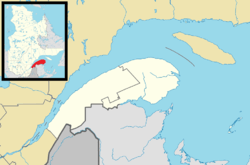 Sainte-Françoise Location in eastern Quebec | |
| Coordinates: 48°06′N 69°04′W / 48.1°N 69.07°WCoordinates: 48°06′N 69°04′W / 48.1°N 69.07°W[1] | |
| Country |
|
| Province |
|
| Region | Bas-Saint-Laurent |
| RCM | Les Basques |
| Constituted | December 6, 1873 |
| Government[2] | |
| • Mayor | Simon Lavoie |
| • Federal riding |
Rimouski-Neigette—Témiscouata —Les Basques |
| • Prov. riding | Rivière-du-Loup-Témiscouata |
| Area[2][3] | |
| • Total | 89.40 km2 (34.52 sq mi) |
| • Land | 88.07 km2 (34.00 sq mi) |
| Population (2011)[3] | |
| • Total | 399 |
| • Density | 4.5/km2 (12/sq mi) |
| • Pop 2006-2011 |
|
| • Dwellings | 229 |
| Time zone | EST (UTC−5) |
| • Summer (DST) | EDT (UTC−4) |
| Postal code(s) | G0L 3B0 |
| Area code(s) | 418 and 581 |
| Highways |
|
Sainte-Françoise is a parish municipality in the Bas-Saint-Laurent region of Quebec, Canada.
Demographics
Population
| Canada census – Sainte-Françoise, Bas-Saint-Laurent, Quebec community profile | |||
|---|---|---|---|
| 2011 | 2006 | 2001 | |
| Population: | 399 (-7.4% from 2006) | 431 (-4.9% from 2001) | 453 (-3.0% from 1996) |
| Land area: | 88.07 km2 (34.00 sq mi) | 88.07 km2 (34.00 sq mi) | 88.06 km2 (34.00 sq mi) |
| Population density: | 4.5/km2 (12/sq mi) | 4.9/km2 (13/sq mi) | 5.1/km2 (13/sq mi) |
| Median age: | 52.6 (M: 53.5, F: 51.6) | 49.7 (M: 49.4, F: 50.1) | 45.6 (M: 45.5, F: 45.8) |
| Total private dwellings: | 229 | 232 | 204 |
| Median household income: | $40,716 | $24,041 | $35,685 |
| References: 2011[4] 2006[5] 2001[6] | |||
| Historical Census Data - Sainte-Françoise, Bas-Saint-Laurent, Quebec[7] | ||
|---|---|---|
| Year | Pop. | ±% |
| 1991 | 506 | — |
| 1996 | 467 | −7.7% |
| 2001 | 453 | −3.0% |
| 2006 | 431 | −4.9% |
| 2011 | 399 | −7.4% |
Language
| Canada Census Mother Tongue - Sainte-Françoise, Bas-Saint-Laurent, Quebec[7] | ||||||||||||||||||
|---|---|---|---|---|---|---|---|---|---|---|---|---|---|---|---|---|---|---|
| Census | Total | French |
English |
French & English |
Other | |||||||||||||
| Year | Responses | Count | Trend | Pop % | Count | Trend | Pop % | Count | Trend | Pop % | Count | Trend | Pop % | |||||
| 2011 |
405 |
395 | |
97.53% | 5 | |
1.23% | 5 | |
1.23% | 0 | |
0.00% | |||||
| 2006 |
420 |
410 | |
97.62% | 0 | |
0.00% | 0 | |
0.00% | 10 | |
2.38% | |||||
| 2001 |
450 |
450 | |
100.00% | 0 | |
0.00% | 0 | |
0.00% | 0 | |
0.00% | |||||
| 1996 |
465 |
465 | n/a | 100.00% | 0 | n/a | 0.00% | 0 | n/a | 0.00% | 0 | n/a | 0.00% | |||||
See also
References
- ↑ Reference number 56176 of the Commission de toponymie du Québec (French)
- 1 2 Geographic code 11030 in the official Répertoire des municipalités (French)
- 1 2 "(Code 2411030) Census Profile". 2011 census. Statistics Canada. 2012.
- ↑ "2011 Community Profiles". Canada 2011 Census. Statistics Canada. July 5, 2013. Retrieved 2014-03-11.
- ↑ "2006 Community Profiles". Canada 2006 Census. Statistics Canada. March 30, 2011. Retrieved 2014-03-11.
- ↑ "2001 Community Profiles". Canada 2001 Census. Statistics Canada. February 17, 2012. Retrieved 2014-03-11.
- 1 2 Statistics Canada: 1996, 2001, 2006, 2011 census
External links
-
 Media related to Sainte-Françoise, Bas-Saint-Laurent, Quebec at Wikimedia Commons
 |
Notre-Dame-des-Neiges | |
Saint-Mathieu-de-Rioux | |
| |
Lac-Boisbouscache | |||
| ||||
| | ||||
| Saint-Éloi | Saint-Jean-de-Dieu | Saint-Médard |
| Cities & Towns | |
|---|---|
| Municipalities | |
| Parishes | |
| Unorganized territories | |
| |
This article is issued from Wikipedia - version of the 12/1/2016. The text is available under the Creative Commons Attribution/Share Alike but additional terms may apply for the media files.