Mirganj, Bihar
| Mirganj | |
|---|---|
| Town | |
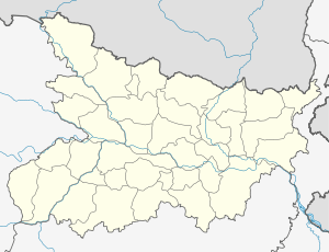 Mirganj Location in Bihar, India | |
| Coordinates: 26°22′04″N 84°20′51″E / 26.36764°N 84.34738°ECoordinates: 26°22′04″N 84°20′51″E / 26.36764°N 84.34738°E | |
| Country |
|
| State | Bihar |
| District | Gopalganj |
| Population (2001) | |
| • Total | 23,579 |
| Languages | |
| • Official | Bhojpuri, Hindi |
| Time zone | IST (UTC+5:30) |
| PIN | 841438 |
| Lok Sabha constituency | Gopalganj |
| Vidhan Sabha constituency | Hathua |
Mirganj is a town and a notified area in Gopalganj district in the Indian state of Bihar. Pin code of Mirganj is 841438. [1]
Demographics
At the 2001 India census,[2] Mirganj had a population of more than 60,000. Males constituted 52% of the population and females 48%. Mirganj had an average literacy rate of 65%, higeher than the national average of 59.5%: male literacy was 61%, and female literacy was 43%. In Mirganj, 18% of the population were under 6 years of age.
Bhojpuri , HINDI English is the locally spoken language of Mirganj.
Temple &Mosque
Dakhin muhala IZMAL BABA MAZAR SARIF, beside of Mosque.Prachin Augadh Dani Mandir,near Railway station Mirganj in front of Post office Mirganj, Shiv Shri Ram Janki Mandir in Sabji Market(mandi) Mirganj, sai baba mandir near rajendra chowk. Madina masjid at thana more Mirganj. A majar of mirjamal sb at hathua more mirganj.
References
- ↑ "Mirganj Pin code". citypincode.in. Retrieved 2015-03-01.
- ↑ "Census of India 2001: Data from the 2010 Census, including cities, villages and towns (Provisional)". Census Commission of India. Archived from the original on 2004-06-16. Retrieved 2008-11-01.