Guyan Township, Gallia County, Ohio
| Guyan Township, Gallia County, Ohio | |
|---|---|
| Township | |
|
State Route 7 just east of Crown City | |
 Location of Guyan Township in Gallia County | |
| Coordinates: 38°37′20″N 82°17′53″W / 38.62222°N 82.29806°WCoordinates: 38°37′20″N 82°17′53″W / 38.62222°N 82.29806°W | |
| Country | United States |
| State | Ohio |
| County | Gallia |
| Area | |
| • Total | 31.6 sq mi (81.9 km2) |
| • Land | 31.6 sq mi (81.8 km2) |
| • Water | 0.0 sq mi (0.1 km2) |
| Elevation[1] | 702 ft (214 m) |
| Population (2000) | |
| • Total | 1,199 |
| • Density | 38.0/sq mi (14.7/km2) |
| Time zone | Eastern (EST) (UTC-5) |
| • Summer (DST) | EDT (UTC-4) |
| FIPS code | 39-32760[2] |
| GNIS feature ID | 1086138[1] |

Guyan Township is one of the fifteen townships of Gallia County, Ohio, United States. The 2000 census found 1,199 people in the township, 788 of whom lived in the unincorporated portions of the township.[3]
Geography
Located in the southern part of the county along the Ohio River, it borders the following townships:
- Harrison Township - north
- Clay Township - northeast corner
- Ohio Township - east
- Rome Township, Lawrence County - south
- Windsor Township, Lawrence County - southwest corner
- Mason Township, Lawrence County - west
- Walnut Township - northwest corner
Cabell County, West Virginia lies across the Ohio River to the southeast.
The farthest downstream Ohio River township in the county, it is also the most southerly township in the county.
The village of Crown City is located in southern Guyan Township. It is the third smallest village in Gallia County.
Name and history
It is the only Guyan Township statewide.[4]
Guyan Township was named after the creek that runs through it.[5]
Government
The township is governed by a three-member board of trustees, who are elected in November of odd-numbered years to a four-year term beginning on the following January 1. Two are elected in the year after the presidential election and one is elected in the year before it. There is also an elected township fiscal officer,[6] who serves a four-year term beginning on April 1 of the year after the election, which is held in November of the year before the presidential election. Vacancies in the fiscal officership or on the board of trustees are filled by the remaining trustees.
References
- 1 2 "US Board on Geographic Names". United States Geological Survey. 2007-10-25. Retrieved 2008-01-31.
- ↑ "American FactFinder". United States Census Bureau. Retrieved 2008-01-31.
- ↑ Gallia County, Ohio — Population by Places Estimates Ohio State University, 2007. Accessed 15 May 2007.
- ↑ "Detailed map of Ohio" (PDF). United States Census Bureau. 2000. Retrieved 2007-02-16.
- ↑ Kilbourn, John (1833). "The Ohio Gazetteer, or, a Topographical Dictionary". Scott and Wright. p. 228. Retrieved 12 December 2013.
- ↑ §503.24, §505.01, and §507.01 of the Ohio Revised Code. Accessed 4/30/2009.
External links
Municipalities and communities of Gallia County, Ohio, United States | ||
|---|---|---|
| Villages | 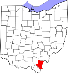 | |
| Townships | ||
| CDP | ||
| Unincorporated communities | ||