Emmet, South Dakota
| Emmet, South Dakota | |
|---|---|
| Township | |
| Coordinates: 42°57′9″N 96°44′35″W / 42.95250°N 96.74306°WCoordinates: 42°57′9″N 96°44′35″W / 42.95250°N 96.74306°W | |
| Country | United States |
| State | South Dakota |
| County | Union |
| Area | |
| • Total | 36.0 sq mi (93.1 km2) |
| • Land | 36.0 sq mi (93.1 km2) |
| • Water | 0.0 sq mi (0.0 km2) |
| Elevation | 1,299 ft (396 m) |
| Population (2000) | |
| • Total | 257 |
| • Density | 7.1/sq mi (2.8/km2) |
| Time zone | Central (CST) (UTC-6) |
| • Summer (DST) | CDT (UTC-5) |
| ZIP code | 57004 |
| Area code(s) | 605 |
| FIPS code | 46-19500[1] |
| GNIS feature ID | 1269001[2] |
Emmet is a ghost town in Emmet Township, Union County, South Dakota, South Dakota, United States.
Geography
Emmet is located at (42.98665, -96.7464).[3]
Emmet has been assigned the ZIP code 57004, and the FIPS place code 19510.
History
The Emmet community started as early as 1871. The area was settled by an Irish-German colony, originating from Galena, Illinois. The community once had a general store, Emmet Hall, and St. Joseph's Catholic Church.
Eventually, the railroads passed through larger towns, causing populations and businesses in smaller communities such as Emmet to move away. Today, the only physical remnant of the Emmet community is the parsonage and the St. Joseph Cemetery, which surrounds the site where the old Catholic church once stood. This cemetery is still commonly known as the Emmet Cemetery.
The old Emmet Hall building (also known as Forrester's Hall) still stands. It is located approximately half a mile north and two miles west of the St. Joseph Cemetery. The multisided building is best known as the place where Lawrence Welk and his band once performed. After the 1950s, the building was no longer used as a dance hall and was converted for farm use. Two large sliding doors were added to the building's west side; and, the building was reported to have been used to store grain and to house sheep.
References
- ↑ "American FactFinder". United States Census Bureau. Retrieved 2008-01-31.
- ↑ "US Board on Geographic Names". United States Geological Survey. 2007-10-25. Retrieved 2008-01-31.
- ↑ "US Gazetteer files: 2010, 2000, and 1990". United States Census Bureau. 2011-02-12. Retrieved 2011-04-23.
External links
Municipalities and communities of Union County, South Dakota, United States | ||
|---|---|---|
| Cities | 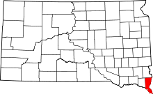 | |
| Townships | ||
| CDPs | ||
| Other unincorporated communities | ||
| Ghost town | ||
| Footnotes | ‡This populated place also has portions in an adjacent county or counties | |