Donnybrook, Oregon
| Donnybrook, Oregon | |
|---|---|
| Unincorporated community | |
 Donnybrook, Oregon  Donnybrook, Oregon | |
| Coordinates: 44°45′15″N 120°39′04″W / 44.7542950°N 120.6511423°WCoordinates: 44°45′15″N 120°39′04″W / 44.7542950°N 120.6511423°W | |
| Country | United States |
| State | Oregon |
| County | Jefferson |
| Elevation | 3,396 ft (1,035 m) |
| Time zone | Pacific (PST) (UTC-8) |
| • Summer (DST) | PDT (UTC-7) |
| ZIP code | 97711 |
| Area code(s) | 458 and 541 |
Donnybrook is a historic unincorporated community in Jefferson County, Oregon, United States.[1] Donnybrook is located about 20 miles south of Antelope, and 10 miles east of Ashwood.[2] The area was first known as "Axehandle", and later as "Kilts".
History
Axehandle was located at 44°45′02″N 120°39′04″W / 44.7506839°N 120.6511421°W.[3] It was about a quarter mile south of Donnybrook.[4] The locale of Axehandle was named for Axehandle Spring, which was given its name in the late 19th century by some wood haulers from Antelope who found a broken axehandle near a watering hole while working to bring wood from the Blue Mountains.[5] The "Axehandle" moniker came to comprise the area of several ranches.[5]
Donnybrook is located at 44°45′15″N 120°39′04″W / 44.7542950°N 120.6511423°W.[1] The name was coined by Joe Brannon for a brawl ("donnybrook", named for the Donnybrook Fair, which took place in Donnybrook, Dublin, Ireland) among some Irish sheepherders during the homestead era.[5][6] At one time Donnybrook had a school.[5]
Jesse Kilts homesteaded in the area, and when a post office was established on September 15, 1914, it was named for Mr. Kilts, whose wife, Ruth, was the first postmaster.[5] Kilts post office closed on June 29, 1940.[5] According to Oregon Geographic Names, Kilts was considered a newcomer in the area, and longtime residents have always called the locale "Donnybrook" instead of "Kilts".[5] Modern atlases show the locale as "Donnybrook".[2] The location of Kilts post office moved many times, as was common in the pioneer era.[6] According to author Ralph Friedman, as of 1993 only one of the private homes in which the post office was located was still standing, all the rest having been burned or torn down.[6] Kilts, which is the only one of the three locations not marked as a "historical" populated place by the USGS, is shown as currently being located at 44°44′19″N 120°35′44″W / 44.7387402°N 120.5955845°W, about 4 miles east of Donnybrook.[4][7]
References
- 1 2 "Donnybrook (historical)". Geographic Names Information System. United States Geological Survey. November 28, 1980. Retrieved February 10, 2015.
- 1 2 Oregon Atlas & Gazetteer (7th ed.). Yarmouth, Maine: DeLorme. 2008. ISBN 0-89933-347-8.
- ↑ "Axehandle (historical)". Geographic Names Information System. United States Geological Survey. May 22, 1986. Retrieved February 10, 2015.
- 1 2 Google (February 10, 2015). "Axehandle, Donnybrook, and Kilts" (Map). Google Maps. Google. Retrieved February 10, 2015.
- 1 2 3 4 5 6 7 McArthur, Lewis A.; McArthur, Lewis L. (2003) [1928]. Oregon Geographic Names (7th ed.). Portland, Oregon: Oregon Historical Society Press. pp. 40–41, 297–298, 535. ISBN 978-0875952772.
- 1 2 3 Friedman, Ralph (2002) [1993]. "A Grasshopper Called Kilts". The Other Side of Oregon (2nd ed.). Caldwell, Idaho: The Caxton Printers, Ltd. p. 241. ISBN 0-87004-352-8.
- ↑ "Kilts". Geographic Names Information System. United States Geological Survey. May 22, 1986. Retrieved February 10, 2015.
External links
- Images of Donnybrook from Flickr
- Ruins of Donnybrook School
Municipalities and communities of Jefferson County, Oregon, United States | ||
|---|---|---|
| Cities | 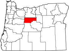 | |
| CDPs | ||
| Other unincorporated communities | ||
| Indian reservation | ||