Brouilletts Creek Township, Edgar County, Illinois
| Brouilletts Creek Township | |
|---|---|
| Township | |
 Location in Edgar County | |
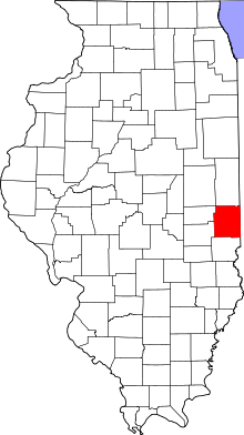 Edgar County's location in Illinois | |
| Coordinates: 39°44′48″N 87°34′53″W / 39.74667°N 87.58139°WCoordinates: 39°44′48″N 87°34′53″W / 39.74667°N 87.58139°W | |
| Country | United States |
| State | Illinois |
| County | Edgar |
| Established | November 4, 1856 |
| Area | |
| • Total | 32.02 sq mi (82.9 km2) |
| • Land | 32.02 sq mi (82.9 km2) |
| • Water | 0 sq mi (0 km2) 0% |
| Elevation | 568 ft (173 m) |
| Population (2010) | |
| • Total | 235 |
| • Density | 7.3/sq mi (2.8/km2) |
| Time zone | CST (UTC-6) |
| • Summer (DST) | CDT (UTC-5) |
| ZIP codes | 61924, 61944 |
| GNIS feature ID | 0428719 |
Brouilletts Creek Township is one of fifteen townships in Edgar County, Illinois, USA. As of the 2010 census, its population was 235 and it contained 114 housing units.[1]
Geography
According to the 2010 census, the township has a total area of 32.02 square miles (82.9 km2), all land.[1]
Extinct towns
- Kidley
- Logan
Cemeteries
The township contains these twelve cemeteries: Adams, Allen, Cameron, Houseton, Igo, Littlefield, McCauley, Mount Carmel, Newcomb, Newton, Old Scott and Sugar Grove.
School districts
- Edgar County Community Unit District 6
- Paris Community Unit School District 4
Political districts
- Illinois' 15th congressional district
- State House District 109
- State Senate District 55
References
- "Brouilletts Creek Township, Edgar County, Illinois". Geographic Names Information System. United States Geological Survey. Retrieved 2010-01-10.
- United States Census Bureau 2007 TIGER/Line Shapefiles
- United States National Atlas
- 1 2 "Population, Housing Units, Area, and Density: 2010 - County -- County Subdivision and Place -- 2010 Census Summary File 1". United States Census. Retrieved 2013-05-28.
External links
 |
Prairie Township | | ||
| Edgar Township | |
Helt Township, Vermillion County, Indiana | ||
| ||||
| | ||||
| Hunter Township |
Municipalities and communities of Edgar County, Illinois, United States | ||
|---|---|---|
| Cities | ||
| Villages | ||
| Townships | ||
| Unincorporated communities | ||
| Footnotes | ‡This populated place also has portions in an adjacent county or counties | |
This article is issued from Wikipedia - version of the 11/9/2016. The text is available under the Creative Commons Attribution/Share Alike but additional terms may apply for the media files.