Zurich, Kansas
| Zurich, Kansas | |
|---|---|
| City | |
 Location within Rooks County and Kansas | |
 KDOT map of Rooks County (legend) | |
| Coordinates: 39°13′58″N 99°26′5″W / 39.23278°N 99.43472°WCoordinates: 39°13′58″N 99°26′5″W / 39.23278°N 99.43472°W | |
| Country | United States |
| State | Kansas |
| County | Rooks |
| Area[1] | |
| • Total | 0.17 sq mi (0.44 km2) |
| • Land | 0.17 sq mi (0.44 km2) |
| • Water | 0 sq mi (0 km2) |
| Elevation | 2,215 ft (675 m) |
| Population (2010)[2] | |
| • Total | 99 |
| • Estimate (2015)[3] | 99 |
| • Density | 580/sq mi (230/km2) |
| Time zone | CST (UTC-6) |
| • Summer (DST) | CDT (UTC-5) |
| ZIP code | 67663 |
| Area code | 785 |
| FIPS code | 20-81025 [4] |
| GNIS feature ID | 0472436 [5] |
Zurich is a city in Rooks County, Kansas, United States. As of the 2010 census, the city population was 99.[6]
History
Zurich was located on the Union Pacific Railroad.[7] It was named by Swiss settlers after Zürich, in Switzerland.[8]
A post office was opened in Zurich in 1880, and remained in operation until it was discontinued in 1996.[9]
Geography
Zurich is located at 39°13′58″N 99°26′5″W / 39.23278°N 99.43472°W (39.232810, -99.434814).[10] According to the United States Census Bureau, the city has a total area of 0.17 square miles (0.44 km2), all of it land.[1]
Demographics
| Historical population | |||
|---|---|---|---|
| Census | Pop. | %± | |
| 1950 | 186 | — | |
| 1960 | 244 | 31.2% | |
| 1970 | 189 | −22.5% | |
| 1980 | 185 | −2.1% | |
| 1990 | 151 | −18.4% | |
| 2000 | 126 | −16.6% | |
| 2010 | 99 | −21.4% | |
| Est. 2015 | 99 | [3] | 0.0% |
| U.S. Decennial Census | |||
2010 census
As of the census[2] of 2010, there were 99 people, 46 households, and 24 families residing in the city. The population density was 582.4 inhabitants per square mile (224.9/km2). There were 67 housing units at an average density of 394.1 per square mile (152.2/km2). The racial makeup of the city was 99.0% White and 1.0% from two or more races.
There were 46 households of which 19.6% had children under the age of 18 living with them, 41.3% were married couples living together, 6.5% had a female householder with no husband present, 4.3% had a male householder with no wife present, and 47.8% were non-families. 39.1% of all households were made up of individuals and 8.7% had someone living alone who was 65 years of age or older. The average household size was 2.15 and the average family size was 3.00.
The median age in the city was 42.8 years. 20.2% of residents were under the age of 18; 13.2% were between the ages of 18 and 24; 19.3% were from 25 to 44; 33.4% were from 45 to 64; and 14.1% were 65 years of age or older. The gender makeup of the city was 48.5% male and 51.5% female.
2000 census
As of the census[4] of 2000, there were 126 people, 51 households, and 37 families residing in the city. The population density was 731.6 people per square mile (286.2/km²). There were 60 housing units at an average density of 348.4 per square mile (136.3/km²). The racial makeup of the city was 99.21% White and 0.79% African American.
There were 51 households out of which 27.5% had children under the age of 18 living with them, 64.7% were married couples living together, 7.8% had a female householder with no husband present, and 25.5% were non-families. 21.6% of all households were made up of individuals and 7.8% had someone living alone who was 65 years of age or older. The average household size was 2.47 and the average family size was 2.89.
In the city the population was spread out with 25.4% under the age of 18, 6.3% from 18 to 24, 26.2% from 25 to 44, 23.0% from 45 to 64, and 19.0% who were 65 years of age or older. The median age was 40 years. For every 100 females there were 90.9 males. For every 100 females age 18 and over, there were 88.0 males.
The median income for a household in the city was $32,000, and the median income for a family was $33,125. Males had a median income of $25,313 versus $14,107 for females. The per capita income for the city was $12,235. There were 5.7% of families and 4.7% of the population living below the poverty line, including no under eighteens and 11.1% of those over 64.
References
- 1 2 "US Gazetteer files 2010". United States Census Bureau. Archived from the original on January 24, 2012. Retrieved 2012-07-06.
- 1 2 "American FactFinder". United States Census Bureau. Retrieved 2012-07-06.
- 1 2 "Annual Estimates of the Resident Population for Incorporated Places: April 1, 2010 to July 1, 2015". Retrieved July 2, 2016.
- 1 2 "American FactFinder". United States Census Bureau. Archived from the original on September 11, 2013. Retrieved 2008-01-31.
- ↑ "US Board on Geographic Names". United States Geological Survey. 2007-10-25. Retrieved 2008-01-31.
- ↑ "2010 City Population and Housing Occupancy Status". U.S. Census Bureau. Archived from the original on July 21, 2011. Retrieved March 6, 2011.
- ↑ Gannett, Henry (1898). A Gazetteer of Kansas. Govt. Print. Off. p. 246.
- ↑ "County History". Rooks County, Kansas. Retrieved 22 June 2014.
- ↑ "Kansas Post Offices, 1828-1961, page 2". Kansas Historical Society. Retrieved 22 June 2014.
- ↑ "US Gazetteer files: 2010, 2000, and 1990". United States Census Bureau. 2011-02-12. Retrieved 2011-04-23.
External links
| Wikimedia Commons has media related to Zurich, Kansas. |
- City
- Photos
- Maps
- Zurich City Map, KDOT
Municipalities and communities of Rooks County, Kansas, United States | ||
|---|---|---|
| Cities | 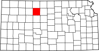 | |
| Unincorporated community | ||