Zonnebeke
| Zonnebeke | |||
|---|---|---|---|
| Municipality | |||
|
Zonnebeke town hall | |||
| |||
 Zonnebeke Location in Belgium | |||
|
Location of Zonnebeke in West Flanders  | |||
| Coordinates: 50°52′N 02°59′E / 50.867°N 2.983°ECoordinates: 50°52′N 02°59′E / 50.867°N 2.983°E | |||
| Country | Belgium | ||
| Community | Flemish Community | ||
| Region | Flemish Region | ||
| Province | West Flanders | ||
| Arrondissement | Ypres | ||
| Government | |||
| • Mayor | Dirk Sioen (INSPRAAK) | ||
| • Governing party/ies | INSPRAAK | ||
| Area | |||
| • Total | 67.57 km2 (26.09 sq mi) | ||
| Population (1 January 2016)[1] | |||
| • Total | 12,417 | ||
| • Density | 180/km2 (480/sq mi) | ||
| Postal codes | 8980 | ||
| Area codes | 051/057 | ||
| Website | www.zonnebeke.be | ||


Zonnebeke is a municipality located in the Belgian province of West Flanders. The municipality comprises the villages of Beselare, Gheluvelt, Passendale, Zandvoorde and Zonnebeke proper. On January 1, 2006, Zonnebeke had a total population of 11,758. The total area is 67.57 km² which gives a population density of 174 inhabitants per km².
History

The villages of Zonnebeke congregated around a large Augustinian abbey and its associated Benedictine convent in Nonnebosschen. Both were destroyed during the iconoclastic outbreak in 1580. Only the abbey was rebuilt, but was looted during the French occupation the abbey was confiscated. Passendale played a role in the Battle of Westrozebeke in 1382.
Situated in the centre of the Ypres Salient, World War I destroyed the whole area. Left abandoned until the early 1920s, people slowly returned and rebuilt the villages. In 1932, the locals opened a cheese making facility, which to this day is the only source of Passendale cheese.[2]
Another battle during World War II during the Allied advance across Europe, where Passendale was used in a defensive operations by the Nazis, did little damage.
Today, Zonnebeke has returned to its long-time balance between agriculture, small business and work in the neighbouring towns. Its major industry is the brickworks in the village of Zonnebeke itself, which extracts the local blue clay.
Zonnebeke underground
The village and district of Zonnebeke and its five villages have the largest concentration of underground constructions from World War I, being located at the centre of the Third Battle of Ypres/Battle of Passchendaele. The blue-clay is now being extracted for commercial purposes by the Terca Zonnebeke N.V. brickworks factory, meaning that the structures are now regularly found as the brickworks expands its commercial extraction activities.[3]
About 180 dugout sites have been located in the Ypres Salient and in the 1990s some of them were entered, at least in part.[4]
In 1983, the Australian-built Bremen Redoubt was discovered at the rear of the Zonnebeke brickworks. Opened to the public until 1998, it is believed that its eventual collapse was due to drying support timbers.[5]
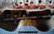
During archaeological excavations of the Augustinian abbey, another dugout was discovered under Zonnebeke church. Today the outline of this dugout is marked in an archaeological garden within the church grounds, and a model of the church dugout can be seen at the "Memorial Museum Passchendaele 1917" in Zonnebeke.[6]
On February 21, 1998, a farmer’s wife disappeared into the ground while washing the windows. Beecham dugout was subsequently discovered less than 400 metres (1,300 ft) from Tyne Cot Cemetery.[3]
It was made public in spring 2006 that the brickworks had received a licence for the extension of its blue-clay extraction zone. The Association for Battlefield Archaeology and Conservation, using maps compiled of 350 underground structures under the management of Belgian archaeologist Johan Vandewalle and British TV producer Peter Barton, showed that at least one structure was near to the proposed development zone, believed to be the Vampire dugout,[7] which had been rediscovered in 2007. Following discussion with local preservation, historic, council and state officials, the ABAC was allowed to start a scientific research project. They engaged the Centre for Battlefield Archaeology at Glasgow University to provide archaeological support (in light of the residence of the Highland Light Infantry).[7]
Towns
The municipality comprises the villages of Zonnebeke proper, Beselare, Gheluvelt, Passendale and Zandvoorde. All are "deelgemeentes", meaning they were independent municipalities before the merger in the 1970s.
| # | Name | Area (km²) | Population (01/01/2014) |
|---|---|---|---|
| I | Zonnebeke | 16,55 | 4.472 |
| II | Beselare | 14,33 | 2.684 |
| III | Gheluvelt | 7,79 | 1.553 |
| IV | Passendale | 22,22 | 3.152 |
| V | Zandvoorde | 6,68 | 521 |
 Zonnebeke, towns and neighbouring town. The yellow areas are urban areas. |
The municipality of Zonnebeke borders the following towns and municipalities:
|
See also
Gallery

 Memorial Museum Passchendaele, 1917 interior
 Memorial in the Polygon Wood, Zonnebeke
 Zonnebeke (1918), painting by William Orpen, showing devastation after World War I
References
- ↑ Population per municipality as of 1 January 2016 (XLS; 397 KB)
- ↑ Deoudekaasmakerij.be
- 1 2 "Memorial Museum Passchendaele 1917". GreatWar.co.uk. Retrieved 2010-06-22.
- ↑ Activities of The Diggers - Restoration of the Yorkshire Trench & Dug-out, access date 10 July 2015
- ↑ "Bremen Redoubt". flanderland.de. Retrieved 2010-06-22.
- ↑ Zonnebeke Church Dugout wordt niet toegankelijk voor publiek, 04/11/2010, access date 9 July 2015
- 1 2 "Vampire Dugout" (PDF). polygonwood.com. Retrieved 2010-06-22.
- ↑ "Gemeente Zonnebeke" (pdf).
External links
| Wikimedia Commons has media related to Zonnebeke. |
- Official website - Information available in Dutch and limited information available in English, French and German
 |
Langemark-Poelkapelle | Staden | Roeselare | |
| Ypres | |
Moorslede | ||
| ||||
| | ||||
| Comines-Warneton (WHT) | Wervik |