Oostrozebeke
| Oostrozebeke | |||
|---|---|---|---|
| Municipality | |||
|
Administrative centre | |||
| |||
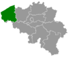
 Oostrozebeke Location in Belgium | |||
|
Location of Oostrozebeke in West Flanders 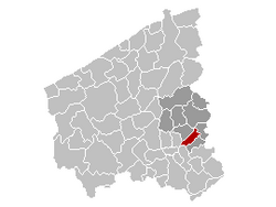 | |||
| Coordinates: 50°55′N 03°20′E / 50.917°N 3.333°ECoordinates: 50°55′N 03°20′E / 50.917°N 3.333°E | |||
| Country | Belgium | ||
| Community | Flemish Community | ||
| Region | Flemish Region | ||
| Province | West Flanders | ||
| Arrondissement | Tielt | ||
| Government | |||
| • Mayor | Karl De Clerck | ||
| • Governing party/ies | CDV | ||
| Area | |||
| • Total | 16.62 km2 (6.42 sq mi) | ||
| Population (1 January 2016)[1] | |||
| • Total | 7,700 | ||
| • Density | 460/km2 (1,200/sq mi) | ||
| Postal codes | 8780 | ||
| Area codes | 056 | ||
| Website | www.oostrozebeke.be | ||
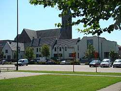

Oostrozebeke is a municipality located in the Belgian province of West Flanders. The municipality comprises only the town of Oostrozebeke proper. On January 1, 2006 Oostrozebeke had a total population of 7,449. The total area is 16.62 km² which gives a population density of 448 inhabitants per km².
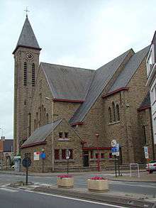
Saint-Amanduschurch
References
- ↑ Population per municipality as of 1 January 2016 (XLS; 397 KB)
External links
 Media related to Oostrozebeke at Wikimedia Commons
- Official website - Available only in Dutch
 |
Meulebeke | Tielt | Dentergem | |
| Ingelmunster | |
Wielsbeke | ||
| ||||
| | ||||
| Harelbeke | Wielsbeke |
This article is issued from Wikipedia - version of the 12/1/2016. The text is available under the Creative Commons Attribution/Share Alike but additional terms may apply for the media files.