Yelta, Victoria
| Yelta Victoria | |||||||||||||
|---|---|---|---|---|---|---|---|---|---|---|---|---|---|
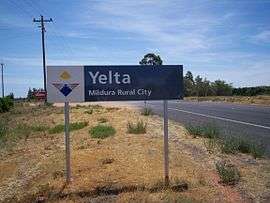 Entry sign | |||||||||||||
 Yelta | |||||||||||||
| Coordinates | 34°07′S 141°59′E / 34.117°S 141.983°ECoordinates: 34°07′S 141°59′E / 34.117°S 141.983°E | ||||||||||||
| Population | 281 (2011 census)[1] | ||||||||||||
| Postcode(s) | 3505 | ||||||||||||
| Location | |||||||||||||
| LGA(s) | Rural City of Mildura | ||||||||||||
| State electorate(s) | Mildura | ||||||||||||
| Federal Division(s) | Mallee | ||||||||||||
| |||||||||||||

The Abbotsford Bridge
Yelta is a small locality in Victoria, Australia. It was for a short time in the 1870s and 1880s the Victorian administrative centre of what is now Sunraysia and the Millewa. This role was then taken over by Mildura. At the 2011 census, Yelta and the surrounding area had a population of 281.[1]
It is notable for containing the terminus of the Melbourne-Mildura railway line.[2]
History
In 1869, Yelta Mission was built on the banks of the Murray River.[3] Local aboriginals called a small billabong near the site of the mission, Yelta.
References
- 1 2 Australian Bureau of Statistics (31 October 2012). "Yelta (State Suburb)". 2011 Census QuickStats. Retrieved 5 November 2012.
- ↑ http://www.vicrailstations.com/Yelta/Yelta/Yelta.html
- ↑ "Koorie Heritage Trust: Glossary". Mission Voices. Australian Broadcasting Corporation. Retrieved 5 November 2012.
This article is issued from Wikipedia - version of the 1/6/2015. The text is available under the Creative Commons Attribution/Share Alike but additional terms may apply for the media files.