Wren, Ohio
| Wren, Ohio | |
|---|---|
| Village | |
|
Houses on Jackson Street | |
 Location of Wren, Ohio | |
 Location of Wren in Van Wert County | |
| Coordinates: 40°47′58″N 84°46′27″W / 40.79944°N 84.77417°WCoordinates: 40°47′58″N 84°46′27″W / 40.79944°N 84.77417°W | |
| Country | United States |
| State | Ohio |
| County | Van Wert |
| Government | |
| • Mayor | Monica Davis |
| Area[1] | |
| • Total | 0.31 sq mi (0.80 km2) |
| • Land | 0.31 sq mi (0.80 km2) |
| • Water | 0 sq mi (0 km2) |
| Population (2010)[2] | |
| • Total | 194 |
| • Estimate (2012[3]) | 193 |
| • Density | 625.8/sq mi (241.6/km2) |
| Time zone | Eastern (EST) (UTC-5) |
| • Summer (DST) | EDT (UTC-4) |
| ZIP code | 45899 |
| Area code(s) | 419 |

Wren is a village in Van Wert County, Ohio, United States. The population was 194 at the 2010 census. It is included within the Van Wert, Ohio Micropolitan Statistical Area.
History
Wren had its start in 1883 when a store was built there.[4] A post office has been in operation at Wren since 1883.[5]
Geography
Wren is located at 40°47′58″N 84°46′27″W / 40.799531°N 84.774222°W.[6]
According to the United States Census Bureau, the village has a total area of 0.31 square miles (0.80 km2), all land.[1]
Demographics
| Historical population | |||
|---|---|---|---|
| Census | Pop. | %± | |
| 1900 | 242 | — | |
| 1910 | 277 | 14.5% | |
| 1920 | 314 | 13.4% | |
| 1930 | 281 | −10.5% | |
| 1940 | 277 | −1.4% | |
| 1950 | 278 | 0.4% | |
| 1960 | 287 | 3.2% | |
| 1970 | 282 | −1.7% | |
| 1980 | 282 | 0.0% | |
| 1990 | 190 | −32.6% | |
| 2000 | 199 | 4.7% | |
| 2010 | 194 | −2.5% | |
| Est. 2015 | 192 | [7] | −1.0% |
2010 census
As of the census[2] of 2010, there were 194 people, 78 households, and 49 families residing in the village. The population density was 625.8 inhabitants per square mile (241.6/km2). There were 93 housing units at an average density of 300.0 per square mile (115.8/km2). The racial makeup of the village was 95.4% White, 1.0% African American, and 3.6% from two or more races. Hispanic or Latino of any race were 2.1% of the population.
There were 78 households of which 29.5% had children under the age of 18 living with them, 52.6% were married couples living together, 3.8% had a female householder with no husband present, 6.4% had a male householder with no wife present, and 37.2% were non-families. 30.8% of all households were made up of individuals and 11.5% had someone living alone who was 65 years of age or older. The average household size was 2.49 and the average family size was 3.16.
The median age in the village was 39.5 years. 23.2% of residents were under the age of 18; 6.7% were between the ages of 18 and 24; 28.8% were from 25 to 44; 26.9% were from 45 to 64; and 14.4% were 65 years of age or older. The gender makeup of the village was 50.5% male and 49.5% female.
2000 census
As of the census[9] of 2000, there were 199 people, 84 households, and 50 families residing in the village. The population density was 642.3 people per square mile (247.9/km2). There were 96 housing units at an average density of 309.8 per square mile (119.6/km2). The racial makeup of the village was 98.49% White, and 1.51% from two or more races. Hispanic or Latino of any race were 2.01% of the population.
There were 84 households out of which 23.8% had children under the age of 18 living with them, 54.8% were married couples living together, 6.0% had a female householder with no husband present, and 39.3% were non-families. 34.5% of all households were made up of individuals and 7.1% had someone living alone who was 65 years of age or older. The average household size was 2.37 and the average family size was 3.12.
In the village the population was spread out with 23.6% under the age of 18, 8.0% from 18 to 24, 31.2% from 25 to 44, 24.6% from 45 to 64, and 12.6% who were 65 years of age or older. The median age was 36 years. For every 100 females there were 82.6 males. For every 100 females age 18 and over, there were 87.7 males.
The median income for a household in the village was $32,115, and the median income for a family was $50,000. Males had a median income of $32,045 versus $25,179 for females. The per capita income for the village was $18,060. About 4.5% of families and 6.7% of the population were below the poverty line, including none of those under the age of eighteen or sixty five or over.
References
- 1 2 "US Gazetteer files 2010". United States Census Bureau. Retrieved 2013-01-06.
- 1 2 "American FactFinder". United States Census Bureau. Retrieved 2013-01-06.
- ↑ "Population Estimates". United States Census Bureau. Retrieved 2013-06-17.
- ↑ Gilliland, Thaddeus Stephens (1906). History of Van Wert County, Ohio and Representative Citizens. Windmill Publications. p. 369.
- ↑ "Van Wert County". Jim Forte Postal History. Retrieved 13 December 2015.
- ↑ "US Gazetteer files: 2010, 2000, and 1990". United States Census Bureau. 2011-02-12. Retrieved 2011-04-23.
- ↑ "Annual Estimates of the Resident Population for Incorporated Places: April 1, 2010 to July 1, 2015". Retrieved July 2, 2016.
- ↑ "Census of Population and Housing". Census.gov. Retrieved June 4, 2015.
- ↑ "American FactFinder". United States Census Bureau. Retrieved 2008-01-31.
External links
Municipalities and communities of Van Wert County, Ohio, United States | ||
|---|---|---|
| Cities | 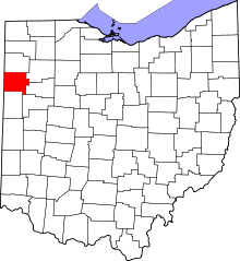 | |
| Villages | ||
| Townships | ||
| Unincorporated communities | ||
| Footnotes | ‡This populated place also has portions in an adjacent county or counties | |