Wonsevu, Kansas
| Wonsevu, Kansas | |
|---|---|
| Unincorporated community | |
 KDOT map of Chase County (legend) | |
 Wonsevu  Wonsevu | |
| Coordinates: 38°9′3″N 96°46′20″W / 38.15083°N 96.77222°WCoordinates: 38°9′3″N 96°46′20″W / 38.15083°N 96.77222°W | |
| Country | United States |
| State | Kansas |
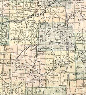
| County | Chase |
| Township | Cedar |
| Government | |
| • Type | Unincorporated |
| Elevation | 1,352 ft (412 m) |
| Time zone | Central (CST) (UTC-6) |
| • Summer (DST) | CDT (UTC-5) |
| Area code | 620 |
| FIPS code | 20-80325[1] |
| GNIS feature ID | 0477793[1] |
Wonsevu is an unincorporated community in southwest Chase County, Kansas, United States. It is located at the intersection of Cedar Creek Rd and E Rd, which is 4.5 miles (7.2 km) north of the Chase-Butler county line and 3.75 miles (6.04 km) east of the Chase-Marion county line in the Flint Hills.
History
Early history
For many millennia, the Great Plains of North America was inhabited by nomadic Native Americans. From the 16th century to 18th century, the Kingdom of France claimed ownership of large parts of North America. In 1762, after the French and Indian War, France secretly ceded New France to Spain, per the Treaty of Fontainebleau.
19th century
In 1802, Spain returned most of the land to France. In 1803, most of the land for modern day Kansas was acquired by the United States from France as part of the 828,000 square mile Louisiana Purchase for 2.83 cents per acre.
In 1854, the Kansas Territory was organized, then in 1861 Kansas became the 34th U.S. state. In 1859, Chase County was established within the Kansas Territory, which included the land for modern day Wonsevu.
A post office existed in Wonsevu from August 23, 1875 to October 15, 1907.[2]
21st century
The town today is almost a ghost town, with only a vacant church, school, two vacant houses, and several ruins left.
Geography
Wonsevu is located at 38°9′3″N 96°46′20″W / 38.15083°N 96.77222°W (38.1508506, -96.7722418), in the scenic Flint Hills of the Great Plains.
Climate
The climate in this area is characterized by hot, humid summers and generally mild to cool winters. According to the Köppen Climate Classification system, Wonsevu has a humid subtropical climate, abbreviated "Cfa" on climate maps.[3]
Education
Primary and secondary education
Wonsevu is part of Unified School District 398.[4][5] All students attend schools in Peabody at two schools:
- Peabody-Burns Junior/Senior High School, located in Peabody.
- Peabody-Burns Elementary School, located in Peabody.
Peabody-Burns High School Sports Championships
- 1977, 2nd Place, Class 2A, High School Boys Football, Head Coach Dennis Franchione.[6][7]
Infrastructure
Utilities
- Internet
- TV
- Satellite TV is provided by DirecTV, Dish Network.
- Free over-the-air ATSC digital TV.
See also
Further reading
References
- 1 2 "US Board on Geographic Names". United States Geological Survey. 2007-10-25. Retrieved 2008-01-31.
- ↑ "Kansas Post Offices, 1828-1961 (archived)". Kansas Historical Society. Archived from the original on October 9, 2013. Retrieved 5 June 2014.
- ↑ Climate Summary for Wonsevu, Kansas
- ↑ USD 398
- ↑ Kansas School District Boundary Map
- ↑ Historic Kansas High School Football Playoff List.
- ↑ Fran-tic Climb; The Topeka Capital-Journal; November 1, 2003.
External links
| Wikimedia Commons has media related to Wonsevu, Kansas. |
- Newspaper
- Peabody Gazette-Bulletin, newspaper
- School
- USD 398, school district for Peabody, Burns, Wonsevu, nearby rural areas of Marion / Chase / Harvey / Butler Counties
- USD 398 School District Boundary Map, KDOT
- Maps
- Chase County Maps: Current, Historic, KDOT
- Topo Map of Wonsevu area, USGS
Municipalities and communities of Chase County, Kansas, United States | ||
|---|---|---|
| Cities | 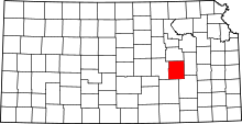 | |
| Unincorporated communities | ||
| Ghost towns | ||
| Townships | ||
| Footnotes | ‡This populated place also has portions in an adjacent county or counties | |