Wolverton railway station
| Wolverton | |
|---|---|
.JPG) | |
| Location | |
| Place | Wolverton |
| Local authority | Borough of Milton Keynes |
| Grid reference | SP820415 |
| Operations | |
| Station code | WOL |
| Managed by | London Midland |
| Number of platforms | 4 |
| DfT category | E |
|
Live arrivals/departures, station information and onward connections from National Rail Enquiries | |
| Annual rail passenger usage* | |
| 2010/11 |
|
| 2011/12 |
|
| 2012/13 |
|
| 2013/14 |
|
| 2014/15 |
|
| History | |
| Key dates | Opened 1881 |
| September 1838[1][2] | First Wolverton station opened by L&BR |
| November 1840[2] | Station rebuilt to a larger design to the south of Stratford Road |
| 1881[1] | Station rebuilt for a second time |
| National Rail – UK railway stations | |
| * Annual estimated passenger usage based on sales of tickets in stated financial year(s) which end or originate at Wolverton from Office of Rail and Road statistics. Methodology may vary year on year. | |
|
| |
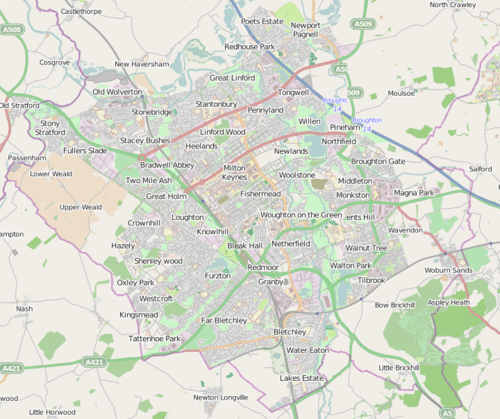
Wolverton railway station serves northern Milton Keynes, Buckinghamshire, especially Stony Stratford, Wolverton and New Bradwell. As the former Castlethorpe railway station is closed, it also serves nearby villages in south Northamptonshire.
The station is served by London Midland services on the West Coast Main Line. It is one of the five stations serving Milton Keynes. The others are Milton Keynes Central, Bletchley, Fenny Stratford and Bow Brickhill. The nearest Northbound Station is Northampton railway station.
The station has four platforms, of which just two (3 and 4) are normally in use.
Station buildings

The first station was built for the opening of the complete line, September 17th 1838 on the embankment just north of the canal above Wolverton Park.[3] It proved to be temporary as the railway company purchased an additional 13.5 acres to the south and chose to build a larger, permanent station there in 1840. The new station included refreshment rooms which for a time were famous throughout the land and employed a full-time staff of 29. A hotel was planned but never built. The waiting room was lavishly redecorated for the visit of Queen Victoria in 1844, who spent that Christmas as the guest of the Duke of Buckingham and Chandos. In 1881 the main line was re-routed to the east to allow for expansion (see 'Wolverton bend' below) and a new station built.[3] The booking hall was a wooden building at street level above the railway line and passengers could reach the platforms via flights of stairs. The current station site has been in use since.
The wooden station stood here for over 100 years until British Rail demolished it in 1991, allegedly as Milton Keynes Borough Council were debating making it a listed building.
For many years after the wooden station building was demolished, Wolverton Railway Station was a 'temporary' shed in the car park (at track level). A new brick building to replace it was finally (and formally) opened on 21 June 2012.[4] The new building is also at track level.
In mid September 2012, the Transport Minister Norman Baker announced in a 'written answer' that the Government has approved London Midland's request to reduce the opening hours of the new ticket office, from the previous 06:00 – 12:00 to 06:15 – 11:00 henceforth.[5]
In 2016, a coffee and snack kiosk opened in the new Station Booking Hall.
Platforms
The station has four platforms, of which just two are normally in use. Platforms 1 & 2 are the 'fast' lines and are trains very rarely stop here: they are used by London Midland during works and Virgin Trains in emergency. Platforms 3 & 4 are used frequently by London Midland, Virgin Trains pass this platform (without stopping) during works.[6]
Wolverton bend and Northampton Loop
.JPG)
In recent years, with the advent of fast trains, Wolverton gained notoriety among railwaymen for its famously tight curve. The curve was a result of the station being moved eastward in 1881, to permit extension of the Wolverton railway works. The path of the original route is visible at both the north and south ends of the divergence. The Advanced Passenger Train failed its trials here but, with another decade of development, the new Virgin Trains Pendolino tilting trains passed theirs. Near the station, the track crosses the valley of the Great Ouse on a viaduct. Slightly further north, the Northampton loop leaves the main line at Hanslope Junction.
Newport Pagnell Branch Line (closed)
From 1865 to 1964, there was a branch line from Wolverton to Newport Pagnell, primarily for employees of Wolverton Works. In 1964 the line was closed to passengers by the Beeching Axe and freight ceased in 1967. Between 1817 and 1864, the section from Great Linford to Newport Pagnell was an arm of the Grand Junction Canal which was then drained to become the track-bed. The route from Wolverton to Newport Pagnell is now a redway. Along the redway, the platforms at New Bradwell and Great Linford are still in place, as are a signal post at Newport Pagnell and an iron bridge taking the line (now the redway) over the Grand Union Canal.
See also
- Wolverton railway works
- Wolverton and Stony Stratford Tramway
- Denbigh Hall railway station: Pending construction of a bridge over the River Ouse, passengers alighted at Denbigh Hall and transferred to coaches on the London-Birmingham turnpike.
Services
Wolverton is served by most London Midland services, with a typical weekday service pattern of two trains per hour in each direction.[6]
| Preceding station | |
Following station | ||
|---|---|---|---|---|
| Northampton | London Midland Northampton loop |
Milton Keynes Central | ||
| Historical railways | ||||
| Castlethorpe Line open, station closed |
London and North Western Railway West Coast Main Line |
Bletchley Line and station open | ||
| Disused railways | ||||
| Bradwell Line and station closed |
London and North Western Railway Wolverton to Newport Pagnell Line |
Terminus | ||
References
- 1 2 Wolverton Society for Arts and Heritage – Accessed 7 December 2007
- 1 2 Mapley family history – Accessed 7 December 2007
- 1 2 Wolverton: From Aqueduct to Viaduct – Milton Keynes Heritage Association
- ↑ Mayor reveals plaque at Wolverton train station – Milton Keynes Citizen, 28 June 2012
- ↑ MPs defend reduction in train ticket office opening hours – Milton Keynes Citizen, 18 September 2012
- 1 2 "train times". londonmidland.com. London Midland. Retrieved 13 December 2015.
External links
- Train times and station information for Wolverton railway station from National Rail
- Pendolino rounds Wolverton bend (before coming to a stop at Milton Keynes Central)
Coordinates: 52°03′55″N 0°48′13″W / 52.0653°N 0.80357°W