Winthrop, Minnesota
| Winthrop, Minnesota | |
|---|---|
| City | |
| Motto: "Preserving The Past, Creating The future" | |
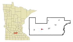 Location of Winthrop within Sibley County, Minnesota | |
| Coordinates: 44°32′33″N 94°22′0″W / 44.54250°N 94.36667°W | |
| Country | United States |
| State | Minnesota |
| County | Sibley |
| Government | |
| • Type | Mayor – Council |
| • Mayor | Kelly Pierson |
| Area[1] | |
| • Total | 1.06 sq mi (2.75 km2) |
| • Land | 1.06 sq mi (2.75 km2) |
| • Water | 0 sq mi (0 km2) |
| Elevation | 1,037 ft (316 m) |
| Population (2010)[2] | |
| • Total | 1,399 |
| • Estimate (2012[3]) | 1,392 |
| • Density | 1,319.8/sq mi (509.6/km2) |
| Time zone | Central (CST) (UTC-6) |
| • Summer (DST) | CDT (UTC-5) |
| ZIP code | 55396 |
| Area code(s) | 507 |
| FIPS code | 27-71122[4] |
| GNIS feature ID | 0654281[5] |
| Website | www.winthropminnesota.com |
Winthrop is a city in Sibley County, Minnesota, United States. The population was 1,399 at the 2010 census.[6]
History
A post office called Winthrop has been in operation since 1882.[7] Winthrop was incorporated as a city in 1910.[8]
Geography
According to the United States Census Bureau, the city has a total area of 1.06 square miles (2.75 km2), all of it land.[1] The South Branch of the Rush River starts near Winthrop.[9]
Minnesota State Highways 15 and 19 are two of the main routes in the city.
Demographics
| Historical population | |||
|---|---|---|---|
| Census | Pop. | %± | |
| 1890 | 488 | — | |
| 1900 | 813 | 66.6% | |
| 1910 | 1,048 | 28.9% | |
| 1920 | 1,147 | 9.4% | |
| 1930 | 1,037 | −9.6% | |
| 1940 | 1,195 | 15.2% | |
| 1950 | 1,251 | 4.7% | |
| 1960 | 1,381 | 10.4% | |
| 1970 | 1,391 | 0.7% | |
| 1980 | 1,376 | −1.1% | |
| 1990 | 1,279 | −7.0% | |
| 2000 | 1,367 | 6.9% | |
| 2010 | 1,399 | 2.3% | |
| Est. 2015 | 1,363 | [10] | −2.6% |
| U.S. Decennial Census | |||
2010 census
As of the census[2] of 2010, there were 1,399 people, 574 households, and 355 families residing in the city. The population density was 1,319.8 inhabitants per square mile (509.6/km2). There were 640 housing units at an average density of 603.8 per square mile (233.1/km2). The racial makeup of the city was 93.4% White, 0.5% African American, 0.7% Native American, 0.5% Asian, 3.9% from other races, and 1.1% from two or more races. Hispanic or Latino of any race were 7.4% of the population.
There were 574 households of which 28.0% had children under the age of 18 living with them, 48.6% were married couples living together, 8.7% had a female householder with no husband present, 4.5% had a male householder with no wife present, and 38.2% were non-families. 33.8% of all households were made up of individuals and 18.8% had someone living alone who was 65 years of age or older. The average household size was 2.36 and the average family size was 2.97.
The median age in the city was 41.7 years. 25.9% of residents were under the age of 18; 5.1% were between the ages of 18 and 24; 21.7% were from 25 to 44; 25.3% were from 45 to 64; and 22% were 65 years of age or older. The gender makeup of the city was 47.7% male and 52.3% female.
2000 census
As of the census[9] of 2000, there were 1,367 people, 591 households, and 346 families residing in the city. The population density was 1,303.8 people per square mile (502.7/km²). There were 632 housing units at an average density of 602.8 per square mile (232.4/km²). The racial makeup of the city was 93.71% White, 0.07% African American, 0.29% Native American, 0.15% Asian, 4.54% from other races, and 1.24% from two or more races. Hispanic or Latino of any race were 6.95% of the population.
There were 591 households out of which 26.1% had children under the age of 18 living with them, 48.7% were married couples living together, 6.8% had a female householder with no husband present, and 41.3% were non-families. 38.7% of all households were made up of individuals and 21.5% had someone living alone who was 65 years of age or older. The average household size was 2.22 and the average family size was 2.96.
In the city the population was spread out with 23.7% under the age of 18, 6.1% from 18 to 24, 23.3% from 25 to 44, 21.2% from 45 to 64, and 25.6% who were 65 years of age or older. The median age was 43 years. For every 100 females there were 88.3 males. For every 100 females age 18 and over, there were 83.6 males.
The median income for a household in the city was $34,813, and the median income for a family was $47,159. Males had a median income of $31,149 versus $20,573 for females. The per capita income for the city was $18,188. About 3.5% of families and 6.1% of the population were below the poverty line, including 5.7% of those under age 18 and 8.2% of those age 65 or over.
Education
Winthrop is the home of ISD #2365's high school.
References
- 1 2 "US Gazetteer files 2010". United States Census Bureau. Retrieved 2012-11-13.
- 1 2 "American FactFinder". United States Census Bureau. Retrieved 2012-11-13.
- ↑ "Population Estimates". United States Census Bureau. Retrieved 2013-05-28.
- ↑ "American FactFinder". United States Census Bureau. Retrieved 2008-01-31.
- ↑ "US Board on Geographic Names". United States Geological Survey. 2007-10-25. Retrieved 2008-01-31.
- ↑ "2010 Census Redistricting Data (Public Law 94-171) Summary File". American FactFinder. United States Census Bureau. Retrieved 27 April 2011.
- ↑ "Sibley County". Jim Forte Postal History. Retrieved 8 August 2015.
- ↑ Upham, Warren (1920). Minnesota Geographic Names: Their Origin and Historic Significance. Minnesota Historical Society. p. 520.
- 1 2 U.S. Census Bureau, 2000 Census data.
- ↑ "Annual Estimates of the Resident Population for Incorporated Places: April 1, 2010 to July 1, 2015". Retrieved July 2, 2016.
Winthrop Eagles, members of the River Valley League (formerly the Carver Central League)
External links
Municipalities and communities of Sibley County, Minnesota, United States | ||
|---|---|---|
| Cities | 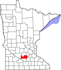 | |
| Townships | ||
| Unincorporated communities | ||
| Footnotes | ‡This populated place also has portions in an adjacent county or counties | |
Coordinates: 44°32′35″N 94°21′59″W / 44.54306°N 94.36639°W