Winnapaug Pond
| Winnapaug Pond | |
|---|---|
| Brightman Pond | |
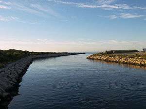 Weekapaug Breachway looking south | |
| Location | Westerly, Washington County, Rhode Island, United States |
| Coordinates | 41°19′54″N 71°47′12″W / 41.331767°N 71.786734°WCoordinates: 41°19′54″N 71°47′12″W / 41.331767°N 71.786734°W |
| Type | saline |
| Basin countries | United States |
| Max. length | 2.5 mi (4.0 km) |
| Surface area | .7439 sq mi (1.927 km2)[1] |
Winnapaug Pond (also known as Brightman Pond[2]) is a breached saltwater pond in Westerly, Rhode Island, United States, connected to Block Island Sound by the Weekapaug Breachway, which was constructed during the mid-1950s.[3][4] The 2.5-mile (4.0 km) lake is separated from the Atlantic by a large sandbar.[5][6] In 2010, its overall water quality was assessed as "good".[7] Winnapaug is relatively small and shallow, and is favorable for kayaking.[2] It is one of nine coastal lagoons, referred to as "salt ponds" by locals, in southern Rhode Island.[8][9]
References
- ↑ "National Assessment Database". U.S. Environmental Protection Agency. Retrieved 2009-05-23.
- 1 2 "Winnapaug Pond". Salt Ponds Coalition. Retrieved 2009-05-23.
- ↑ "Restore America's Estuaries 4th National Conference on Coastal and Estuarine" (PDF). Rhode Island Coastal Resources Management Council. 2008. Retrieved 2009-05-20.
- ↑ "South County icons". The Providence Journal. Retrieved 2009-05-20.
- ↑ "Winnapaug Pond". The Columbia Gazetteer of North America. 2000. Retrieved 2009-05-20.
- ↑ "Salt Ponds Region". Rhode Island Rivers Council. Retrieved 2009-05-20.
- ↑ "2010 Waterbody Report for Winnapaug Pond". Retrieved 11 August 2012.
- ↑ Donald Wyatt (1995). "Rhode Island's last execution". FAQs.org. Retrieved 2009-05-25.
- ↑ S.W. Nixon and B. A. Buckley (2007). "Nitrogen Inputs to Rhode Island Coastal Salt – Too Much of a Good Thing" (PDF). Rhode Island Department of Environmental Management. Retrieved 2009-05-25.
| Wikimedia Commons has media related to Rhode Island salt ponds. |
Rhode Island's salt ponds | ||
|---|---|---|
This article is issued from Wikipedia - version of the 12/18/2015. The text is available under the Creative Commons Attribution/Share Alike but additional terms may apply for the media files.