Washington County, Rhode Island
| Washington County, Rhode Island | |
|---|---|
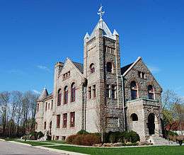 Former Washington County Courthouse in West Kingston | |
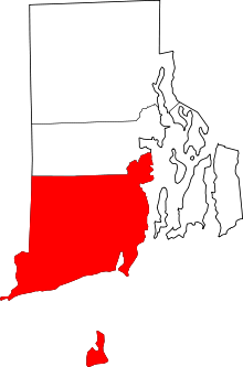 Location in the U.S. state of Rhode Island | |
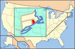 Rhode Island's location in the U.S. | |
| Founded | June 3, 1729 |
| Seat | South Kingstown |
| Largest town | South Kingstown |
| Area | |
| • Total | 563 sq mi (1,458 km2) |
| • Land | 329 sq mi (852 km2) |
| • Water | 234 sq mi (606 km2), 41% |
| Population (est.) | |
| • (2015) | 126,517 |
| • Density | 1,000/sq mi (386/km²) |
| Congressional district | 2nd |
| Time zone | Eastern: UTC-5/-4 |
Washington County, known locally as South County, is a county located in the U.S. state of Rhode Island. As of the 2010 census, the population was 126,979.[1] Rhode Island counties, including Washington County, have no governmental functions other than as court administrative and sheriff corrections boundaries, which are part of the state government.[2]
Washington County is included in the Providence-Warwick, RI-MA Metropolitan Statistical Area, which is also included in the Boston-Worcester-Providence, MA-RI-NH-CT Combined Statistical Area.
History
Washington County was created from Providence Plantations in 1729 as Kings County. It was renamed Washington County on October 29, 1781, in honor of General and President Washington.
At the earliest stage of colonial settlement, the area was called "The Narragansett Country", named after the Algonquin tribe of the same name and its tributary tribe the (Eastern) Niantics, whose territory it was, and these held power in the area long after the Wampanoags to the east had lost most of their territory to the Plymouth Colony. (The Algonquin Nipmucs may have held a piece of what is today the westernmost part of the town of Hopkinton.)
Early land purchases in the Narragansett Country were effected by Dutch and English settlers after the establishment of Indian trading posts at Fort Neck, today's town of Charlestown by the Dutch, and at "Smith's Castle", Cocumcussoc, now Wickford, in today's North Kingstown, and these were most notably the so-called "Atherton Purchases" North Kingstown, Quidnesset, and of the Boston Neck area of Narragansett; and the somewhat-conflicting "Pettaquamscutt Purchase" of the rest of North and South Kingstown, Narragansett, and parts of Exeter. Subsequent purchases including the "Misquamicut Purchase" brought in area now part of Richmond, Hopkinton and Westerly. A series of conflicts involving the Manisseans on Block Island gave that island to the Massachusetts Bay Colony for a number of years, before being transferred to the Rhode Island Colony under Newport County, and then finally to Washington County in 1959.
Holding claims to "South County" from the beginning of the Colonial period were two sovereign nations, the Netherlands and Great Britain, and no less than four colonies: Connecticut Colony, the Massachusetts Bay Colony, Plymouth Colony, and Rhode Island Colony. Since the Narragansetts had pledged their fealty to King Charles, the area was styled "The King's Province", and was placed under the authority of Rhode Island "until the King's pleasure was further known". In 1664 a royal commission under Charles II stepped in to adjudicate these conflicting land claims over the so-called Narragansett Country. The commission extinguished the claims of Massachusetts, and Rhode Island was granted jurisdiction until the commission finished processing Connecticut's appeals, which were not ended until 1726. Settlements of King's Province were named to reflect the English Restoration, in honor of King Charles II. Modern towns reflecting this history include the two Kingstowns and Charlestown, as well as the villages of Kingston and West Kingston. Washington County had been named "King's County" until the American Revolution, when it was renamed after George Washington.
Geography
According to the U.S. Census Bureau, the county has a total area of 563 square miles (1,460 km2), of which 329 square miles (850 km2) is land and 234 square miles (610 km2) (41%) is water.[3] It is the largest county in Rhode Island by total area and the smallest county in the US that is a state's largest county. The county's topography ranges from flat along the shoreline to gently rolling hills further inland. The highest point is a large area approximately 560 feet (171 m) in the Exeter neighborhood of Black Plain;[4] the lowest point is sea level along the coast. The northern boundary, west of Davisville, is approximately 41.60°N. The western boundary, north of Westerly, is approximately -71.79°W. It is the least-densely populated county in Rhode Island.
National protected areas
- Block Island National Wildlife Refuge
- John H. Chafee National Wildlife Refuge
- Ninigret National Wildlife Refuge
- Trustom Pond National Wildlife Refuge
Demographics
| Historical population | |||
|---|---|---|---|
| Census | Pop. | %± | |
| 1790 | 18,323 | — | |
| 1800 | 16,135 | −11.9% | |
| 1810 | 14,962 | −7.3% | |
| 1820 | 15,687 | 4.8% | |
| 1830 | 15,411 | −1.8% | |
| 1840 | 14,324 | −7.1% | |
| 1850 | 16,430 | 14.7% | |
| 1860 | 18,715 | 13.9% | |
| 1870 | 20,097 | 7.4% | |
| 1880 | 22,495 | 11.9% | |
| 1890 | 23,649 | 5.1% | |
| 1900 | 24,154 | 2.1% | |
| 1910 | 24,942 | 3.3% | |
| 1920 | 24,932 | 0.0% | |
| 1930 | 29,334 | 17.7% | |
| 1940 | 32,493 | 10.8% | |
| 1950 | 48,542 | 49.4% | |
| 1960 | 59,054 | 21.7% | |
| 1970 | 83,586 | 41.5% | |
| 1980 | 93,317 | 11.6% | |
| 1990 | 110,006 | 17.9% | |
| 2000 | 123,546 | 12.3% | |
| 2010 | 126,979 | 2.8% | |
| Est. 2015 | 126,517 | [5] | −0.4% |
| U.S. Decennial Census[6] 1790-1960[7] 1900-1990[8] 1990-2000[9] 2010-2015[1] | |||
2000 census
As of the census[10] of 2000, there were 123,546 people, 46,907 households, and 32,037 families residing in the county. The population density was 371 people per square mile (143/km²). There were 56,816 housing units at an average density of 171 per square mile (66/km²). The racial makeup of the county was 94.82% White, 0.92% Black or African American, 0.93% Native American, 1.50% Asian, 0.02% Pacific Islander, 0.46% from other races, and 1.35% from two or more races. 1.44% of the population were Hispanic or Latino of any race. 19.2% were of Italian, 18.5% Irish, 14.7% English, 6.7% French and 5.8% German ancestry. 92.8% spoke English, 1.8% Spanish and 1.6% Italian as their first language.
There were 46,907 households out of which 31.80% had children under the age of 18 living with them, 55.50% were married couples living together, 9.40% had a female householder with no husband present, and 31.70% were non-families. 24.10% of all households were made up of individuals and 9.20% had someone living alone who was 65 years of age or older. The average household size was 2.52 and the average family size was 3.01.
In the county, the population was spread out with 23.40% under the age of 18, 11.20% from 18 to 24, 28.30% from 25 to 44, 24.40% from 45 to 64, and 12.80% who were 65 years of age or older. The median age was 37 years. For every 100 females there were 94.20 males. For every 100 females age 18 and over, there were 91.30 males.
The median income for a household in the county was $53,103, and the median income for a family was $64,112. Males had a median income of $43,956 versus $30,659 for females. The per capita income for the county was $25,530. About 4.20% of families and 7.30% of the population were below the poverty line, including 7.40% of those under age 18 and 5.60% of those age 65 or over.
2010 census
As of the 2010 United States Census, there were 126,979 people, 49,177 households, and 32,297 families residing in the county.[11] The population density was 385.7 inhabitants per square mile (148.9/km2). There were 62,206 housing units at an average density of 188.9 per square mile (72.9/km2).[12] The racial makeup of the county was 93.8% white, 1.6% Asian, 1.2% black or African American, 0.9% American Indian, 0.7% from other races, and 1.8% from two or more races. Those of Hispanic or Latino origin made up 2.4% of the population.[11] In terms of ancestry, 27.8% were Irish, 21.4% were Italian, 19.9% were English, 10.8% were German, and 2.7% were American.[13]
Of the 49,177 households, 28.6% had children under the age of 18 living with them, 52.2% were married couples living together, 9.5% had a female householder with no husband present, 34.3% were non-families, and 26.1% of all households were made up of individuals. The average household size was 2.45 and the average family size was 2.95. The median age was 42.3 years.[11]
The median income for a household in the county was $70,285 and the median income for a family was $87,999. Males had a median income of $59,598 versus $44,851 for females. The per capita income for the county was $34,737. About 3.4% of families and 7.4% of the population were below the poverty line, including 6.3% of those under age 18 and 5.0% of those age 65 or over.[14]
Communities
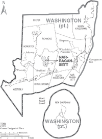
Towns
- Charlestown
- Exeter
- Hopkinton
- Narragansett
- New Shoreham
- North Kingstown
- Richmond
- South Kingstown (traditional county seat)
- Westerly
Census-designated places
Villages
- Alton
- Arcadia
- Ashaway
- Barberville
- Bethel
- Bradford
- Burdickville
- Canonchet
- Centerville
- Davisville
- Galilee
- Hamilton
- Hopkinton City
- Jerusalem
- Kenyon
- Lafayette
- Locustville
- Matunuck
- Misquamicut
- Moscow
- Peace Dale
- Point Judith
- Quonochontaug
- Rockville
- Saunderstown
- Shannock
- Slocum
- South Hopkinton
- Usquepaug
- Watch Hill
- Wakefield
- West Kingston
- White Rock
- Wickford
- Wood River Junction
- Woodville
See also
References
- 1 2 "State & County QuickFacts". United States Census Bureau. Retrieved November 22, 2013.
- ↑ National Associations of Counties listing for Washington County, Rhode Island
- ↑ "2010 Census Gazetteer Files". United States Census Bureau. August 22, 2012. Retrieved March 14, 2015.
- ↑ 41°35′09″N 71°39′16″W / 41.58583°N 71.65444°W
- ↑ "County Totals Dataset: Population, Population Change and Estimated Components of Population Change: April 1, 2010 to July 1, 2015". Retrieved July 2, 2016.
- ↑ "U.S. Decennial Census". United States Census Bureau. Retrieved March 14, 2015.
- ↑ "Historical Census Browser". University of Virginia Library. Retrieved March 14, 2015.
- ↑ Forstall, Richard L., ed. (March 27, 1995). "Population of Counties by Decennial Census: 1900 to 1990". United States Census Bureau. Retrieved March 14, 2015.
- ↑ "Census 2000 PHC-T-4. Ranking Tables for Counties: 1990 and 2000" (PDF). United States Census Bureau. April 2, 2001. Retrieved March 14, 2015.
- ↑ "American FactFinder". United States Census Bureau. Retrieved 2011-05-14.
- 1 2 3 "DP-1 Profile of General Population and Housing Characteristics: 2010 Demographic Profile Data". United States Census Bureau. Retrieved 2016-01-12.
- ↑ "Population, Housing Units, Area, and Density: 2010 - County". United States Census Bureau. Retrieved 2016-01-12.
- ↑ "DP02 SELECTED SOCIAL CHARACTERISTICS IN THE UNITED STATES – 2006-2010 American Community Survey 5-Year Estimates". United States Census Bureau. Retrieved 2016-01-12.
- ↑ "DP03 SELECTED ECONOMIC CHARACTERISTICS – 2006-2010 American Community Survey 5-Year Estimates". United States Census Bureau. Retrieved 2016-01-12.
External links
| Wikivoyage has a travel guide for South County. |
| Wikimedia Commons has media related to Washington County, Rhode Island. |

Municipalities and communities of Washington County, Rhode Island, United States | ||
|---|---|---|
| Towns | | |
| Villages |
| |
Providence (capital) | |
| Topics |
|
| Society |
|
| Regions | |
| Cities | |
| Towns |
|
Coordinates: 41°23′N 71°37′W / 41.39°N 71.62°W