Windsor Place, Missouri
| Windsor Place, Missouri | |
|---|---|
| Area[1] | |
| • Total | 0.20 sq mi (0.52 km2) |
| • Land | 0.20 sq mi (0.52 km2) |
| • Water | 0 sq mi (0 km2) |
| Population (2010)[2] | |
| • Total | 309 |
| • Estimate (2012[3]) | 329 |
| • Density | 1,545.0/sq mi (596.5/km2) |
Windsor Place is a village in Cooper County, Missouri, United States. It was incorporated in 2006.[4] The population was 309 at the 2010 census. On November 30, 2014 a plane crashed during landing at the nearby Boonville, Mo airport. The airport is about 1/2 mile from the village. The plane crashed just short of the runway. About 1/2 from the village. 3 were injured and 1 was killed. It was confirmed that there was a battery failure.
Geography
According to the United States Census Bureau, the village has a total area of 0.20 square miles (0.52 km2), all of it land.[1]
Demographics
| Historical population | |||
|---|---|---|---|
| Census | Pop. | %± | |
| 2010 | 309 | — | |
| Est. 2015 | 332 | [5] | 7.4% |
2010 census
As of the census[2] of 2010, there were 309 people, 113 households, and 92 families residing in the village. The population density was 1,545.0 inhabitants per square mile (596.5/km2). There were 119 housing units at an average density of 595.0 per square mile (229.7/km2). The racial makeup of the village was 92.2% White, 1.3% African American, 2.3% Asian, 0.6% from other races, and 3.6% from two or more races. Hispanic or Latino of any race were 1.9% of the population.
There were 113 households of which 42.5% had children under the age of 18 living with them, 60.2% were married couples living together, 16.8% had a female householder with no husband present, 4.4% had a male householder with no wife present, and 18.6% were non-families. 16.8% of all households were made up of individuals and 4.4% had someone living alone who was 65 years of age or older. The average household size was 2.73 and the average family size was 3.00.
The median age in the village was 33.6 years. 29.1% of residents were under the age of 18; 7.7% were between the ages of 18 and 24; 30% were from 25 to 44; 21.7% were from 45 to 64; and 11.3% were 65 years of age or older. The gender makeup of the village was 46.6% male and 53.4% female.
References
- 1 2 "US Gazetteer files 2010". United States Census Bureau. Retrieved 2012-07-08.
- 1 2 "American FactFinder". United States Census Bureau. Retrieved 2012-07-08.
- ↑ "Population Estimates". United States Census Bureau. Retrieved 2013-05-30.
- ↑ "2007 New Incorporations" (TXT). Geography Division, United States Census Bureau. 2006-05-19. Retrieved 2008-07-13.
- ↑ "Annual Estimates of the Resident Population for Incorporated Places: April 1, 2010 to July 1, 2015". Retrieved July 2, 2016.
- ↑ "Census of Population and Housing". Census.gov. Retrieved June 4, 2015.
Municipalities and communities of Cooper County, Missouri, United States | ||
|---|---|---|
| Cities | 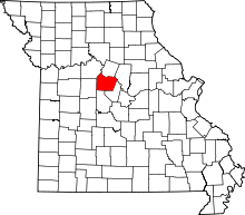 | |
| Villages | ||
| Townships | ||
| Unincorporated communities | ||
Coordinates: 38°55′58″N 92°41′36″W / 38.93278°N 92.69333°W