Whitehall, Michigan
| Whitehall, Michigan | |
|---|---|
| City | |
 Location of Whitehall, Michigan | |
| Coordinates: 43°24′36″N 86°20′55″W / 43.41000°N 86.34861°W | |
| Country | United States |
| State | Michigan |
| County | Muskegon |
| Government | |
| • Type | Commission-Manager |
| • Mayor | Edward Whalen |
| • City Manager | Scott Huebler |
| Area[1] | |
| • Total | 3.79 sq mi (9.82 km2) |
| • Land | 3.12 sq mi (8.08 km2) |
| • Water | 0.67 sq mi (1.74 km2) |
| Elevation | 607 ft (185 m) |
| Population (2010)[2] | |
| • Total | 2,706 |
| • Estimate (2012[3]) | 2,688 |
| • Density | 867.3/sq mi (334.9/km2) |
| Time zone | Eastern (EST) (UTC-5) |
| • Summer (DST) | EDT (UTC-4) |
| ZIP codes | 49461, 49463 |
| Area code(s) | 231 |
| FIPS code | 26-86780[4] |
| GNIS feature ID | 1622149[5] |
| Website | www.cityofwhitehall.org |
Whitehall is a city in Muskegon County in the U.S. state of Michigan. The population was 2,706 at the 2010 census. The city is located in the southwest corner of Whitehall Township. Montague is its neighbor.
It is located on White Lake (actually the mouth of the White River on Lake Michigan). Whitehall's recorded history began circa 1859 when Charles Mears, a noted lumber baron to the area, platted the village along with Giles B. Slocum, naming it Mears. The population continued to grow due to its strategic location for floating and distributing lumber.
In 1862, it was renamed Whitehall and incorporated as the Village of Whitehall in 1867. It later was incorporated as a city in 1942.
Geography
The town is located about 5 miles (8.0 km) from Lake Michigan. White Lake is now connected to Lake Michigan by a dredged canal.
According to the United States Census Bureau, the city has a total area of 3.79 square miles (9.82 km2), of which 3.12 square miles (8.08 km2) is land and 0.67 square miles (1.74 km2) is water.[1]
Major highways
 US 31
US 31 Bus. US 31 is a business loop through the downtowns of both Whitehall and Montague.
Demographics
| Historical population | |||
|---|---|---|---|
| Census | Pop. | %± | |
| 1870 | 842 | — | |
| 1880 | 1,724 | 104.8% | |
| 1890 | 1,903 | 10.4% | |
| 1900 | 1,481 | −22.2% | |
| 1910 | 1,437 | −3.0% | |
| 1920 | 1,230 | −14.4% | |
| 1930 | 1,394 | 13.3% | |
| 1940 | 1,407 | 0.9% | |
| 1950 | 1,819 | 29.3% | |
| 1960 | 2,590 | 42.4% | |
| 1970 | 3,017 | 16.5% | |
| 1980 | 2,856 | −5.3% | |
| 1990 | 3,027 | 6.0% | |
| 2000 | 2,884 | −4.7% | |
| 2010 | 2,706 | −6.2% | |
| Est. 2015 | 2,711 | [6] | 0.2% |
2010 census
As of the census[2] of 2010, there were 2,706 people, 1,153 households, and 678 families residing in the city. The population density was 867.3 inhabitants per square mile (334.9/km2). There were 1,288 housing units at an average density of 412.8 per square mile (159.4/km2). The racial makeup of the city was 95.0% White, 1.4% African American, 0.6% Native American, 0.5% Asian, 0.1% Pacific Islander, 0.5% from other races, and 2.0% from two or more races. Hispanic or Latino of any race were 2.7% of the population.
There were 1,153 households of which 29.3% had children under the age of 18 living with them, 41.4% were married couples living together, 13.1% had a female householder with no husband present, 4.3% had a male householder with no wife present, and 41.2% were non-families. 35.8% of all households were made up of individuals and 15.3% had someone living alone who was 65 years of age or older. The average household size was 2.22 and the average family size was 2.89.
The median age in the city was 42.9 years. 22.7% of residents were under the age of 18; 6.9% were between the ages of 18 and 24; 22.9% were from 25 to 44; 26.6% were from 45 to 64; and 20.8% were 65 years of age or older. The gender makeup of the city was 45.8% male and 54.2% female.
2000 census
As of the census[4] of 2000, there were 2,884 people, 1,165 households, and 739 families residing in the city. The population density was 960.0 per square mile (371.2/km²). There were 1,262 housing units at an average density of 420.1 per square mile (162.4/km²). The racial makeup of the city was 96.60% White, 0.76% African American, 1.14% Native American, 0.31% Asian, 0.69% from other races, and 0.49% from two or more races. Hispanic or Latino of any race were 2.08% of the population.
There were 1,165 households out of which 31.5% had children under the age of 18 living with them, 46.4% were married couples living together, 12.5% had a female householder with no husband present, and 36.5% were non-families. 32.2% of all households were made up of individuals and 16.1% had someone living alone who was 65 years of age or older. The average household size was 2.35 and the average family size was 2.97.
In the city the population was spread out with 24.7% under the age of 18, 8.1% from 18 to 24, 25.9% from 25 to 44, 21.8% from 45 to 64, and 19.6% who were 65 years of age or older. The median age was 40 years. For every 100 females there were 85.1 males. For every 100 females age 18 and over, there were 81.2 males.
The median income for a household in the city was $37,641, and the median income for a family was $50,944. Males had a median income of $41,964 versus $18,615 for females. The per capita income for the city was $18,544. About 5.5% of families and 7.3% of the population were below the poverty line, including 9.2% of those under age 18 and 8.8% of those age 65 or over.
Culture and recreation
Music and fine arts

Whitehall is home to the Howmet Playhouse. The 400-seat theater was built in 1916 to be a performance venue for the White Lake area. In 1973 the theater was in danger of demolition and was acquired and renovated by nearby Blue Lake Fine Arts Camp with the help of a local fund drive and the participation of Whitehall’s largest employer, Howmet Castings. Blue Lake had been putting out productions until they built their own on-site facility in 2006. The theater was then transferred to the city, which puts on a season of theater running through the summer.[8] Community fund raising efforts to improve the playhouse and keep it running are ongoing.
Whitehall is also home to 3 Frank Lloyd Wright cottages and a house, built from 1897-1905.
Festivals
- White Lake Area Arts & Crafts Festival : Features more than 150 talented and creative artists, live entertainment and food.
- White Lake Maritime Festival : Festival that features sailing regatta, beer tent, live bands, shrimp boil, and other arts and crafts fair.
- Celebrate White Lake : Family festival with an antique boat show, historical displays and tours.
- Cruz'in : Classic Cars on display starting at downtown Whitehall going through Montague, MI
- Fall Fest : festival that includes beer tent, live bands, farmer's market, hay rides, and arts & crafts festival.
- White Lake Chamber Music Festival: Features over 30 events during the 1st week of August. A mix of visiting professional groups and local talent offer a wide variety of performances throughout the White Lake Area. Concerts, master classes, 5pm Serendipity Recitals, afternoon tea recitals, children’s concerts, and more.
Notable people
- George Edward Hilt, founder of the nation’s largest farm-store retailer
- Nate McLouth, professional baseball player for the Washington Nationals and Gold Glove winner.
- Ruth Thompson, first female state representative of Michigan, first female U.S. Representative from Michigan, first female on the U.S. House Judiciary Committee.
- Stacy Essebaggers-Shepherd, 2001 Miss Michigan and Top-10 semifinalist at the Miss America pageant.[9]
- Kellin Quinn, lead singer of Sleeping with Sirens
- Ryan Van Bergen, played Defensive End for the University of Michigan, 2008-2011.
References
- 1 2 "US Gazetteer files 2010". United States Census Bureau. Retrieved 2012-11-25.
- 1 2 "American FactFinder". United States Census Bureau. Retrieved 2012-11-25.
- ↑ "Population Estimates". United States Census Bureau. Retrieved 2013-06-03.
- 1 2 "American FactFinder". United States Census Bureau. Retrieved 2008-01-31.
- ↑ U.S. Geological Survey Geographic Names Information System: Whitehall, Michigan
- ↑ "Annual Estimates of the Resident Population for Incorporated Places: April 1, 2010 to July 1, 2015". Retrieved July 2, 2016.
- ↑ "Census of Population and Housing". Census.gov. Retrieved June 4, 2015.
- ↑ cityofwhitehall.org, 2007
- ↑ Official Miss Michigan website
External links
Municipalities and communities of Muskegon County, Michigan, United States | ||
|---|---|---|
| Cities | 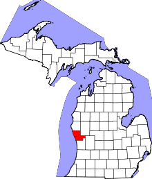 | |
| Villages | ||
| Charter townships | ||
| General law townships | ||
| CDPs | ||
| Other unincorporated community | ||
| Footnotes | ‡This populated place also has portions in an adjacent county or counties | |
Coordinates: 43°24′36″N 86°20′55″W / 43.41000°N 86.34861°W