White Salmon, Washington
| White Salmon | |
|---|---|
| City | |
| White Salmon, Washington | |
|
White Salmon City Hall. | |
| Nickname(s): The Land Where The Sun Meets The Rain | |
 | |
| Coordinates: 45°43′44″N 121°29′1″W / 45.72889°N 121.48361°WCoordinates: 45°43′44″N 121°29′1″W / 45.72889°N 121.48361°W | |
| Country | United States |
| State | Washington |
| County | Klickitat |
| Area[1] | |
| • Total | 1.22 sq mi (3.16 km2) |
| • Land | 1.22 sq mi (3.16 km2) |
| • Water | 0 sq mi (0 km2) |
| Elevation | 623 ft (190 m) |
| Population (2010)[2] | |
| • Total | 2,224 |
| • Estimate (2015)[3] | 2,343 |
| • Density | 1,823.0/sq mi (703.9/km2) |
| Time zone | Pacific (PST) (UTC-8) |
| • Summer (DST) | PDT (UTC-7) |
| ZIP code | 98672 |
| Area code(s) | 509 |
| FIPS code | 53-78330[4] |
| GNIS feature ID | 1512803[5] |
| Website | City of White Salmon |

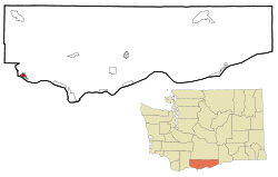
White Salmon is a city in Klickitat County, Washington, United States. It is located in the Columbia River Gorge. The population was 2,193 at the 2000 census and increased 1.4% to 2,224 at the 2010 census.
History
White Salmon was first settled in 1852 by Erastus Joslyn and his wife.[6] White Salmon was officially incorporated on June 3, 1907.
White Salmon was part of the home of the Klickitat Tribe, now a part of the Yakama Confederated Nations. The Klickitat Tribe sold some land to the Joslyns. They were generally Native advocates for the time. The area was thrown open on October 31, 1858 for white settlement after the Klickitat and Yakama lost the fight for their homelands in the Yakama War. Within the same year, the region was very rapidly and heavily settled by white immigrants making land claims. The Klickitat were forced to relocate to the Yakama Reservation.[7]
Government
White Salmon's current city government includes Mayor David Poucher, who was re-elected to a new, four-year term in November 2011. City council member Mark Peppel (Position 4), who ran unsuccessfully for mayor against Poucher, remains on the council for the last 2 years of his current term. New council members elected in November 2011 to four-year terms include Bill Werst (Position 1), George Rau (Position 2), Jason Sabourin (Position 3) and Allan Wolf (Position 5).[8]
Geography
White Salmon is located at 45°43′44″N 121°29′1″W / 45.72889°N 121.48361°W (45.728792, -121.483557).[9]
According to the United States Census Bureau, the city has a total area of 1.22 square miles (3.16 km2), all of it land.[1]
It is located opposite Hood River, Oregon on the Columbia River.
Climate
| Climate data for White Salmon, Washington | |||||||||||||
|---|---|---|---|---|---|---|---|---|---|---|---|---|---|
| Month | Jan | Feb | Mar | Apr | May | Jun | Jul | Aug | Sep | Oct | Nov | Dec | Year |
| Record high °F (°C) | 63 (17) |
68 (20) |
81 (27) |
90 (32) |
102 (39) |
105 (41) |
107 (42) |
108 (42) |
100 (38) |
89 (32) |
69 (21) |
66 (19) |
108 (42) |
| Average high °F (°C) | 42 (6) |
47 (8) |
55 (13) |
61 (16) |
69 (21) |
74 (23) |
82 (28) |
82 (28) |
76 (24) |
64 (18) |
50 (10) |
40 (4) |
61.8 (16.6) |
| Average low °F (°C) | 31 (−1) |
31 (−1) |
35 (2) |
39 (4) |
45 (7) |
51 (11) |
55 (13) |
54 (12) |
46 (8) |
38 (3) |
34 (1) |
30 (−1) |
40.8 (4.8) |
| Record low °F (°C) | −20 (−29) |
−21 (−29) |
9 (−13) |
23 (−5) |
26 (−3) |
32 (0) |
37 (3) |
36 (2) |
26 (−3) |
15 (−9) |
−5 (−21) |
−10 (−23) |
−21 (−29) |
| Average precipitation inches (mm) | 5.32 (135.1) |
4.06 (103.1) |
3.01 (76.5) |
1.76 (44.7) |
1.30 (33) |
0.87 (22.1) |
0.28 (7.1) |
0.31 (7.9) |
0.92 (23.4) |
2.29 (58.2) |
5.39 (136.9) |
5.91 (150.1) |
31.42 (798.1) |
| Source: [10] | |||||||||||||
Demographics
| Historical population | |||
|---|---|---|---|
| Census | Pop. | %± | |
| 1910 | 682 | — | |
| 1920 | 619 | −9.2% | |
| 1930 | 798 | 28.9% | |
| 1940 | 985 | 23.4% | |
| 1950 | 1,353 | 37.4% | |
| 1960 | 1,590 | 17.5% | |
| 1970 | 1,585 | −0.3% | |
| 1980 | 1,853 | 16.9% | |
| 1990 | 1,861 | 0.4% | |
| 2000 | 2,193 | 17.8% | |
| 2010 | 2,224 | 1.4% | |
| Est. 2015 | 2,343 | [11] | 5.4% |
| U.S. Decennial Census[12] 2015 Estimate[3] | |||
2010 census
As of the census[2] of 2010, there were 2,224 people, 921 households, and 559 families residing in the city. The population density was 1,823.0 inhabitants per square mile (703.9/km2). There were 1,039 housing units at an average density of 851.6 per square mile (328.8/km2). The racial makeup of the city was 78.8% White, 0.3% African American, 1.4% Native American, 0.9% Asian, 14.7% from other races, and 3.9% from two or more races. Hispanic or Latino of any race were 24.4% of the population.
There were 921 households of which 31.5% had children under the age of 18 living with them, 45.7% were married couples living together, 10.7% had a female householder with no husband present, 4.2% had a male householder with no wife present, and 39.3% were non-families. 33.1% of all households were made up of individuals and 14.3% had someone living alone who was 65 years of age or older. The average household size was 2.41 and the average family size was 3.09.
The median age in the city was 38.1 years. 25.6% of residents were under the age of 18; 6.5% were between the ages of 18 and 24; 26.8% were from 25 to 44; 25.2% were from 45 to 64; and 15.8% were 65 years of age or older. The gender makeup of the city was 48.6% male and 51.4% female.
2000 census
As of the census[4] of 2000, there were 2,193 people, 887 households, and 590 families residing in the city. The population density was 1,759.2 people per square mile (677.4/km²). There were 948 housing units at an average density of 760.5 per square mile (292.8/km²). The racial makeup of the city was 83.08% White, 0.23% African American, 1.14% Native American, 0.73% Asian, 0.09% Pacific Islander, 12.04% from other races, and 2.69% from two or more races. Hispanic or Latino of any race were 16.83% of the population.
There were 887 households out of which 34.4% had children under the age of 18 living with them, 50.1% were married couples living together, 12.3% had a female householder with no husband present, and 33.4% were non-families. 29.7% of all households were made up of individuals and 14.2% had someone living alone who was 65 years of age or older. The average household size was 2.46 and the average family size was 3.03.
In the city the population was spread out with 28.7% under the age of 18, 7.0% from 18 to 24, 28.2% from 25 to 44, 20.4% from 45 to 64, and 15.7% who were 65 years of age or older. The median age was 37 years. For every 100 females there were 93.0 males. For every 100 females age 18 and over, there were 84.7 males.
The median income for a household in the city was $34,787, and the median income for a family was $39,653. Males had a median income of $33,021 versus $20,417 for females. The per capita income for the city was $17,995. About 13.0% of families and 16.7% of the population were below the poverty line, including 23.6% of those under age 18 and 12.8% of those age 65 or over.
References
- 1 2 "US Gazetteer files 2010". United States Census Bureau. Retrieved 2012-12-19.
- 1 2 "American FactFinder". United States Census Bureau. Retrieved 2012-12-19.
- 1 2 "Population Estimates". United States Census Bureau. Retrieved July 12, 2016.
- 1 2 "American FactFinder". United States Census Bureau. Retrieved 2008-01-31.
- ↑ "White Salmon". Geographic Names Information System. United States Geological Survey.
- ↑ Majors, Harry M. (1975). Exploring Washington. Van Winkle Publishing Co. p. 150. ISBN 978-0-918664-00-6.
- ↑ http://journals.lib.washington.edu/index.php/WHQ/article/viewFile/6477/5551
- ↑ http://www.whitesalmonenterprise.com/archives/Story.aspx/12968/election-2011
- ↑ "US Gazetteer files: 2010, 2000, and 1990". United States Census Bureau. 2011-02-12. Retrieved 2011-04-23.
- ↑ "weather.com".
- ↑ "Annual Estimates of the Resident Population for Incorporated Places: April 1, 2010 to July 1, 2015". Retrieved July 2, 2016.
- ↑ United States Census Bureau. "Census of Population and Housing". Retrieved August 31, 2014.
External links
- City website
- The Enterprise, local newspaper
Municipalities and communities of Klickitat County, Washington, United States | ||
|---|---|---|
| Cities |  | |
| CDPs | ||
| Unincorporated communities | ||
| Ghost towns | ||