Weston, Wisconsin
| Weston, Wisconsin | |
|---|---|
| Village | |
 Location of Weston, Wisconsin | |
| Coordinates: 44°54′14″N 89°34′3″W / 44.90389°N 89.56750°WCoordinates: 44°54′14″N 89°34′3″W / 44.90389°N 89.56750°W | |
| Country | United States |
| State | Wisconsin |
| County | Marathon |
| Area[1] | |
| • Total | 21.58 sq mi (55.89 km2) |
| • Land | 21.55 sq mi (55.81 km2) |
| • Water | 0.03 sq mi (0.08 km2) |
| Elevation[2] | 1,250 ft (381 m) |
| Population (2010)[3] | |
| • Total | 14,868 |
| • Estimate (2012[4]) | 14,930 |
| • Density | 689.9/sq mi (266.4/km2) |
| Time zone | Central (CST) (UTC-6) |
| • Summer (DST) | CDT (UTC-5) |
| Area code(s) | 715 & 534 |
| FIPS code | 55-86025[5] |
| GNIS feature ID | 1761601[2] |
| Website |
www |
Weston is a village in Marathon County, Wisconsin, United States. It is part of the Wausau Metropolitan Statistical Area. The population was 14,868 at the 2010 census.[6]
History
The village was founded on March 11, 1996. Much of the area of the town of Weston was split off from it to form the new village of the same name.
Geography
According to the United States Census Bureau, the village has a total area of 21.58 square miles (55.89 km2), of which, 21.55 square miles (55.81 km2) of it is land and 0.03 square miles (0.08 km2) is water.[1]
Demographics
| Historical population | |||
|---|---|---|---|
| Census | Pop. | %± | |
| 1970 | 3,375 | — | |
| 1980 | 8,775 | 160.0% | |
| 1990 | 9,714 | 10.7% | |
| 2000 | 12,079 | 24.3% | |
| 2010 | 14,868 | 23.1% | |
| Est. 2015 | 15,069 | [7] | 1.4% |
2010 census
As of the census[3] of 2010, there were 14,868 people, 5,772 households, and 3,928 families residing in the village. The population density was 689.9 inhabitants per square mile (266.4/km2). There were 6,364 housing units at an average density of 295.3 per square mile (114.0/km2). The racial makeup of the village was 87.7% White, 0.8% African American, 0.4% Native American, 8.7% Asian, 0.8% from other races, and 1.6% from two or more races. Hispanic or Latino of any race were 2.0% of the population.
There were 5,772 households of which 36.5% had children under the age of 18 living with them, 51.2% were married couples living together, 11.3% had a female householder with no husband present, 5.5% had a male householder with no wife present, and 31.9% were non-families. 25.1% of all households were made up of individuals and 7.9% had someone living alone who was 65 years of age or older. The average household size was 2.54 and the average family size was 3.06.
The median age in the village was 35.6 years. 27.4% of residents were under the age of 18; 7.8% were between the ages of 18 and 24; 28.4% were from 25 to 44; 24.8% were from 45 to 64; and 11.5% were 65 years of age or older. The gender makeup of the village was 49.5% male and 50.5% female.
2000 census
As of the census of 2000, there were 12,079 people, 4,572 households, and 3,214 families residing in the village. The population density was 567.2 people per square mile (219.0/km²). There were 4,806 housing units at an average density of 87.1 persons/km² (225.7 persons/sq mi). The racial makeup of the village was 93.11% White, 0.30% African American, 0.40% Native American, 4.88% Asian, 0.02% Pacific Islander, 0.32% from other races, and 0.97% from two or more races. 0.70% of the population were Hispanic or Latino of any race.
There were 4,572 households out of which 38.0% had children under the age of 18 living with them, 56.5% were married couples living together, 9.8% have a woman whose husband does not live with her, and 29.7% were non-families. 22.2% of all households were made up of individuals and 5.7% had someone living alone who was 65 years of age or older. The average household size was 2.61 and the average family size was 3.10.
In the village the population was spread out with 28.4% under the age of 18, 9.4% from 18 to 24, 33.3% from 25 to 44, 19.7% from 45 to 64, and 9.1% who were 65 years of age or older. The median age was 32 years. For every 100 females there were 98.3 males. For every 100 females age 18 and over, there were 96.4 males.
The median income for a household in the village was $46,063, and the median income for a family was $52,398. Males had a median income of $36,586 versus $25,047 for females. The per capita income for the village was $20,148. 5.1% of the population and 4.2% of families were below the poverty line. Out of the total people living in poverty, 6.4% are under the age of 18 and 5.9% are 65 or older.
Education
The village is served by the D.C. Everest School District. Public schools located in Weston are Mountain Bay Elementary, Mountain Bay Elementary, D.C. Everest Middle School, D.C. Everest Junior High, and D.C. Everest Senior High School.[9]
See also
References
- 1 2 "US Gazetteer files 2010". United States Census Bureau. Retrieved 2012-11-18.
- 1 2 "US Board on Geographic Names". United States Geological Survey. 2007-10-25. Retrieved 2008-01-31.
- 1 2 "American FactFinder". United States Census Bureau. Retrieved 2012-11-18.
- ↑ "Population Estimates". United States Census Bureau. Retrieved 2013-06-24.
- ↑ "American FactFinder". United States Census Bureau. Retrieved 2008-01-31.
- ↑ "Profile of General Population and Housing Characteristics: 2010 Demographic Profile Data (DP-1): Weston village, Wisconsin". U.S. Census Bureau, American Factfinder. Retrieved September 10, 2012.
- ↑ "Annual Estimates of the Resident Population for Incorporated Places: April 1, 2010 to July 1, 2015". Retrieved July 2, 2016.
- ↑ "Census of Population and Housing". Census.gov. Retrieved June 4, 2015.
- ↑ D.C. Everest Area Schools
External links
Municipalities and communities of Marathon County, Wisconsin, United States | ||
|---|---|---|
| Cities | 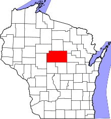 | |
| Villages | ||
| Towns |
| |
| CDPs | ||
| Unincorporated communities |
| |
| Ghost towns/ neighborhoods | ||
| Footnotes | ‡This populated place also has portions in an adjacent county or counties | |