Western Mexico

The Western Mexico (Spanish: Occidente de México) is a region of United Mexican States formed by the states of Nayarit, Jalisco, Colima, and Michoacán,[1] and including the Revillagigedo Islands, Marías Islands, and several smaller islands. The region extends from the coastal plain of the Pacific Ocean, the Sierra Madre Occidental, the Volcanic axis, the basin of Balsas River, the Sierra Madre del Sur and the southwest of the Mexican Plateau.
Description
Pre-Columbian era

Early archaeologists who wrote about the Western Mexico pointed that this region was somehow connected with Mesoamerica; then, other researchers felt that the archeology of the western area belonged to the Mesoamerican studies, and finally the more recent authors argue that the area should be incorporated into a redefined Mesoamerica.[2] There is very little information about early human occupation of the area, the earliest evidence is a camp established on the basis of a volcanic mountain in the Bay of Matanchén, Nayarit,which is a likely date from 2200 to 1730 b.c.[3] Part of the area was under the dominion of the Purépecha Empire
New Kingdom of Galicia
The New Kingdom of Galicia (Spanish: Nuevo Reino de Galicia) was one of only two autonomous kingdoms in the Viceroyalty of New Spain. The conquest of territory was accomplished by Nuño de Guzmán and named as Conquista del Espíritu Santo de la Mayor España (English: Conquest of the Holy Spirit of Spain Mayor). However, queen Joanna of Castile (Joanna the Mad ), mother of Charles V, did not agree with the name given to the conquered territory, and by Royal Decree, on January 25, 1531, ordered to call the conquered territory as Reino de la Nueva Galicia and was founded a city named Santiago de Galicia de Compostela as capital city.[4]
Nueva Galicia was home to many Mexican national heroes, the most important are Josefa Ortiz de Domínguez, José María Morelos and Agustín de Iturbide, all born in Valladolid, now Morelia, Michoacán. It was also the birthplace of presidents José Justo Corro and Valentín Gómez Farías both born in Guadalajara, Jalisco.
States
| State | Official name
Estado Libre y Soberano de: |
Flag | Capital | Largest city | Area[5] | Population (2010)[6] | Order of admission to Federation |
Date of admission to Federation |
|---|---|---|---|---|---|---|---|---|
| Colima | Colima | 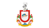 |
Colima | Manzanillo | 5,625 km2 (2,172 sq mi) | 650,129 | 23 | 09-12-1856[7][8] |
| Jalisco | Jalisco | 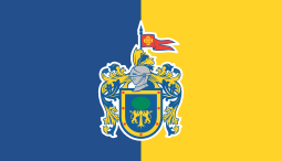 |
Guadalajara | Guadalajara | 78,599 km2 (30,347 sq mi) | 7,350,355 | 9 | 23-12-1823[9] |
| Michoacán | Michoacán de Ocampo | 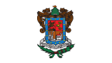 |
Morelia | Morelia | 58,643 km2 (22,642 sq mi) | 4,348,485 | 5 | 22-12-1823[9] |
| Nayarit | Nayarit | 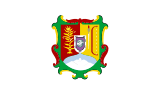 |
Tepic | Tepic | 27,815 km2 (10,739 sq mi) | 1,084,957 | 28 | 26-01-1917[10] |
Major cities
| Major cities of Colima | ||||
 |
 |
 | ||
| Colima | Manzanillo | Tecomán | ||
| Major cities of Jalisco | ||||
 |
 |
 |
 | |
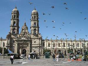
| Guadalajara | Zapopan | Tepatitlán de Morelos | Puerto Vallarta | |
| Major cities of Michoacán | ||||
 |
 |
 |
 | |
| Morelia | Lázaro Cárdenas | Zamora | Pátzcuaro | |
| Major cities of Nayarit | ||||
 |
 |
.JPG) | ||
| Tepic | Bahía de Banderas | San Blas | ||
See also
- Eastern Mexico
- North-Central Mexico
- Northeastern Mexico
- Northwestern Mexico
- South-Central Mexico
- Southeastern Mexico
- Southwestern Mexico
External links
| Wikimedia Commons has media related to Mexico West. |
References
- ↑ "Folia Etimologica Mexicana." (PDF). Sociedad Mexicana de Entomologia A.C. Retrieved October 1, 2010.
- ↑ "El Antiguo Occidente de México: Un Área Cultural Mesoamericana.". FAMSI. Retrieved October 1, 2010.
- ↑ "Los Primeros Habitantes del Occidente.". FAMSI. Retrieved October 1, 2010.
- ↑ Fondo de cultura económica
- ↑ "INEGI".
- ↑ CONAPO
- ↑ "Portal Ciudadano de Baja California".
- ↑ "Universidad de Colima".
- 1 2 "La Diputación Provincial y El Federalismo Mexicano".
- ↑ "Gobierno del Estado de Tlaxcala".