Southwestern Mexico

Southwestern Mexico.
Southwestern Mexico (Spanish: Suroeste de México) is a region of Mexico, formed by the states of Chiapas,[1] Guerrero[2] and Oaxaca.[3]
Because of its population is mostly indigenous people,[4] these states are famous for the deep roots of their traditions, holidays, crafts and great food.[5] The area has some of the most beautiful colonial cities and towns of Mexico as Oaxaca and San Cristobal de las Casas, and also natural wonders such as Agua Azul waterfalls, Sumidero Canyon and the Árbol del Tule and impressive archaeological sites such as Toniná, Bonampak, Monte Alban, Yaxchilán and Palenque.
States
| State | Official Name
Estado Libre y Soberano de: |
Flag | Capital | Largest city | Area[6] | Population (2010)[7] | Order of Admission to Federation |
Date of Admission to Federation |
|---|---|---|---|---|---|---|---|---|
| Chiapas | Chiapas | |
Tuxtla Gutiérrez | Tuxtla Gutiérrez | 73,289 km2 (28,297 sq mi) | 4,796,580 | 19 | 1824-09-14[8] |
| Guerrero | Guerrero | |
Chilpancingo de los Bravo |
Acapulco de Juárez | 63,621 km2 (24,564 sq mi) | 3,388,768 | 21 | 1849-10-27[9] |
| Oaxaca | Oaxaca | |
Oaxaca de Juárez | Oaxaca de Juárez | 93,793 km2 (36,214 sq mi) | 3,801,962 | 3 | 1823-12-21[8] |
Major cities
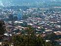
| Major Cities of Chiapas | ||||
 |
 |
 | ||
| Tuxtla Gutiérrez | San Cristóbal de las Casas | Tapachula | Chiapa de Corzo | |
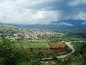
| Major Cities of Guerrero | ||||
 |
 |
 |
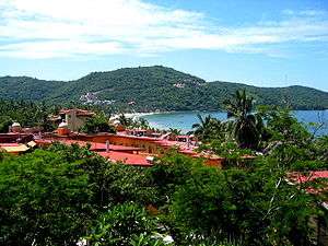 | |
| Acapulco de Juárez | Chilpancingo de los Bravo | Iguala de la Independencia | Ixtapa-Zihuatanejo | |
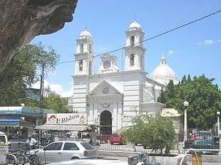
| Major Cities of Oaxaca | |
 |
 |
| Oaxaca de Juárez | Salina Cruz |
See also
- Eastern Mexico
- North-Central Mexico
- Northeastern Mexico
- Northwestern Mexico
- South-Central Mexico
- Southeastern Mexico
- Western Mexico
External links
References
- ↑ "Miocene mollusks from the Simojovel area in Chiapas, southwestern Mexico." (PDF). Retrieved April 4, 2011.
- ↑ "Informacion General, Guerrero.". Explorando Mexico. Retrieved April 4, 2011.
- ↑ "Oaxaca.". Explorando Mexico. Retrieved April 4, 2011.
- ↑ "GRUPOS ETNOLINGÜÍSTICOS EN EL MÉXICO DEL SIGLO XXI." (PDF). Retrieved April 4, 2011.
- ↑ "Oaxaca.". Turiguide. Retrieved April 4, 2011.
- ↑ "INEGI".
- ↑ Censo 2010
- 1 2 "Las Diputaciones Provinciales" (PDF) (in Spanish). p. 15.
- ↑ "Erección del Estado de Guerrero".
This article is issued from Wikipedia - version of the 5/5/2016. The text is available under the Creative Commons Attribution/Share Alike but additional terms may apply for the media files.