West Pearsall, Texas
| West Pearsall, Texas | |
|---|---|
| CDP | |
 West Pearsall, Texas Location within the state of Texas | |
| Coordinates: 28°53′52″N 99°6′29″W / 28.89778°N 99.10806°WCoordinates: 28°53′52″N 99°6′29″W / 28.89778°N 99.10806°W | |
| Country | United States |
| State | Texas |
| County | Frio |
| Area | |
| • Total | 0.1 sq mi (0.2 km2) |
| • Land | 0.1 sq mi (0.2 km2) |
| • Water | 0.0 sq mi (0.0 km2) |
| Elevation | 617 ft (188 m) |
| Population (2000) | |
| • Total | 349 |
| • Density | 4,553.6/sq mi (1,758.2/km2) |
| Time zone | Central (CST) (UTC-6) |
| • Summer (DST) | CDT (UTC-5) |
| FIPS code | 48-77818[1] |
| GNIS feature ID | 1852782[2] |
West Pearsall was a census-designated place (CDP) in Frio County, Texas, United States. The population was 349 at the 2000 census.
West Pearsall was annexed into the City of Pearsall in late 2002.[3]
Geography
West Pearsall is located at 28°53′52″N 99°6′29″W / 28.89778°N 99.10806°W (28.897874, - 99.107938).[4]
According to the United States Census Bureau, the CDP had a total area of 0.1 square miles (0.26 km2), all of it land.
Demographics
As of the census[1] of 2000, there were 349 people, 107 households, and 89 families residing in the CDP. The population density was 4,553.6 people per square mile (1,684.4/km²). There were 127 housing units at an average density of 1,657.0/sq mi (612.9/km²). The racial makeup of the CDP was 67.05% White, 0.29% African American, 29.23% from other races, and 3.44% from two or more races. Hispanic or Latino of any race were 99.71% of the population.
There were 107 households out of which 40.2% had children under the age of 18 living with them, 54.2% were married couples living together, 20.6% had a female householder with no husband present, and 16.8% were non-families. 13.1% of all households were made up of individuals and 5.6% had someone living alone who was 65 years of age or older. The average household size was 3.26 and the average family size was 3.54.
In the CDP the population was spread out with 34.7% under the age of 18, 9.7% from 18 to 24, 28.4% from 25 to 44, 16.6% from 45 to 64, and 10.6% who were 65 years of age or older. The median age was 29 years. For every 100 females there were 106.5 males. For every 100 females age 18 and over, there were 100.0 males.
The median income for a household in the CDP was $26,000, and the median income for a family was $26,550. Males had a median income of $14,205 versus $12,917 for females. The per capita income for the CDP was $8,168. About 11.3% of families and 7.9% of the population were below the poverty line, including none of those under age 18 and 38.2% of those age 65 or over.
Education
West Pearsall is served by the Pearsall Independent School District.
References
- 1 2 "American FactFinder". United States Census Bureau. Retrieved 2008-01-31.
- ↑ "US Board on Geographic Names". United States Geological Survey. 2007-10-25. Retrieved 2008-01-31.
- ↑ "Boundary Changes". Geographic Change Notes: Texas. Population Division, United States Census Bureau. 2006-05-19. Retrieved 2008-05-27.
- ↑ "US Gazetteer files: 2010, 2000, and 1990". United States Census Bureau. 2011-02-12. Retrieved 2011-04-23.
External links
Municipalities and communities of Frio County, Texas, United States | ||
|---|---|---|
| Cities | 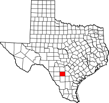 | |
| CDPs | ||
| Ghost towns | ||