West Lawn, Pennsylvania
| West Lawn | |
| Census-designated place | |
 Houses on Penn Avenue | |
| Country | United States |
|---|---|
| State | Pennsylvania |
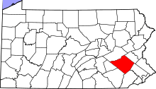
| County | Berks |
| Township | Spring |
| Elevation | 374 ft (114.0 m) |
| Coordinates | 40°19′43″N 75°59′40″W / 40.32861°N 75.99444°WCoordinates: 40°19′43″N 75°59′40″W / 40.32861°N 75.99444°W |
| Area | 0.2 sq mi (0.5 km2) |
| - land | 0.2 sq mi (1 km2) |
| - water | 0.0 sq mi (0 km2) |
| Population | 1,715 (2010) |
| Density | 7,428.8/sq mi (2,868.3/km2) |
| Dissolved | January 1, 2006 |
| Timezone | EST (UTC-5) |
| - summer (DST) | EDT (UTC-4) |
| ZIP Code | 19609 |
| Area code | 610 and 484 |
 Location of West Lawn in Pennsylvania | |
 Location of Pennsylvania in the United States | |
West Lawn is a former borough in Berks County, Pennsylvania, United States. Now as of 2010, it is a census-designated place. The population was 1,715 at the 2010 census. This borough was dissolved and became part of Spring Township on January 1, 2006. Voters in both municipalities approved the dissolution during a general election vote in November 2004.
Geography
West Lawn is located at 40°19′43″N 75°59′40″W / 40.32861°N 75.99444°W (40.328676, −75.994407).[1]
According to the United States Census Bureau, the census-designated place has a total area of 0.2 square miles (0.52 km2), all land.
Demographics
| Historical population | |||
|---|---|---|---|
| Census | Pop. | %± | |
| 1970 | 1,973 | — | |
| 1980 | 1,686 | −14.5% | |
| 1990 | 1,606 | −4.7% | |
| 2000 | 1,597 | −0.6% | |
| Est. 2005 | 1,578 | ||
| Sources:[2][3][4] | |||
As of the census[3] of 2000, there were 1,597 people, 706 households, and 441 families residing in the borough. The population density was 7,428.8 inhabitants per square mile (2,936.2/km²). There were 730 housing units at an average density of 3,395.8 per square mile (1,342.2/km²). The racial makeup of the borough was 95.93% White, 1.63% African American, 1.31% Asian, 0.44% from other races, and 0.69% from two or more races. Hispanic or Latino of any race were 1.50% of the population.
There were 706 households, out of which 26.5% had children under the age of 18 living with them, 47.6% were married couples living together, 10.3% had a female householder with no husband present, and 37.5% were non-families. 31.0% of all households were made up of individuals, and 15.0% had someone living alone who was 65 years of age or older. The average household size was 2.26 and the average family size was 2.83.
In the borough, the population was spread out, with 22.2% under the age of 18, 6.0% from 18 to 24, 32.4% from 25 to 44, 20.0% from 45 to 64, and 19.3% who were 65 years of age or older. The median age was 38 years. For every 100 females there were 91.9 males. For every 100 females age 18 and over, there were 86.8 males.
The median income for a household in the borough was $40,595, and the median income for a family was $48,854. Males had a median income of $35,956 versus $25,403 for females. The per capita income for the borough was $20,357. About 2.3% of families and 3.6% of the population were below the poverty line, including 3.3% of those under age 18 and 3.6% of those age 65 or over.
Education
Wilson Senior High School, as well as Whitfield Elementary reside within West Lawn. Wilson is known for its excellent academics and athletics programs. Their swimming program is one of the best in the nation and is currently run by Head Coach Roy Snyder.
Well known notable natives
- Clayton Morris Fox & Friends Co-Host & Co-Host of The Grizzly Bear Egg Café
- Mike Quackenbush Super Hero, Professional Wrestler & Co-Host of The Grizzly Bear Egg Café
- Chad Henne Quarterback for the University of Michigan and currently, the Jacksonville Jaguars
- Kerry Collins Quarterback for Penn State University, the New York Giants, the Tennessee Titans and the Indianapolis Colts
References
- ↑ "US Gazetteer files: 2010, 2000, and 1990". United States Census Bureau. 2011-02-12. Retrieved 2011-04-23.
- ↑ "Census of Population and Housing". U.S. Census Bureau. Retrieved 11 December 2013.
- 1 2 "American FactFinder". United States Census Bureau. Retrieved 2008-01-31.
- ↑ "Incorporated Places and Minor Civil Divisions Datasets: Subcounty Resident Population Estimates: April 1, 2010 to July 1, 2012". Population Estimates. U.S. Census Bureau. Retrieved 11 December 2013.