Glover, Vermont
| Glover, Vermont | |
|---|---|
| Town | |
 Located in Orleans County, Vermont | |
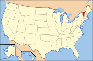 Location of Vermont with the U.S.A. | |
| Coordinates: 44°41′39″N 72°13′16″W / 44.69417°N 72.22111°WCoordinates: 44°41′39″N 72°13′16″W / 44.69417°N 72.22111°W | |
| Country | United States |
| State | Vermont |
| County | Orleans |
| Chartered | November 20, 1783 |
| Area | |
| • Total | 38.6 sq mi (100.0 km2) |
| • Land | 37.9 sq mi (98.1 km2) |
| • Water | 0.7 sq mi (1.9 km2) |
| Elevation | 945 ft (507 m) |
| Population (2000) | |
| • Total | 966 |
| • Density | 25.5/sq mi (9.8/km2) |
| • Households | 384 |
| • Families | 269 |
| Time zone | EST (UTC-5) |
| • Summer (DST) | EDT (UTC-4) |
| ZIP code | 05839 |
| Area code(s) | 802 |
| FIPS code | 50-28075[1] |
| GNIS feature ID | 1462103[2] |
Glover is a town in Orleans County, Vermont, in the United States. As of the 2000 census the town's population was 966. It contains two unincorporated villages, Glover and West Glover.
The town is named for Brigadier General John Glover,[3] who served in the American Revolutionary War. He was the prime proprietor of the town.
Glover is home of the Bread & Puppet Museum.
Government
Town
- Selectman - Jack Sumburg
- Selectman - Mike Ladd
- Selectman - Brian Carroll
- Constable -
- Clerk/Treasurer - Donna Sweeney
- Assistant - Jessica Sweeney
- Library Trustee - Ned Andrews (2013)
- 2010-2011 Budget - 736,525.22
School District
- Director - Jason Kennedy
- Budget - $1.7 million plus town's assessment for Lake Region Union High School (Orleans Central Supervisory Union)
In 2009 and 2010, the Glover Community School stood highest in the county for averaged proficiency in reading and mathematics on the standardized NE-CAP test.[4][5]
Geography
According to the United States Census Bureau, the town has a total area of 38.6 square miles (100.0 km2), of which 37.9 square miles (98.1 km2) is land and 0.7 square mile (1.9 km2) (1.92%) is water.
The surface of the town is uneven, with hills and valleys. The highest elevation is Black Hills, at 2,258 feet (688 m), in the south part of town.[6] The town drains northward via the northern branches of the Barton River, and southward via branches of the Passumpsic, Lamoille, and Black Rivers, which have their sources here. Four ponds of considerable size also are found here, Parker Pond, in the north, Stone's and Clark's pond, in the south and central, and Sweeney pond in the west, as well as Shadow Lake.[7]
Demographics
| Historical population | |||
|---|---|---|---|
| Census | Pop. | %± | |
| 1800 | 36 | — | |
| 1810 | 387 | 975.0% | |
| 1820 | 549 | 41.9% | |
| 1830 | 902 | 64.3% | |
| 1840 | 1,119 | 24.1% | |
| 1850 | 1,137 | 1.6% | |
| 1860 | 1,244 | 9.4% | |
| 1870 | 1,178 | −5.3% | |
| 1880 | 1,055 | −10.4% | |
| 1890 | 970 | −8.1% | |
| 1900 | 891 | −8.1% | |
| 1910 | 932 | 4.6% | |
| 1920 | 826 | −11.4% | |
| 1930 | 860 | 4.1% | |
| 1940 | 788 | −8.4% | |
| 1950 | 727 | −7.7% | |
| 1960 | 683 | −6.1% | |
| 1970 | 649 | −5.0% | |
| 1980 | 843 | 29.9% | |
| 1990 | 820 | −2.7% | |
| 2000 | 966 | 17.8% | |
| 2010 | 1,122 | 16.1% | |
| Est. 2014 | 1,099 | [8] | −2.0% |
| U.S. Decennial Census[9] | |||
As of the census[1] of 2000, there were 966 people, 384 households, and 269 families residing in the town. The population density was 25.5 inhabitants per square mile (9.8/km2). There were 677 housing units at an average density of 17.9 per square mile (6.9/km2). The racial makeup of the town was 96.38% White, 0.21% African American, 0.93% Native American, 0.21% Asian, 0.31% from other races, and 1.97% from two or more races. Hispanic or Latino of any race were 0.62% of the population.
There were 384 households out of which 29.7% had children under the age of 18 living with them, 58.9% were married couples living together, 8.6% had a female householder with no husband present, and 29.9% were non-families. 23.2% of all households were made up of individuals and 7.3% had someone living alone who was 65 years of age or older. The average household size was 2.40 and the average family size was 2.83.
In the town the population was spread out with 22.0% under the age of 18, 6.1% from 18 to 24, 23.2% from 25 to 44, 34.1% from 45 to 64, and 14.6% who were 65 years of age or older. The median age was 44 years. For every 100 females there were 100.0 males. For every 100 females age 18 and over, there were 95.6 males.
Economy
Personal Income
The median income for a household in the town was $33,403, and the median income for a family was $38,309. Males had a median income of $25,977 versus $21,172 for females. The per capita income for the town was $15,112. About 10.8% of families and 11.9% of the population were below the poverty line, including 15.2% of those under age 18 and 14.9% of those age 65 or over.
Tourism
The town is second in the county for the highest percentage of second home ownership.[10][11]
History
In the most cataclysmic natural catastrophe affecting Orleans County in post-Columbian times, the banks of Glover's Long Pond gave way on June 6, 1810, and flooded the Barton River valley. The hero of the day was laborer Spencer Chamberlain who ran ahead of the flood to warn people at the mill. The wayward pond was forever after known as "Runaway Pond".
From about the 1820s to the 1930s, there was a settlement, Slab City, near Shadow Lake, whose economy was dependent on the logging, and three sawmills in the area. The settlement also contained a lime kiln, butter tub factory, a cider mill, a one-room schoolhouse, a post office, a church, and other allied businesses.[12]
The unincorporated village of West Glover had a municipal septic system which failed in 2008.[13] This was replaced in 2012. It connected to the main sewage line in Glover village, which in turns was connected to the wastewater treatment facility in adjacent Barton. This was funded by USDA Rural Development Agency.[14]
Transportation
Major Routes
Town maintained roads
The town has 40 miles (64 km) of dirt roads. These lose an estimated 11,720 cubic yards (8,960 m3) of gravel annually which must be replaced.[15]
Notable people
- Emory A. Hebard, Member of the Vermont House of Representatives from 1961 to 1977 and Vermont State Treasurer from 1977 to 1989
- Peter Schumann, founder and director of the Bread & Puppet Theater
References
- 1 2 "American FactFinder". United States Census Bureau. Retrieved 2008-01-31.
- ↑ "US Board on Geographic Names". United States Geological Survey. 2007-10-25. Retrieved 2008-01-31.
- ↑ Gannett, Henry (1905). The Origin of Certain Place Names in the United States. Govt. Print. Off. p. 139.
- ↑ Braithwaite, Chris (3 February 2010). "NECAP results show four standouts". Barton, Vermont: the Chronicle. p. 2.
- ↑ Starr, Tena (February 15, 2011). "Student test scores released by state". Barton, Vermont: the Chronicle. p. 14.
- ↑ Orleans County Vermont Summits
- ↑ Gazetteer of Lamoille and Orleans Counties, VT.; 1883-1884, Compiled and Published by Hamilton Child; May 1887
- ↑ "Annual Estimates of the Resident Population for Incorporated Places: April 1, 2010 to July 1, 2014". Retrieved June 4, 2015.
- ↑ "U.S. Decennial Census". United States Census Bureau. Archived from the original on May 11, 2015. Retrieved June 19, 2015.
- ↑ The first is Westmore
- ↑ Starr, Tena (7 July 2010). "Glover to study summer people's spending habits". Barton, Vermont: the Chronicle. pp. 10A.
- ↑ Ashe, Connie (January 9, 2013). "Info about Glover's "Slab City" sought". the chronicle. Barton, Vermont. pp. 16B.
- ↑ Braithwaite, Chris (March 5, 2008). Quilts soften mood at crowded Town Meeting. the Chronicle.
- ↑ "Wastewater treatment facility is upgraded". the chronicle. Barton, Vermont. February 27, 2013. p. 23.
- ↑ Creaser, Richard (May 2, 2007). Rough roads are the subject of special meeting. the Chronicle.
External links
Municipalities and communities of Orleans County, Vermont, United States | ||
|---|---|---|
| City | 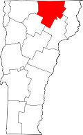 | |
| Towns | ||
| Villages | ||
| CDPs | ||
| Unincorporated community | ||