Wausaukee, Wisconsin
| Wausaukee, Wisconsin | |
|---|---|
| Village | |
|
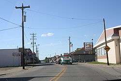
U.S. Route 141 in Wausaukee, Wisconsin | |
 Location of Wausaukee, Wisconsin | |
| Coordinates: 45°24′N 87°55′W / 45.400°N 87.917°WCoordinates: 45°24′N 87°55′W / 45.400°N 87.917°W | |
| Country | United States |
| State | Wisconsin |
| County | Marinette |
| Area[1] | |
| • Total | 1.41 sq mi (3.65 km2) |
| • Land | 1.40 sq mi (3.63 km2) |
| • Water | 0.01 sq mi (0.03 km2) |
| Elevation[2] | 774 ft (236 m) |
| Population (2010)[3] | |
| • Total | 575 |
| • Estimate (2012[4]) | 578 |
| • Density | 410.7/sq mi (158.6/km2) |
| Time zone | Central (CST) (UTC-6) |
| • Summer (DST) | CDT (UTC-5) |
| Area code(s) | 715 & 534 |
| FIPS code | 55-84550[5] |
| GNIS feature ID | 1584382[2] |
Wausaukee is a village in Marinette County, Wisconsin, in the United States. The population was 575 at the 2010 census. The village is part of the Marinette, WI–MI Micropolitan Statistical Area.
Geography
Wausaukee is located at 45°23′N 87°57′W / 45.383°N 87.950°W (45.3767, -87.9561).[6]
According to the United States Census Bureau, the village has a total area of 1.41 square miles (3.65 km2), of which, 1.40 square miles (3.63 km2) of it is land and 0.01 square miles (0.03 km2) is water.[1]
History
Wausaukee is a Menominee word that means “river in the hills.”[7] The town was started in 1863 by John S. Monroe, who bought 160 acres of land from Lars Kovala and built a mill to supply the railroads with lumber for bridges and culverts.[8] His first building was a log cabin home that was also used to board the mill workers. Eventually as the town grew more and people moved in, his log cabin grew into an Inn and was the only public eating establishment north of Green Bay.[7]
On August 19, 2011 at 4:45pm, a F-1 Class tornado struck Wausaukee.[9] An F-1 Class tornado is one with wind speeds 86–110 miles per hour.[10] One fatality was recorded.[9]
Demographics
| Historical population | |||
|---|---|---|---|
| Census | Pop. | %± | |
| 1930 | 663 | — | |
| 1940 | 655 | −1.2% | |
| 1950 | 612 | −6.6% | |
| 1960 | 608 | −0.7% | |
| 1970 | 557 | −8.4% | |
| 1980 | 648 | 16.3% | |
| 1990 | 656 | 1.2% | |
| 2000 | 572 | −12.8% | |
| 2010 | 575 | 0.5% | |
| Est. 2015 | 568 | [11] | −1.2% |
2010 census
As of the census[3] of 2010, there were 575 people, 275 households, and 145 families residing in the village. The population density was 410.7 inhabitants per square mile (158.6/km2). There were 325 housing units at an average density of 232.1 per square mile (89.6/km2). The racial makeup of the village was 95.7% White, 1.2% Native American, 0.2% Asian, 0.5% from other races, and 2.4% from two or more races. Hispanic or Latino of any race were 2.8% of the population.
There were 275 households of which 25.8% had children under the age of 18 living with them, 33.5% were married couples living together, 12.7% had a female householder with no husband present, 6.5% had a male householder with no wife present, and 47.3% were non-families. 41.8% of all households were made up of individuals and 24% had someone living alone who was 65 years of age or older. The average household size was 2.09 and the average family size was 2.78.
The median age in the village was 43.3 years. 22.8% of residents were under the age of 18; 7.8% were between the ages of 18 and 24; 21.6% were from 25 to 44; 25.2% were from 45 to 64; and 22.4% were 65 years of age or older. The gender makeup of the village was 48.7% male and 51.3% female.
2000 census
As of the census[5] of 2000, there were 572 people, 251 households, and 150 families residing in the village. The population density was 402.4 people per square mile (155.5/km²). There were 294 housing units at an average density of 206.8 per square mile (79.9/km²). The racial makeup of the village was 96.50% White, 0.87% Black or African American, 22.22% Native American, 0.17% from other races, and 1.22% from two or more races. 0.87% of the population were Hispanic or Latino of any race.
There were 251 households out of which 28.7% had children under the age of 18 living with them, 43.0% were married couples living together, 13.5% had a female householder with no husband present, and 40.2% were non-families. 35.9% of all households were made up of individuals and 20.3% had someone living alone who was 65 years of age or older. The average household size was 2.27 and the average family size was 2.97.
In the village the population was spread out with 26.2% under the age of 18, 7.2% from 18 to 24, 22.9% from 25 to 44, 21.9% from 45 to 64, and 21.9% who were 65 years of age or older. The median age was 40 years. For every 100 females there were 84.5 males. For every 100 females age 18 and over, there were 75.8 males.
The median income for a household in the village was $25,313, and the median income for a family was $35,833. Males had a median income of $30,313 versus $20,417 for females. The per capita income for the village was $13,098. About 17.5% of families and 23.0% of the population were below the poverty line, including 36.8% of those under age 18 and 11.3% of those age 65 or over.
Notable residents
- Harlan P. Bird, Wisconsin State Senator
- Lyle Mays, jazz pianist and composer with the Pat Metheny Group
- Zachary A. Vane, Washington State Legislator and businessman
Images
 Municipal building and town hall.
 The Ice Cream Station is a seasonally open destination in downtown Wausaukee.
 U.S. Route 141 in Wausaukee, Wisconsin
 Wausaukee is surrounded by fertile soil and farms.
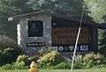 City welcome sign
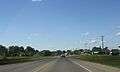 Looking north while entering Wausaukee
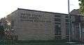 Post office
References
- 1 2 "US Gazetteer files 2010". United States Census Bureau. Retrieved 2012-11-18.
- 1 2 "US Board on Geographic Names". United States Geological Survey. 2007-10-25. Retrieved 2008-01-31.
- 1 2 "American FactFinder". United States Census Bureau. Retrieved 2012-11-18.
- ↑ "Population Estimates". United States Census Bureau. Retrieved 2013-06-24.
- 1 2 "American FactFinder". United States Census Bureau. Retrieved 2008-01-31.
- ↑ "US Gazetteer files: 2010, 2000, and 1990". United States Census Bureau. 2011-02-12. Retrieved 2011-04-23.
- 1 2 The Great Wisconsin Touring Book: 30 Spectacular Auto Trips By Gary G. Knowles
- ↑ 'The Great Wisconsin Touring Book: 30 Spectacular Auto Trips,' Gary G. Knowles
- 1 2 http://www.wausaukee.com/Tornado%20Gallery%20Page.html
- ↑ Enhanced Fujita scale
- ↑ "Annual Estimates of the Resident Population for Incorporated Places: April 1, 2010 to July 1, 2015". Retrieved July 2, 2016.
- ↑ "Census of Population and Housing". Census.gov. Retrieved June 4, 2015.
External links
| Wikimedia Commons has media related to Wausaukee, Wisconsin. |
- Wausaukee (Town & Village), Wisconsin website
- Sanborn fire insurance map: 1911
Municipalities and communities of Marinette County, Wisconsin, United States | ||
|---|---|---|
| Cities | 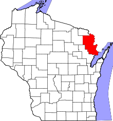 | |
| Villages | ||
| Towns | ||
| CDPs | ||
| Unincorporated communities | ||
| Footnotes | ‡This populated place also has portions in an adjacent county or counties | |