Waterfoot, East Renfrewshire
| Waterfoot | |
| Scots: Watterfit | |
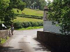 Waterfoot Bridge |
|
 Waterfoot |
|
| Population | 1,279 |
|---|---|
| OS grid reference | NS569546 |
| – Edinburgh | 44 mi (71 km) ENE |
| – London | 340 mi (550 km) SSE |
| Council area | East Renfrewshire |
| South Lanarkshire | |
| Lieutenancy area | Renfrewshire |
| Lanarkshire | |
| Country | Scotland |
| Sovereign state | United Kingdom |
| Post town | Glasgow |
| Postcode district | G76 |
| Dialling code | 01355 |
| 0141 | |
| Police | Scottish |
| Fire | Scottish |
| Ambulance | Scottish |
| EU Parliament | Scotland |
| UK Parliament | East Renfrewshire |
| East Kilbride, Strathaven and Lesmahagow | |
| Scottish Parliament | Eastwood |
| East Kilbride | |
Coordinates: 55°45′50″N 4°16′59″W / 55.764°N 4.283°W
Waterfoot (Scots: Watterfit)[1] is a hamlet in East Renfrewshire and South Lanarkshire, Scotland. It is on the B767 road between Clarkston and Eaglesham, which are one mile north and south respectively, while Newton Mearns is about two miles to the west and East Kilbride about three miles to the east.
The Glasgow Southern Orbital road (part of the A726) passes just to the south of Waterfoot. The hamlet lies on the west bank of the White Cart Water, and the original settlement grew up around a farm, mill and smithy. One early record of the hamlet is in Timothy Pont's maps of Scotland (1583 - 1596).
Waterfoot today is, however, purely residential in character, having expanded in the latter half of the 20th century as a commuter dormitory hamlet. Although Waterfoot is relatively affluent, there are no shops or other services, with residents having to travel to other areas to access amenities. The 2001 census reported that Waterfoot had a population of 1,279. Waterfoot is also the home to Hi-Fi equipment company and record label, Linn Products.
A small part of Waterfoot on the east side of the White Cart lies in the South Lanarkshire council area.
Gallery
 Weir White Cart Water
 Brackenrig Burn
 "Floors Farm" near Waterfoot
References
- ↑ Andy Eagle (2003-02-27). "The Online Scots Dictionary". Scots-online.org. Retrieved 2013-09-26.
External links
| Wikimedia Commons has media related to Waterfoot, East Renfrewshire. |