Watchaug Pond
| Watchaug pond | |
|---|---|
 | |
| Location | Washington County, Rhode Island, United States |
| Coordinates | 41°23′00″N 71°41′23″W / 41.3834339°N 71.6897864°WCoordinates: 41°23′00″N 71°41′23″W / 41.3834339°N 71.6897864°W |
| Type | kettle pond |
| Basin countries | United States |
| Surface area | 573 acres (2.32 km2) |
| Average depth | 8 ft (2.4 m) |
| Max. depth | 36 ft (11 m) |
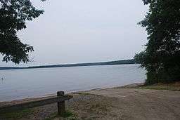
Watchaug pond is a kettle pond (lake) located at the southern tip of Rhode Island, in the town of Charlestown. It is surrounded by nature trails and is near the Audubon Society's Kimball Wildlife Refuge. The 573-acre (2.32 km2) pond is within 3,000 acres (12 km2) of public land. To access the public cement boat ramp at this pond, follow Prosser Trail to Sanctuary Road.
External links
This article is issued from Wikipedia - version of the 12/18/2015. The text is available under the Creative Commons Attribution/Share Alike but additional terms may apply for the media files.