Warwick, Georgia
| Warwick, Georgia | |
|---|---|
| City | |
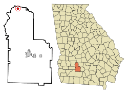 Location in Worth County and the state of Georgia | |
| Coordinates: 31°49′49″N 83°55′15″W / 31.83028°N 83.92083°WCoordinates: 31°49′49″N 83°55′15″W / 31.83028°N 83.92083°W | |
| Country | United States |
| State | Georgia |
| County | Worth |
| Area | |
| • Total | 0.8 sq mi (2.1 km2) |
| • Land | 0.8 sq mi (2.1 km2) |
| • Water | 0 sq mi (0 km2) |
| Elevation | 279 ft (85 m) |
| Population (2000) | |
| • Total | 430 |
| • Density | 537.5/sq mi (204.8/km2) |
| Time zone | Eastern (EST) (UTC-5) |
| • Summer (DST) | EDT (UTC-4) |
| ZIP code | 31796 |
| Area code(s) | 229 |
| FIPS code | 13-80676[1] |
| GNIS feature ID | 0333371[2] |
Warwick is a city in Worth County, Georgia, United States. The population was 430 at the 2000 census. It is part of the Albany, Georgia Metropolitan Statistical Area.
Geography
Warwick is located at 31°49′49″N 83°55′15″W / 31.83028°N 83.92083°W (31.830351, -83.920705).[3]
According to the United States Census Bureau, the city has a total area of 0.8 square miles (2.1 km2), all of it land.
Demographics
| Historical population | |||
|---|---|---|---|
| Census | Pop. | %± | |
| 1910 | 226 | — | |
| 1920 | 274 | 21.2% | |
| 1930 | 381 | 39.1% | |
| 1940 | 379 | −0.5% | |
| 1950 | 449 | 18.5% | |
| 1960 | 434 | −3.3% | |
| 1970 | 466 | 7.4% | |
| 1980 | 488 | 4.7% | |
| 1990 | 501 | 2.7% | |
| 2000 | 430 | −14.2% | |
| 2010 | 423 | −1.6% | |
| Est. 2015 | 407 | [4] | −3.8% |
As of the census[1] of 2000, there were 430 people, 160 households, and 123 families residing in the city. The population density was 531.9 people per square mile (205.0/km²). There were 181 housing units at an average density of 223.9 per square mile (86.3/km²). The racial makeup of the city was 37.67% White, 61.16% African American, 0.47% Asian, 0.47% from other races, and 0.23% from two or more races. Hispanic or Latino of any race were 0.47% of the population.
There were 160 households out of which 31.3% had children under the age of 18 living with them, 43.8% were married couples living together, 28.1% had a female householder with no husband present, and 23.1% were non-families. 23.1% of all households were made up of individuals and 12.5% had someone living alone who was 65 years of age or older. The average household size was 2.69 and the average family size was 3.14.
In the city the population was spread out with 30.9% under the age of 18, 9.5% from 18 to 24, 20.2% from 25 to 44, 24.2% from 45 to 64, and 15.1% who were 65 years of age or older. The median age was 34 years. For every 100 females there were 84.5 males. For every 100 females age 18 and over, there were 73.7 males.
The median income for a household in the city was $30,208, and the median income for a family was $37,778. Males had a median income of $26,250 versus $14,125 for females. The per capita income for the city was $12,766. About 18.5% of families and 27.7% of the population were below the poverty line, including 41.5% of those under age 18 and 25.0% of those age 65 or over.
News & Media
References
- 1 2 "American FactFinder". United States Census Bureau. Retrieved 2008-01-31.
- ↑ "US Board on Geographic Names". United States Geological Survey. 2007-10-25. Retrieved 2008-01-31.
- ↑ "US Gazetteer files: 2010, 2000, and 1990". United States Census Bureau. 2011-02-12. Retrieved 2011-04-23.
- ↑ "Annual Estimates of the Resident Population for Incorporated Places: April 1, 2010 to July 1, 2015". Retrieved July 2, 2016.
- ↑ "Census of Population and Housing". Census.gov. Retrieved June 4, 2015.
Municipalities and communities of Worth County, Georgia, United States | ||
|---|---|---|
| Cities | 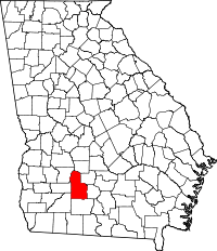 | |
| Town | ||
| Unincorporated community | ||