Warriorstand, Alabama
| Warriorstand, Alabama | |
|---|---|
| Unincorporated community | |
 Warriorstand, Alabama Location in Alabama. | |
| Coordinates: 32°18′43″N 85°33′12″W / 32.31194°N 85.55333°W | |
| Country | United States |
| State | Alabama |
| County | Macon |
| Elevation | 489 ft (149 m) |
| Time zone | Central (CST) (UTC-6) |
| • Summer (DST) | CDT (UTC-5) |
| Area code(s) | 334 |
| GNIS feature ID | 128603 |
Warriorstand (also Warrior Stand) is an unincorporated community in Macon County, Alabama, United States.
History
The lands of Macon County were historically occupied by Creek Indians prior to European-American settlement.
In 1805, the Old Federal Road was built across the Creek Nation, connecting Milledgeville, Georgia with Fort Stoddert, Mississippi Territory. The Creek were given authority by the United States to operate "houses of entertainment" along the route. A tavern was established at "Warrior Stand", a stagecoach stop owned by Big Warrior, a prominent Creek Chief.[1] When Marquis de Lafayette visited the United States in 1824-1825, his party stayed one night at the tavern.[2]
The community had a Methodist Episcopalian Church, as well as a Masonic Grand Lodge (#115).
Demographics
| Historical population | |||
|---|---|---|---|
| Census | Pop. | %± | |
| 1880 | 145 | — | |
| 1890 | 215 | 48.3% | |
| U.S. Decennial Census[3] | |||
Warrior Stand was listed on the 1880 and 1890 U.S. Censuses. It did not appear on any others after.
Today
The community today consists of a scattering of homes and farms located along County Road 10. The Ridge Macon County Archaeology Project is located in Warrior Stand. The Ridge Macon County Archeology Project (a.k.a. The Ridge Project) is a non-profit organization founded in 2011 with a grant provided by the Alabama Historical Commission. The organization, founded by Shari Williams, is dedicated to archaeological exploration to document the story of the cultural evolution in Macon County, Alabama. Glenn Drummond, Macon County Archivist, conceived the name “The Ridge” because it aptly describes the topography found in southeastern Macon County where Native Americans established a pathway on high ground that eventually became link in one of their major east/west trade routes. This ridge divides the drainage basins of the Chattahoochee and Tallapoosa Rivers.
In 2012, The Ridge Project collaborated with the Dr. John Cottier* and graduate students Kelly Irvin and Hamilton Bryant from Auburn University to conduct site surveys in order to identify viable excavation sites. *(Dr. Cottier, professional Archaeologist, and Associate Professor of Sociology and Anthropology, died in July 2015. He was noted for a 50 -year career, which included documenting archaeological and cultural sites along the Old Federal Road).
By May 2012, Professor Dana Chandler, Tuskegee University Archivist and History Professor, discovered Native American lithics that were just lying on the eroded slope of the Interpretive Center front lot. He had a hunch that we had a viable dig site right under our noses. He offered to bring his summer term American History class to the Center to open an excavation pit. The students conducted field work the summer of 2012 and found that Professor Chandler's hunch was right. The students found Native American and other artifacts that were so significant that Professor Chandler and a new group of students returned the summer of 2013 to continue the excavation. Mr. Rob Perry, Surveyor, and Mr. Drummond assisted with the Tuskegee student excavations.
Additional excavations were conducted during the fall of 2012, 2013, 2014 and 2015 by fourth grade students from Lee-Scott Academy in Auburn. The students participated in a dig and other activities during their field trip to The Ridge Interpretive Center. Their discoveries included flakes, arrowheads, pottery pieces, charcoal and daub.
Professor Chandler wrote a site investigation summary report of the Tuskegee student digs and artifact discoveries.[4] An article about excavations at The Ridge was published in the July 2016 edition of the Central States Archaeological Journal.
The Warrior Stand Volunteer Fire Department has been recognized for its exceptional work providing rural fire safety education.[5] The baseball diamond at the South Macon Recreation Center in Warrior Stand is used for local competitions.
Notable people
- George Wylie Henderson, author.[6]
- William D. Jelks, Governor of Alabama from 1901-1907.[7]
References
- ↑ Christopher, Raven M. (April 2012). "Archaeological Survey of the Old Federal Road in Alabama" (PDF). Center for Archaeological Studies: University of South Alabama.
- ↑ Lewis, Herbert J. "Jim" (June 26, 2013). "Lafayette's Visit to Alabama". Encyclopedia of Alabama.
- ↑ "U.S. Decennial Census". Census.gov. Retrieved June 6, 2013.
- ↑ "Initial Report on the Site Investigation at The Ridge Macon County Archaeology Project Interpretive Center Warrior Stand, Alabama". Aug 26, 2013.
- ↑ "Tuskegee Fire Department and Warrior Stand Among Honorees". Tuskegee News. Nov 1, 2007.
- ↑ Nicholls, David (2000). Conjuring the Folk: Forms of Modernity in African America. University of Michigan Press.
- ↑ "Alabama Governor William Dorsey Jelks". National Governors Association. Retrieved Aug 28, 2013.
External links
Municipalities and communities of Macon County, Alabama, United States | ||
|---|---|---|
| City | 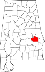 | |
| Towns | ||
| Unincorporated communities | ||
| Footnotes | ‡This populated place also has portions in an adjacent county or counties | |