Waratah-Wynyard Council
| Waratah-Wynyard Tasmania | |||||||||||||
|---|---|---|---|---|---|---|---|---|---|---|---|---|---|
 Waratah-Wynyard LGA | |||||||||||||
| Coordinates | 41°12′36″S 145°32′24″E / 41.21000°S 145.54000°ECoordinates: 41°12′36″S 145°32′24″E / 41.21000°S 145.54000°E | ||||||||||||
| Population | 14,289 (2015 est)[1] | ||||||||||||
| • Density | 121.1/km2 (313.6/sq mi) | ||||||||||||
| Established | 1993 | ||||||||||||
| Area | 118 km2 (45.6 sq mi) | ||||||||||||
| Mayor | Robert Walsh | ||||||||||||
| Council seat | Wynyard | ||||||||||||
| Region | Wynyard and Waratah | ||||||||||||
| State electorate(s) | Braddon | ||||||||||||
| Federal Division(s) | Braddon | ||||||||||||
|
| |||||||||||||
| Website | Waratah-Wynyard | ||||||||||||
| |||||||||||||
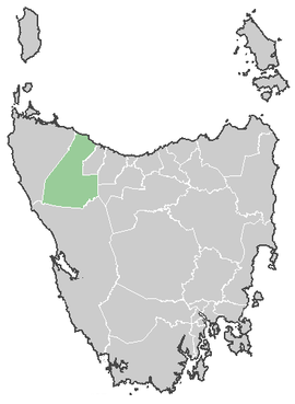
Waratah-Wynyard is a local government area of Tasmania, Australia and is governed by the Waratah-Wynyard Council. It covers the areas along the coastline from the Cam River at Somerset, to Wynyard, and then Sisters Beach, and extends inland to encompass the mining towns of Waratah and Savage River.
The Wynyard Council was originally called the 'Municipality of Table Cape' and was renamed to Wynyard Municipal Council in 1945. The Waratah-Wynyard Council formed after the amalgamation of the Waratah and Wynyard municipalities in 1993.[2] There had been suggestion of renaming the council to Table Cape, which was the former name of the Wynyard council, but this move failed at the ballot box.
Government
The current mayor is Robert 'Robby' Walsh and the current Deputy Mayor is Mary Duniam. Other sitting Councillors are Maureen Bradley, Gary Bramich, Darren Fairbrother, Alwyn Friedersdorff, Kevin Hyland and Stephen Wright. All Councillors will be up for re-election in 2018.[3]
Previous Mayors
- Roger Chalk (October 2000 - October 2005)
- Kevin Hyland (October 2005 - December 2010)
Suburbs[4]
| Suburb | Census Population 2011 | Reason |
|---|---|---|
| Sisters Creek | 201 | Includes Myalla |
| Sisters Beach | 439 | |
| Boat Harbour Beach | 429 | Includes in Boat Harbour |
| Boat Harbour, Tasmania | Incl. in Boat Harbour Beach | |
| Flowerdale | 324 | Includes Table Cape |
| Table Cape | Incl. in Flowerdale | |
| Wynyard | 5,990 | Includes Seabrook, Doctors Rocks |
| Seabrook | Incl. in Wynyard | |
| Somerset | 3,975 | |
| Doctors Rocks | Incl. in Wynyard | |
| Elliot | 350 | |
| Yolla | 337 | |
| Henrietta | 236 | Includes Oonah, Parrawe, West Takone, Takone |
| Oonah | Incl. in Henrietta | |
| Parrawe | Incl. in Henrietta | |
| Guildford | Incl. in Waratah | |
| Corinna | Incl. in Waratah | |
| Savage River | Incl. in Waratah | |
| West Takone | Incl. in Henrietta | |
| Takone | Incl. in Henrietta | |
| Mueunna | Incl. in Lapoinya | |
| Preolenna | Incl. in Lapoinya | |
| Calder | 375 | Includes Kellatier, Moorleah |
| Kellatier | Incl. in Calder | |
| Oldina | 111 | |
| Milabena | Incl. in Lapoinya | |
| Lapoinya | 287 | Includes Meunna, Preolenna, Milabena |
| Moorleah | Incl. Calder | |
| Myalla | Incl. in Sisters Creek | |
| Mount Hicks | 353 | |
| Waratah | 298 | Includes Guildford, Corinna, Savage River |
| Total | 13,705 | |
| 3 | Variance | |
| Local Government Total | 13,708 | Gazetted Central Coast Local Government Area |
References
- ↑ "3218.0 – Regional Population Growth, Australia, 2014–15". Australian Bureau of Statistics. Retrieved 29 September 2016.
- ↑ "The Story Behind Our Logo". warwyn.tas.gov.au. Waratah-Wynyard Council. Retrieved 13 August 2016.
- ↑ "Waratah-Wynyard Councillors". Waratah-Wynyard Council. Retrieved 9 Jan 2015.
- ↑ Australian Bureau of Statistics. "2011 Census QuickStats". Retrieved 9 April 2016.